SEQUOIA NATIONAL FOREST
“The conservation of natural resources is the fundamental problem. Unless we solve that problem it will avail us little to solve all others." -- Theodore Roosevelt 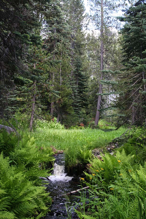
“The creek is very clear and beautiful, gliding through tangles of shrubs and flower-beds, gay bee and butterfly pastures, ... pure Sequoia water, flowing all the year, every drop filtered through moss and leaves and ... myriad spongy rootlets .....” – John Muir 
“Man did not weave the web of life; he is merely a strand in it. Whatever he does to the web he does to himself.” – Sealth, Suquamish Chief (Chief Seattle)
"The interior landscape responds to the character and subtlety of an exterior landscape; the shape of the individual mind is affected by land as it is by genes.” – Barry Lopez
“The nation behaves well if it treats the natural resources as assets which it must turn over to the next generation increased; and not impaired in value.” – Theodore Roosevelt

"What we are doing to the forests of the world is but a mirror reflection of what we are doing to ourselves and to one another." -- Chris Maser
Photos for this article courtesy of: David Baselt; Bob Burd; Carla Cloer; DaveWiz84, CC BY-SA; KernRiverSierra.com; kevingong.com; mountainbikebill.com; Oklahoma Historical Society Photograph Collection, George Prince photo; Terry Ommen; pashnit.com; Casey Schreiner/ModernHiker.com; Tulare County Library, Annie R. Mitchell History Room; yourownhike.com
|
The Story of the Origins of Sequoia National Forest: The Sierra Forest Reserve
by William Tweed In terms of the acreage involved, no other conservation effort in the history of Tulare County comes close to the establishment of the Sequoia National Forest, and that story, like so many others, has its origins among the citizens of this county. When the effort began, the campaigns that would ultimately result in the creation of both Sequoia National Park and the Sequoia National Forest were one and the same. The goal, quite simply, was to protect all the Sierra Nevada watersheds that provided mountain water to the expanding farms of the San Joaquin Valley. The initiative got under way in Visalia in October 1889, when four local residents – Tipton Lindsey, Frank. J. Walker, John Tuohy, and George Stewart – launched a campaign to protect the mountain lands adjacent to the southern half of the San Joaquin Valley. Each of the four brought special skills to the movement. Lindsey, because he worked in the United States Land Office in Visalia, provided his knowledge of federal lands. Walker and Stewart were associated with the Visalia Delta newspaper. Tuohy, a rancher, knew the mountains first hand. Collecting information from the group, Stewart drafted a map of the area they wanted to see protected from overgrazing and logging, a huge tract of over two hundred thirty-six-square-mile townships, and circulated a petition calling for its protection as a federally-controlled reserve. 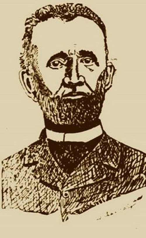 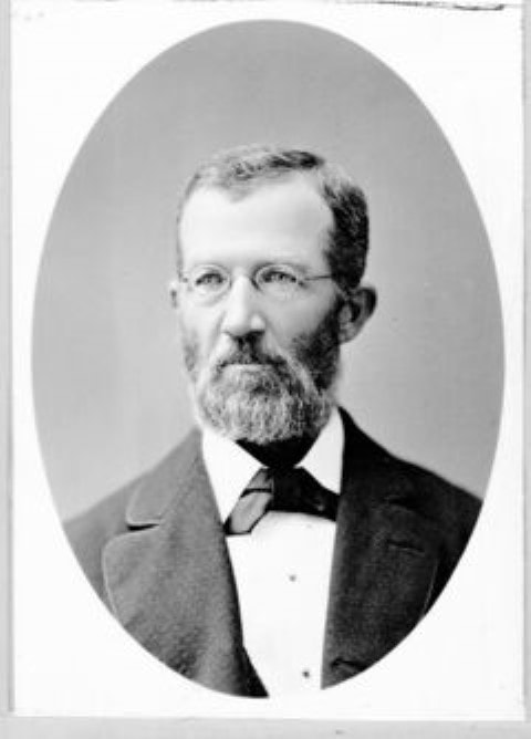 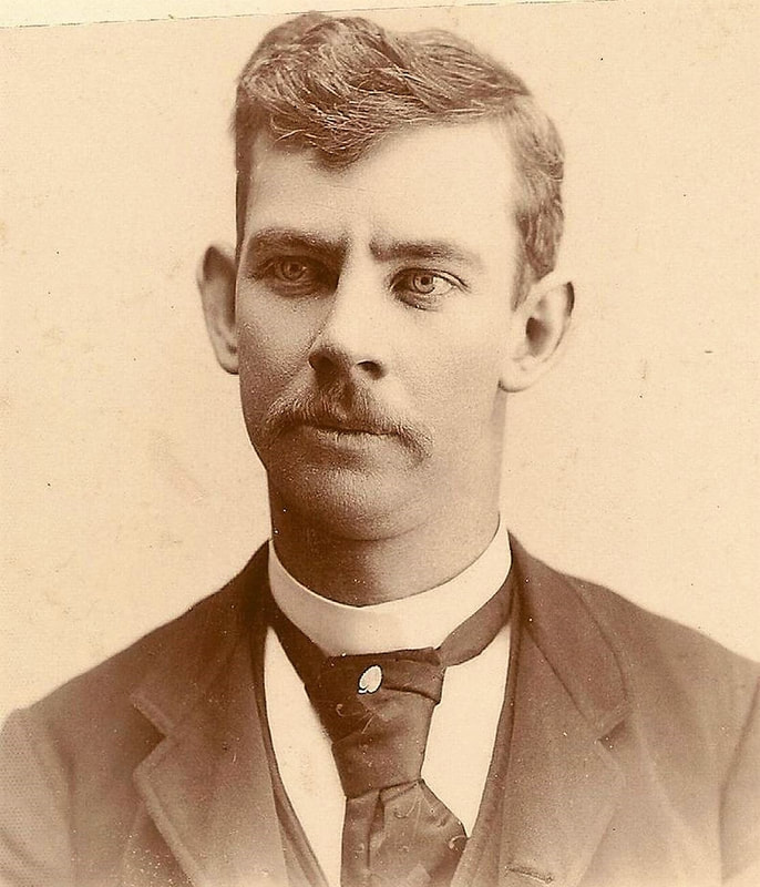 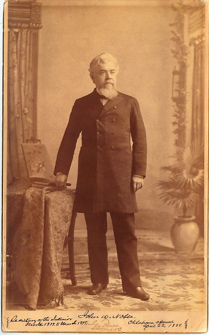 The threat to the giant sequoia trees soon became so intense, however, that Stewart and his friends temporarily set aside this broader target and shifted their focus to a more limited and immediate goal – the establishment of a national park to protect the best of the giant sequoia trees. This effort gained energy over the summer of 1890, and Congress passed a bill establishing such a park in September 1890. A mere week later, the new park was enlarged, but it still contained only seven of the two hundred townships the group wanted to protect.
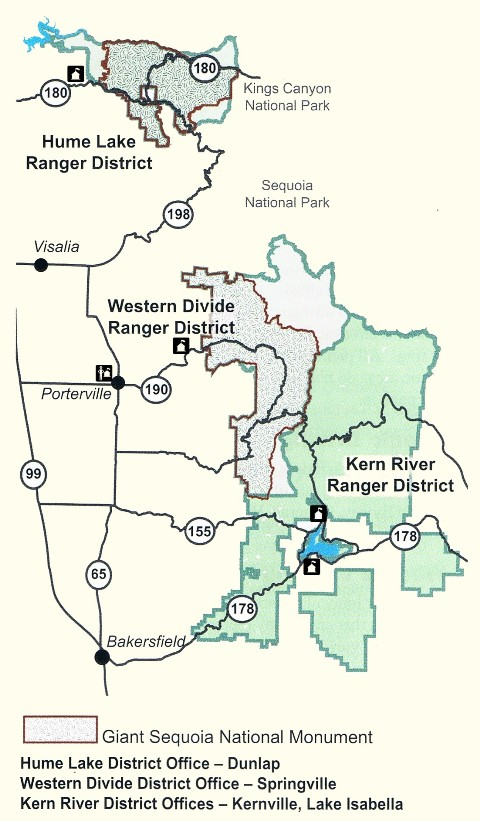
The Visalia group remained in close contact with Interior Department Secretary John Noble, who was highly sympathetic to what they were trying to accomplish. Noble had the ear of President Benjamin Harrison, who had appointed him. This was an important connection because Harrison supported what came next when Noble succeeded in adding a forest reserve clause to an obscure piece of legislation focused on repealing obsolete timber culture laws. The March 1891 Forest Reserve Act, as it came to be known, gave the president the right to set aside lands from the public domain as “forest reserves,” thus withdrawing them from sale to private interests. This provided the Visalians with just the authority they needed to renew their campaign for protecting the entirety of the southern Sierra. The Visalia group resumed their political efforts. Responding to the resulting local interest in forest protection, Secretary Noble put special land agent B. F. Allen on the ground in the Sierra studying what lands might logically be placed within a “Tulare Forest Reserve.” 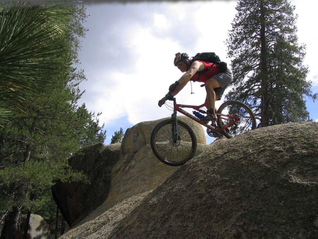 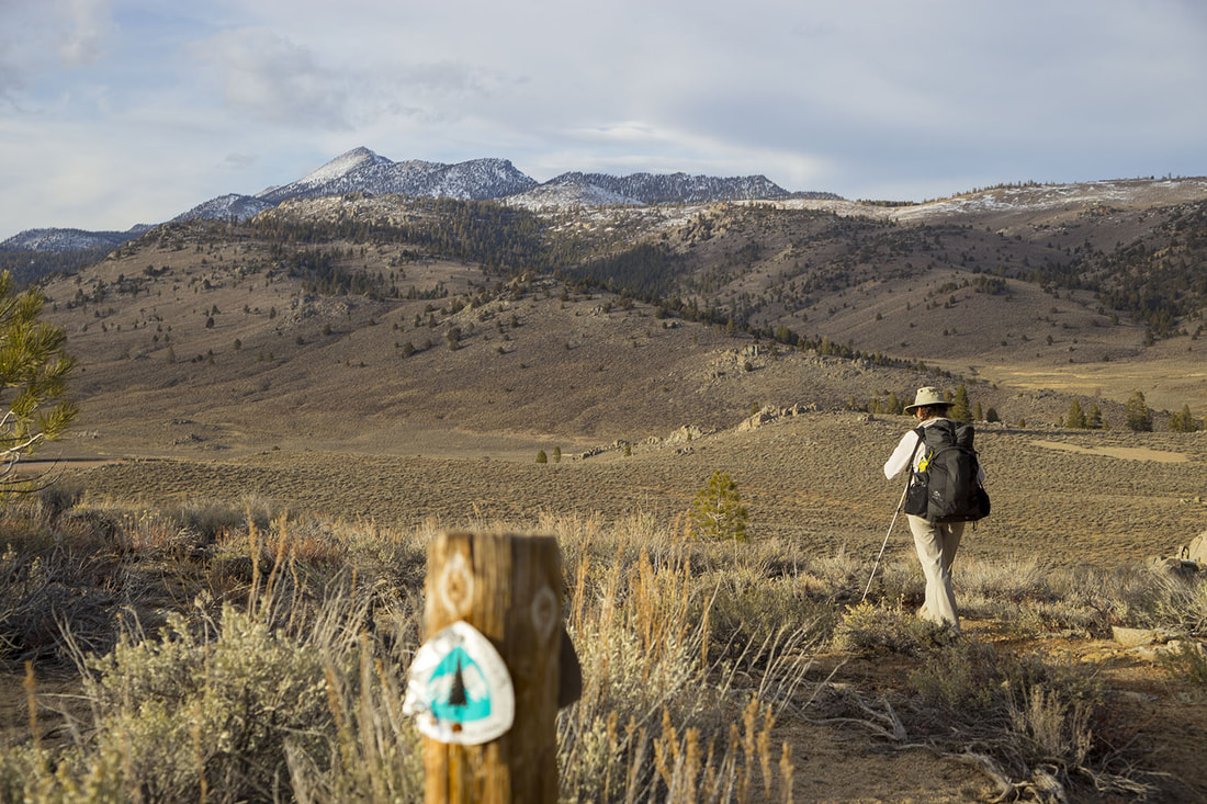 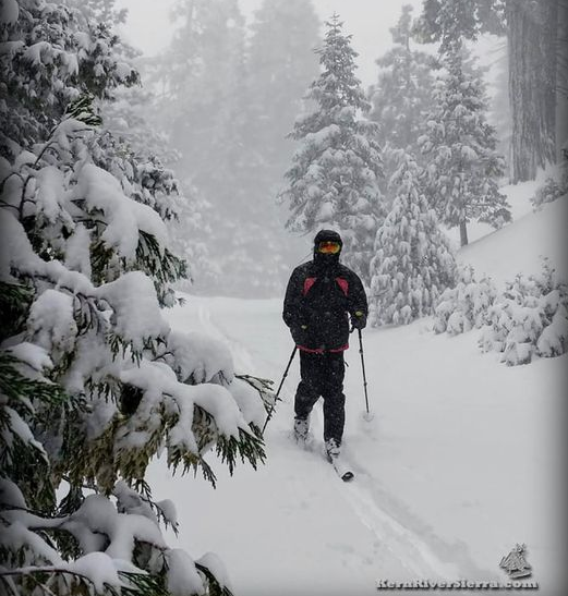 Allen, working largely alone, resumed his efforts once the snows melted from the Sierra in the spring of 1892, and he finished his report in January 1893. He had spent most of a year riding the trails of the Sierra, checking on conditions, and listening to local concerns. Time was running short now, for President’s Harrison’s term was ending, and thus Noble would soon also be leaving the Interior Department. Noble pushed Allen’s report onto the president’s desk, and on February 14, 1893, just two weeks before the end of his term, President Harrison created the “Sierra Forest Reserve” under the authority granted to him by the Forest Reserve Act. The new reservation set aside for permanent public ownership over four million acres of forest land. It took another dozen years and a government reorganization before effective management came to the reserve, but the changes did come. In 1905, management of the reserve was transferred to a new agency in the Agriculture Department, the United States Forest Service. In 1908, the new managers renamed the Tulare County portion of the forest reserve the Sequoia National Forest, the name under which the huge area is still managed today (with 353,000 acres of it designated as Giant Sequoia National Monument in April, 2000). Tipton Lindsey, Frank. J. Walker, John Tuohy, and George Stewart had succeeded beyond their wildest dreams. The Sequoia National Forest is the direct result of the efforts of these forward-thinking early Tulare County citizens. October, 2012 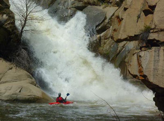 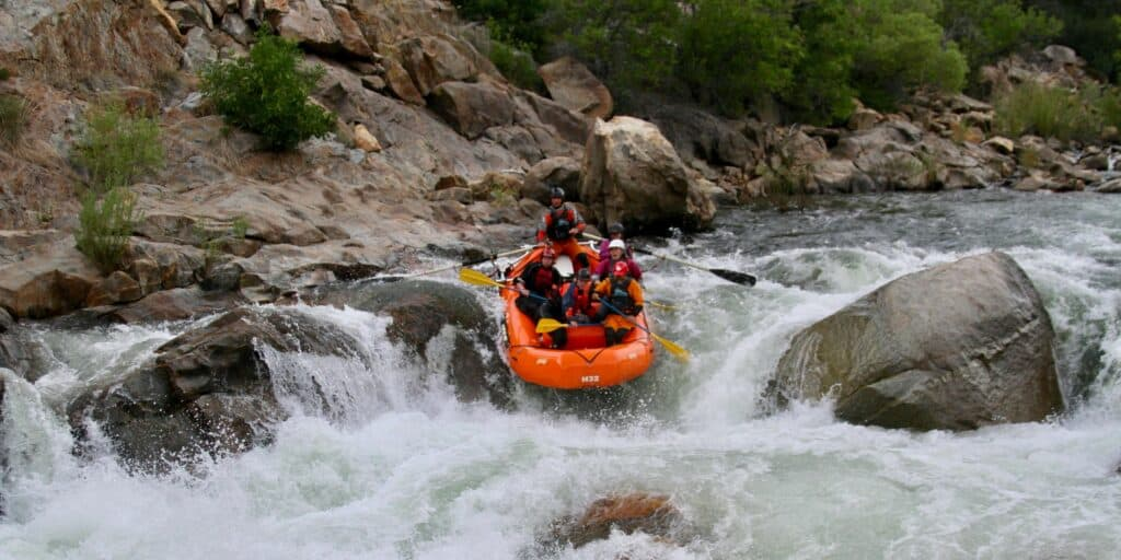 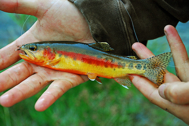 The Sequoia National Forest includes elevations ranging from 1,000 to over 12,000 feet, more than 30 giant sequoia groves (and Giant Sequoia National Monument), over 1500 miles of maintained roads, 1000 miles of abandoned roads, and 850 miles of trails (including 78 miles of the Pacific Crest National Scenic Trail and three National Recreation Trails: Summit, Cannell Meadow, and Jackass Creek), over 200 miles of Wild and Scenic Rivers, over 300,000 acres of wilderness, 158 ponds and lakes, 52 developed campgrounds, and frontcountry and backcountry winter activity areas. Portions of four of its six designated wilderness areas are within Tulare County: South Sierra, Dome Land, Jennie Lakes, and Golden Trout. Three USDA Forest Service ranger districts -- Hume Lake, Western Divide, and Kern River -- administer the 1.1 million-acre Sequoia National Forest.
|
Maps, Directions, and Site Details:
|
|
Three main roads from the west side will take you to the Sequoia National Forest: 1. From Visalia, take Hwy 198 East to Hwy 65 South to Hwy 190 East through Springville to the Forest (or stay on Hwy 65 South to Ducor and take J22/Avenue 56 East to Fountain Springs, where either M56/Hot Springs Drive or M190/Old Stage Road lead into the Forest/Giant Sequoia National Monument (Western Divide Ranger District and, if you keep going east, Kern River Ranger District). 2. From Visalia, take Hwy 198 East through Three Rivers and the Ash Mountain Entrance Station of Sequoia National Park (fee) and continue on the Generals Highway through the Park, passing Dorst campground, to enter the National Forest/Giant Sequoia National Monument, and trails to Jennie Lakes Wilderness (Hume Lake Ranger District). 3. From Visalia, take Hwy 63 North to Hwy 180 East through the Big Stump entrance station to Kings Canyon National Park (fee), and then go either left or right at the "Y" junction to access the Forest/Giant Sequoia National Monument (Hume Lake Ranger District). |

Site Details:
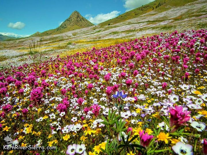
Environment: Foothills, Mountains, oak woodlands, conifer forests, giant sequoias
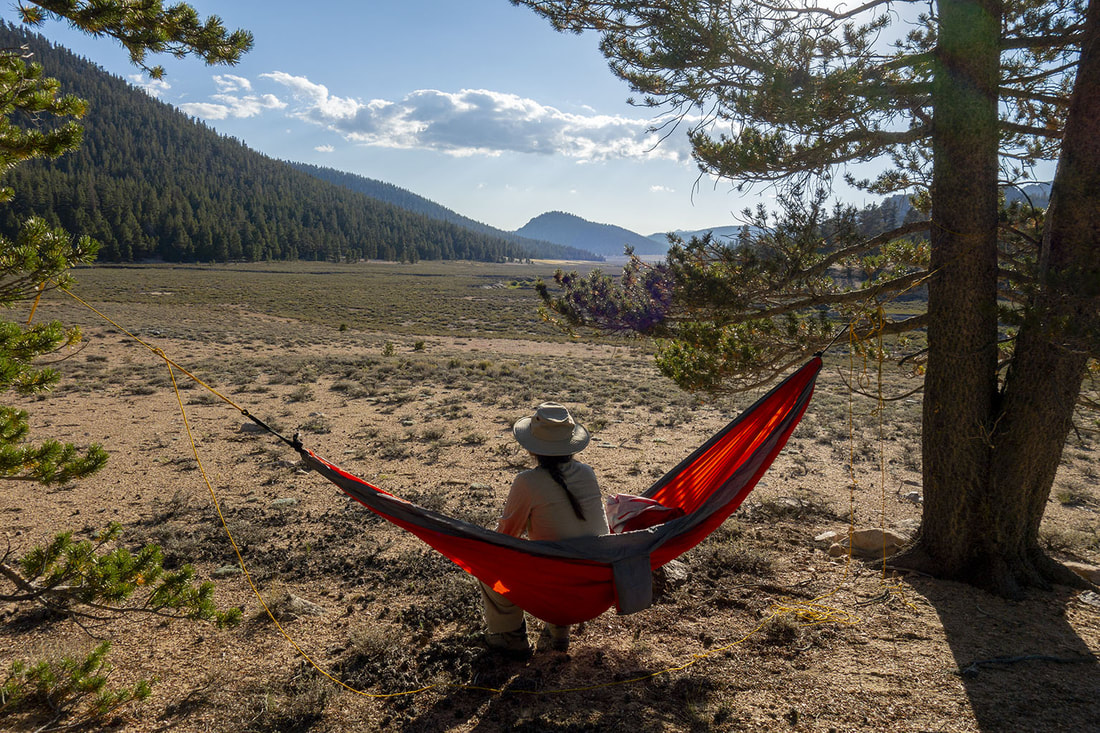
Activities: backpacking, bird watching, boating, botanizing, camping, dog walking (on a 6' leash; scoop poop), fire lookouts, fishing, hiking, horseback riding and packing, hunting, kayaking, OHV routes, pack trains, photography, picnicking, mountain biking, scenic drives, skiing, snowboarding, snowshoeing, snowmobiling, swimming, whitewater rafting, and wildlife viewing
Open: daily, year-round, weather permitting, free admission
Site Steward: USDA-National Forest Service
Links: USDA site for Sequoia National Forest; Hume Lake Ranger District; Western Divide Ranger District; Kern River Ranger District
Southern Sierra Trailheadsl
Books: The Magic of My Mountains--Memories from California's Sequoia National Forest 1919-1926 by Norman L. Norris, 1998
Environment: Foothills, Mountains, oak woodlands, conifer forests, giant sequoias
Activities: backpacking, bird watching, boating, botanizing, camping, dog walking (on a 6' leash; scoop poop), fire lookouts, fishing, hiking, horseback riding and packing, hunting, kayaking, OHV routes, pack trains, photography, picnicking, mountain biking, scenic drives, skiing, snowboarding, snowshoeing, snowmobiling, swimming, whitewater rafting, and wildlife viewing
Open: daily, year-round, weather permitting, free admission
Site Steward: USDA-National Forest Service
Links: USDA site for Sequoia National Forest; Hume Lake Ranger District; Western Divide Ranger District; Kern River Ranger District
Southern Sierra Trailheadsl
Books: The Magic of My Mountains--Memories from California's Sequoia National Forest 1919-1926 by Norman L. Norris, 1998