THE SMITHSONIAN INSTITUTION SHELTER
ON MOUNT WHITNEY
|
|
Science and Shelter at the Summit by Laurie Schwaller Mt. Whitney's distinction as the highest peak in our 48 contiguous states has made it a hiker magnet for almost 150 years. It also made it an astrophysicist magnet that drew a number of world-renowned scientists to its summit in the late 1800s and early 1900s. It was the scientists who, in 1908-1909, were responsible for the design and construction of the Smithsonian stone hut that continues to offer shelter and photo opportunities to the tens of thousands of trekkers striving to reach the top each year. |
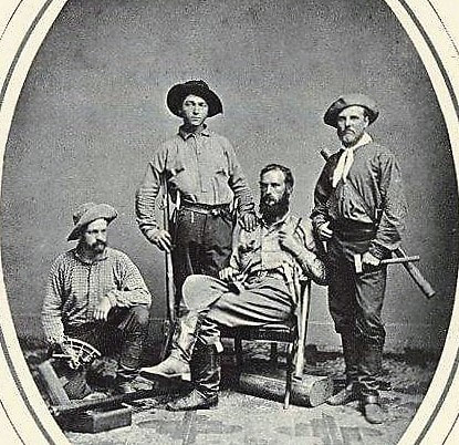 L-R James T. Gardiner, Richard Cotter, William
H. Brewer, Clarence King L-R James T. Gardiner, Richard Cotter, William
H. Brewer, Clarence King
Mount Whitney, elevation 14,505 feet, was "discovered" by scientific Americans in July, 1864, when the California Geological Survey's Brewer party decided that it was "so far as known" the state's highest point and named it in honor of Josiah D. Whitney, the Survey's Chief Geologist. (The Owens Valley Paiute Tribes called it Tumanguwa.)
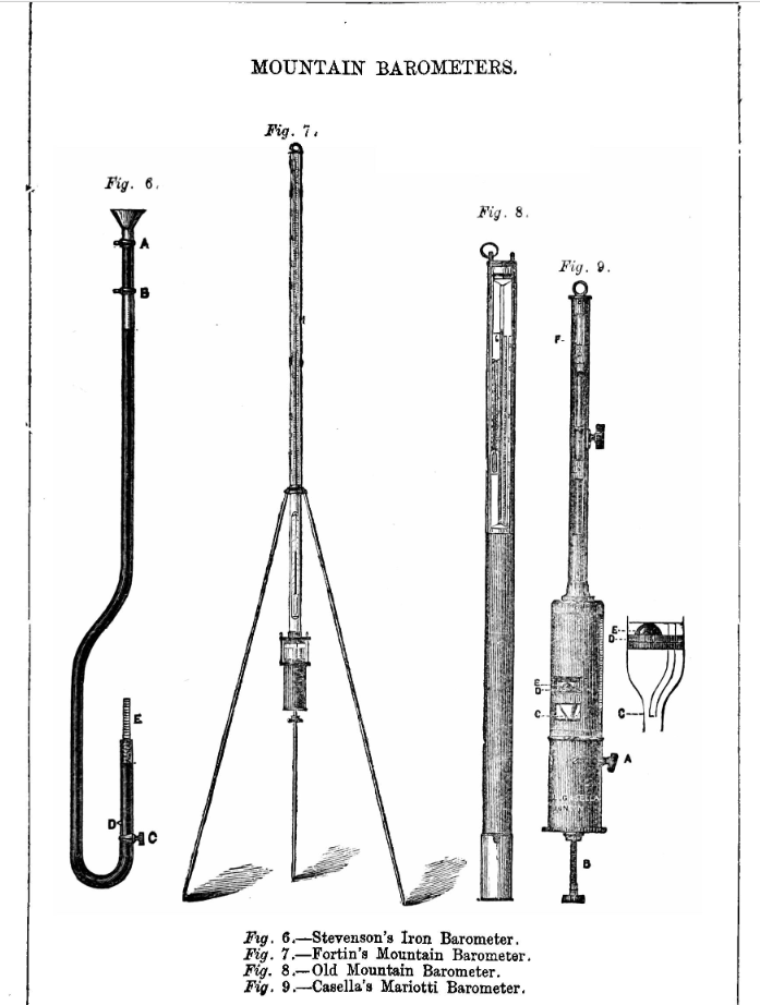
On August 18, 1873, three Owens Valley fishermen made the first recorded successful summit climb. On September 6, Carl Rabe, an assistant in the State Geological Survey, arrived on the peak with a mountain mercurial barometer and made the first determination of the mountain's height.
Langley wanted to find out whether Mt. Whitney's very high altitude, very dry atmosphere, and very clear air would reduce the interference of earth's moist atmosphere with astrophysical observations. "In no country is there a finer site for meteorological and atmospheric observations than . . . Mount Whitney and its neighboring peaks. . . . The sky is of the most deep violet blue, . . . an incomparably beautiful sky for the observer's purposes." -- Samuel P. Langley, 1881
In 1896, Swedish scientist Svante Arrhenius, winner of the Nobel Prize for chemistry in 1903, used Langley's measurement of interference of the infrared radiation by carbon dioxide in Earth's atmosphere to make the first calculation of how earth's climate and temperature would change from a future doubling of carbon dioxide levels.
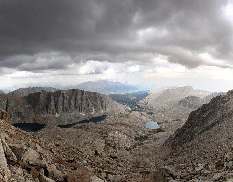 View west from Whitney to troops' Guitar Lake campsite View west from Whitney to troops' Guitar Lake campsite
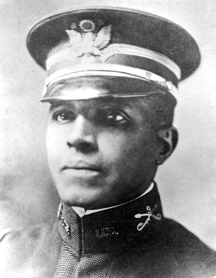
In 1903, Langley's sketchy 20-year-old path had almost disappeared. Captain Charles Young deployed troops from Sequoia National Park to make a new trail suitable for stock travel over Army Pass, cutting 20 miles off the old multi-day route to the mountain's west base. They started work on the east side trail as well.
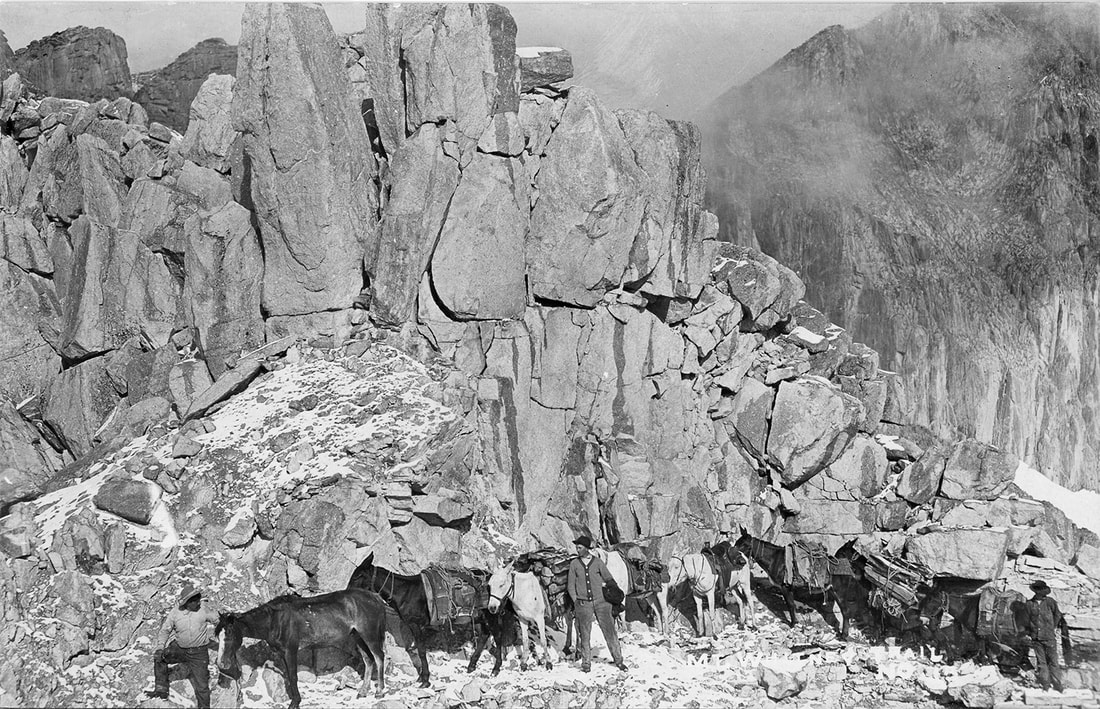
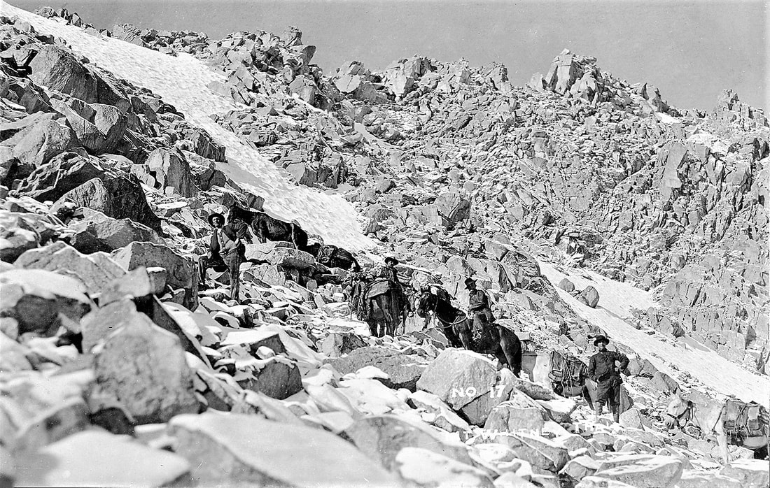 Horsemen and pack animals on the trail Horsemen and pack animals on the trail
On July 22, 1904, Gustave Marsh wrote to Dr. McAdie that "{W]e completed the pack trail to the summit of Mount Whitney . . . and parties are going over it every day." Four days later, Dr. Barton Evermann, chief of the Division of Scientific Inquiry, U.S. Bureau of Fisheries, and three employees took the new trail to the top. They were eating lunch when lightning struck them, killing Byrd Surby.

Astronomer Percival Lowell proclaimed that there was intelligent life on the Red Planet, evidenced by the "canals" crisscrossing its surface that he had seen from his observatory on "Mars Hill" near Flagstaff, Arizona. 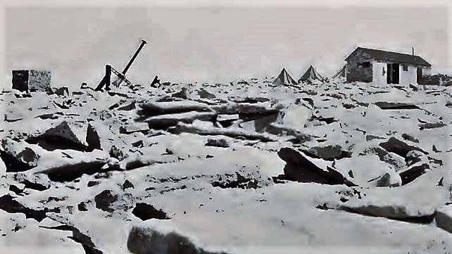
"[I] arrived on the summit August 22. The walls of the building were done except gables and partitions, and the frame of the roof was up. The masons were laying the walls of the little stone hut for my work, and they finished it, including the roof, that day. Several 6 x 6 tents had been loaned by Professor Campbell, and in these we cooked, ate, and slept." "Marsh worked at all kinds of jobs himself -- cooking, breaking stone, carrying stone, carrying snow for water, riveting and cementing, as well as general bossing. He will never get paid in this world for the work he did on that house." -- C.G. Abbot, 1909
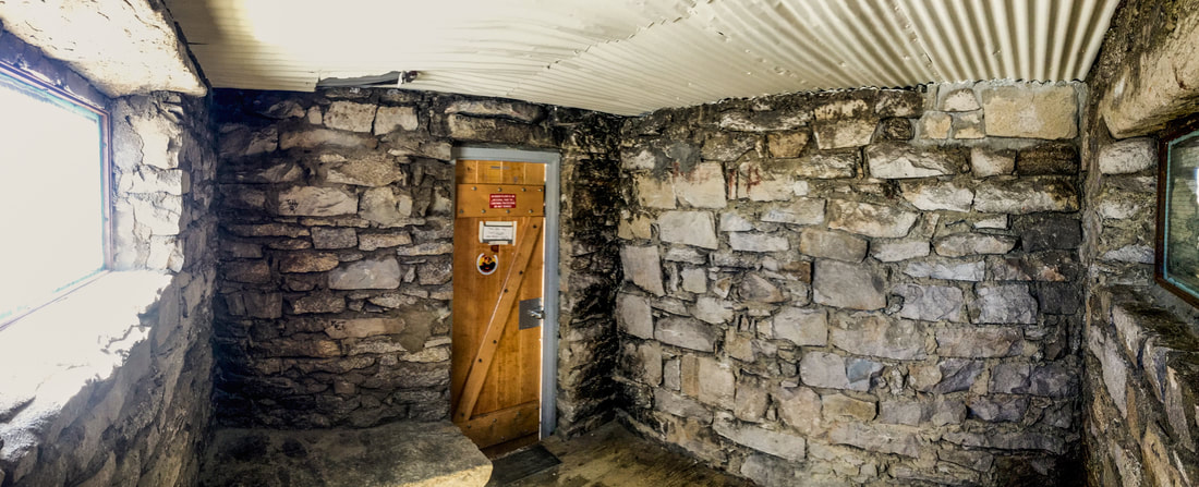
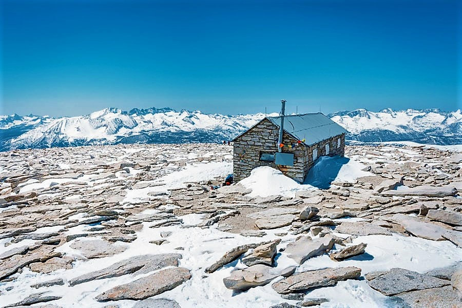
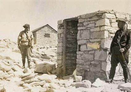
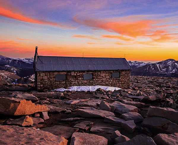
The approximately 11 x 30 foot structure is built of concrete-mortared granite from the site, with a roof of corrugated steel riveted to a steel truss frame. The three rooms are in a line, with windows in each and an east-facing door in both the north and south rooms. Iron shutters can cover the windows and doors. Built to withstand extreme weather conditions, the Smithsonian shelter has undergone only minor alterations since its construction in 1909. -- NRHP Nomination Form

"Two of the rooms communicate, and are kept locked by the Institution except when in use by authorized observing parties. The third room is accessible to the general public, and will doubtless be very welcome to persons who may be caught by storms or cold blasts on the top of Mount Whitney." -- C.G. Abbot, 1909

Distant lightning bristled the hair on the necks of the 14 animals in the pack train ascending Mount Whitney. "Two of the mules, Jack and Lucky, were specially honored," McAdie wrote, "because they carried the mirrors safely to the top." The size of the mirrors had been set by the heaviest load that a mule could carry.

"To an Easterner it is hardly a trail even now, and even Mr. Marsh said . . . that he hardly saw how the mules could go over it, unless they had hooks on their hind feet to hang on by till they found a place for their fore feet. There are places where . . . the mules must step down as far as from a high desk to the floor, landing on jagged rocks, not on dirt or sand." -- C.G. Abbot, 1909
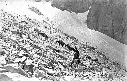
"[A]t an elevation of about 13,000 feet, . . . four mules and a saddle horse, loaded with mirrors, photographic material, hygrograph and thermograph, lost their footing and glissaded the snow fields ... fortunately ... the injuries were mostly flesh wounds." -- Alexander McAdie, re 1909 expedition
"May we not hope that this is the nucleus of a great aero-physical observatory where work shall be done that will both add luster to American science and justify in fullest measure the aim of the Smithsonian Institution in its purpose to diffuse knowledge throughout the world for the welfare of men." -- Alexander G. McAdie, 1910
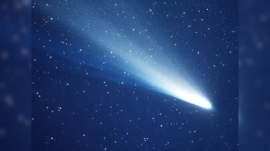
"I found the [Smithsonian shelter] in good shape and everything as I had left it. . . . [The Comet] was a good deal larger than I expected . . . and the tail streamed out for a long distance and was very beautiful . . . I forgot all about the time, but was wishing . . . I had someone with me who understood more about it." -- G.F. Marsh, atop Mt. Whitney to see Haley's Comet, May 23, 1910
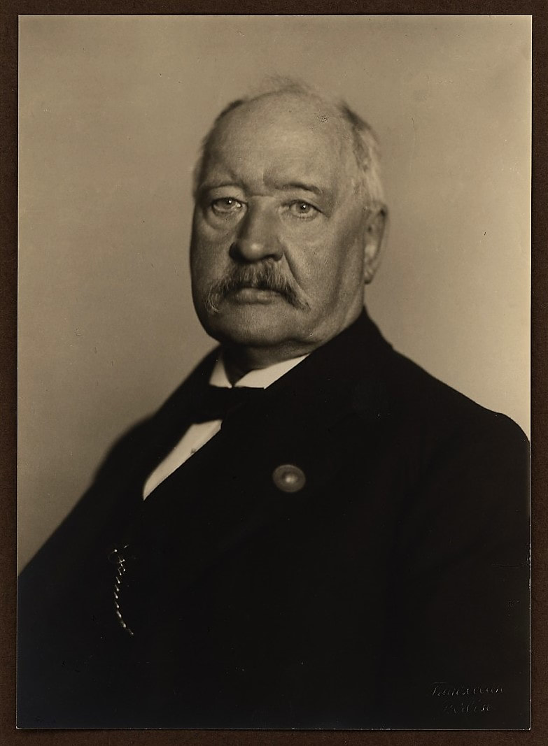
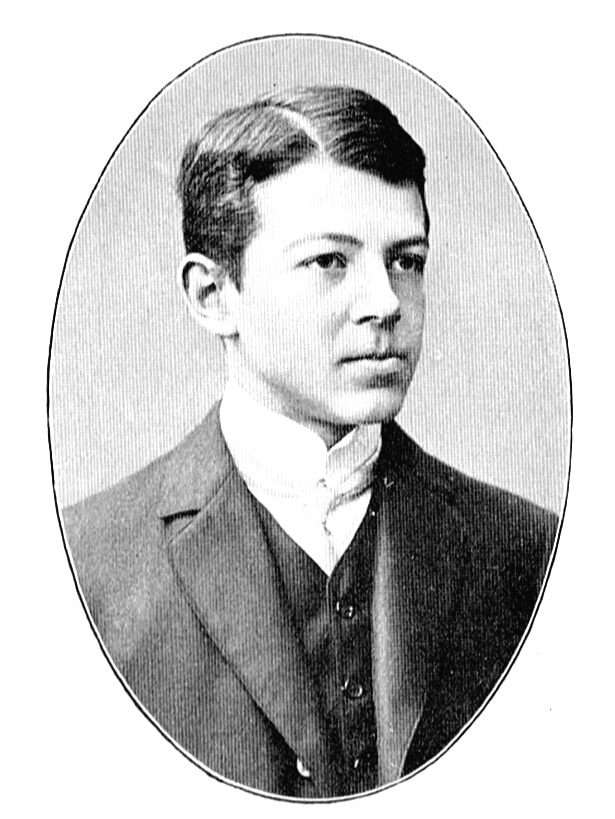 Anders Knutsson Angstrom Anders Knutsson Angstrom
In 1913, a final Smithsonian Whitney expedition used the shelter. A colleague of Dr. Abbot, Anders Angstrom, then aged 25, of Uppsala, Sweden, came to study the radiation of the atmosphere. W.R. Gregg, of the U.S. Weather Bureau, launched captive balloons from the summit to explore the upper air. Gustave Marsh rebuilt the trail and organized the logistics from Lone Pine.
Abbot's small flat-roofed stone shelter was again used for setting up the instruments inside and on its roof, while the 11 x 30 foot shelter provided living quarters and storage. "A thrilling electric storm raged for some time. Every point of rock and the tips of the nails and hair emitted electric discharges. But the little stone-and-iron building of the Smithsonian Institution furnished shelter." -- Anders Angstrom, 1915
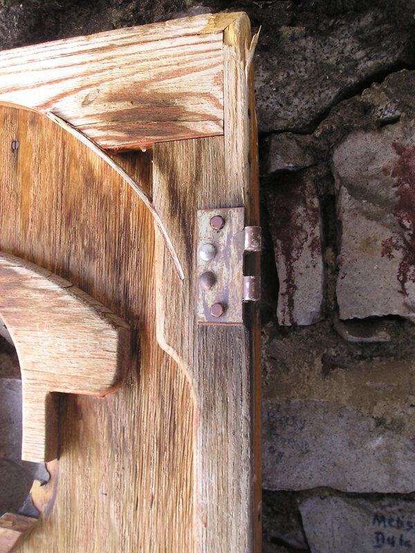
"The Mount Whitney shelter . . . received some much needed repairs by Thor [Riksheim] in mid-September. He re-hung the doors and patched some of the holes in the structure too in an attempt to keep blowing snow out of the building. . . . The lightning diffusion system is intact and in good repair." -- SEKI Crabtree Ranger End of Season Report, 2006
"During its centennial summer of 2009, recognition is extended to all who have hiked to the summit and seen the shelter. Special appreciation is being noted for the services of construction foreman Gustave F. Marsh, his crew, and the citizens of Inyo County whose support was key to seeing that the shelter was built in time for the 1909 observations of Mars." -- U.S. Forest Service, Inyo National Forest
|
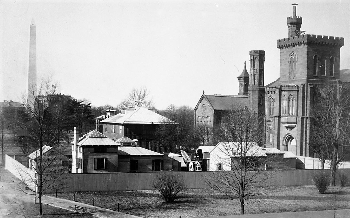
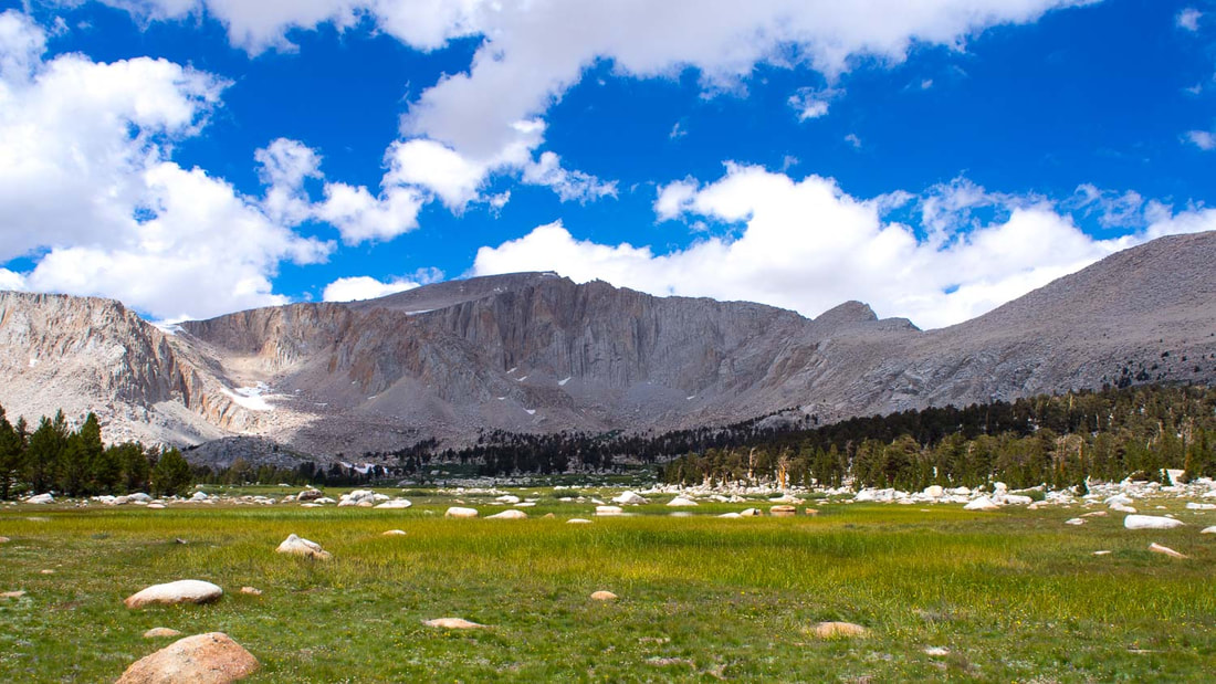
In September, 1881, Samuel Pierpont Langley, then director of Allegheny Observatory and subsequently Secretary of the Smithsonian Institution in Washington, D.C., and director of its Astrophysical Observatory, led an expedition up a narrow foot trail from Lone Pine to the barren 4-acre plateau at the mountain's top to study solar radiation.    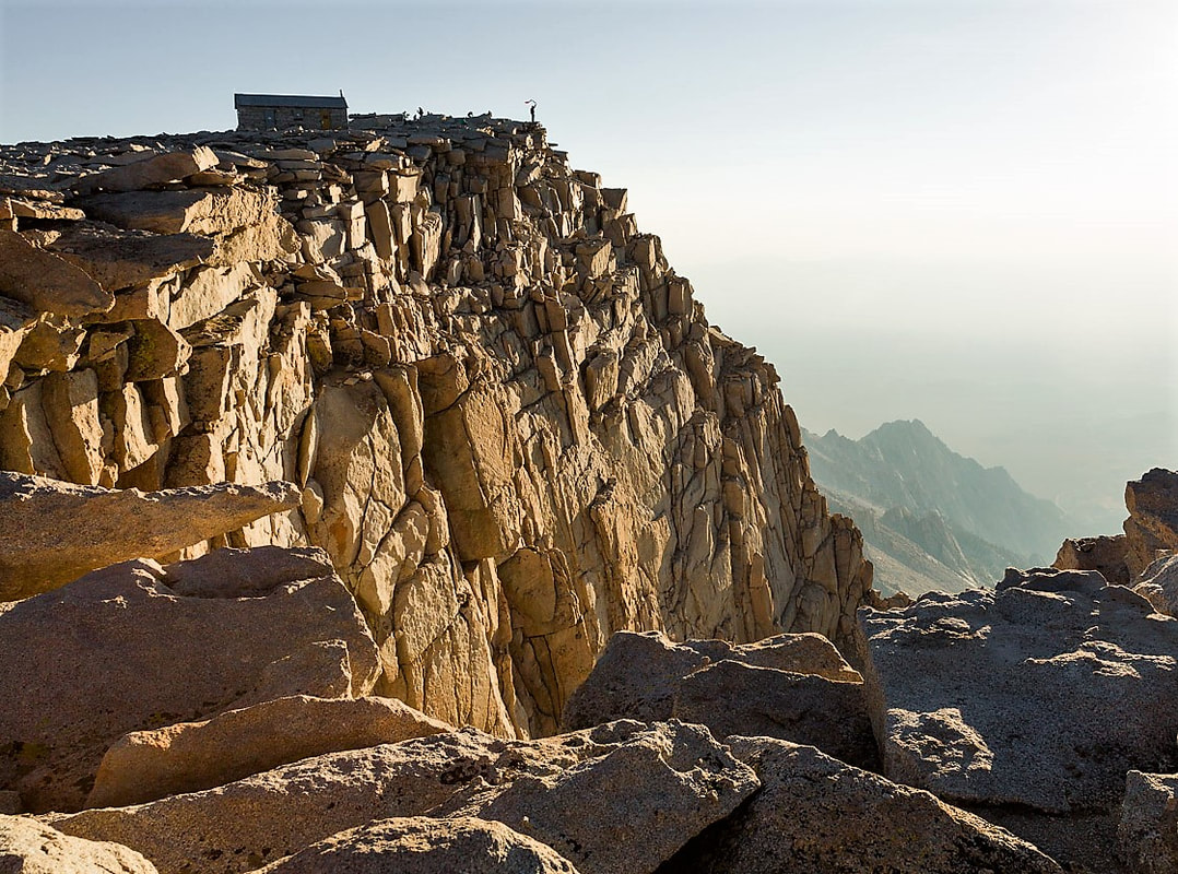 Excited by the quality of his results, Langley recommended that Mount Whitney and its environs be reserved by the government as a prime location for a high-altitude observatory. His expedition report noted that a permanent shelter was required to enable scientists and support teams to remain at the summit, and added that "Stone for the erection of permanent buildings is here in unlimited quantity."
In July, 1903, Professor Alexander G. McAdie, Chief of the U.S. Weather Bureau in San Francisco, and Professor Joseph N. LeConte reached the summit with their instruments, in company with a 137-member Sierra Club High Trip group. McAdie's report that Mount Whitney was "most suited for a meteorological observatory" contributed ultimately to a series of expeditions under the auspices of the Smithsonian Institution.  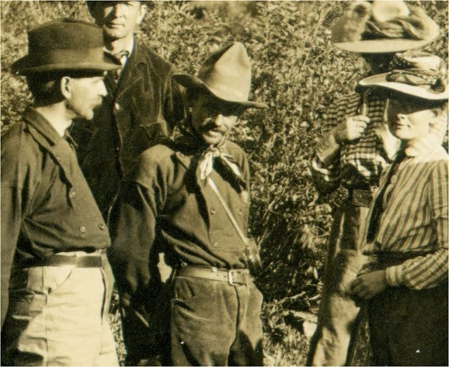 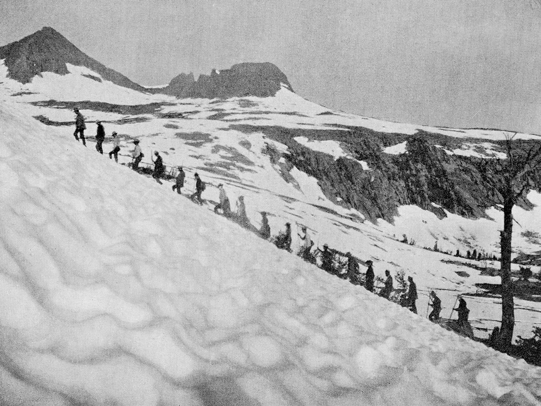 Spurred by the tourists', scientists', and National Park's interest in "their" mountain, the citizens of Lone Pine raised money to complete the trail work started in 1903 by U.S. Army troops under Captain Charles Young, Acting Superintendent of Sequoia National Park that year. Gustave F. Marsh, who operated a stage line and express business in Lone Pine, was contracted to engineer and finish building the Army's good path for pack and riding stock all the way to the summit. He finished his work on July 22, 1904.
   Plans for a summit shelter finally got made in 1908, as a result of a summit expedition that August. Dr. William Wallace Campbell of the University of California's Lick Observatory and Dr. Charles Greeley Abbot, the new director of the Smithsonian's Astrophysical Observatory after Langley's death, ascended the peak on a reconnaissance mission. Campbell had decided 14 years earlier that he had to be atop Mount Whitney in late August of 1909, when Mars would next be most favorably positioned for his studies, at its brightest and closest to Earth, opposite the Sun in Earth's sky. He was determined to debunk the "evidence" of intelligent life on Mars that was currently being popularized. Abbot was accompanying him to continue Professor Langley's studies of solar radiation.
    With only a two-week opportunity for the best viewing in 1909, the scientists had climbed Whitney a year in advance so they could meticulously plan and prepare for that expedition. Gustave Marsh, head of the crew that opened the east side pack trail to the summit in 1903-04, had been hired to guide both the 1908 and 1909 expeditions.
After the scientists spent a frigid night on the summit in 1908, Campbell decided that observations in 1909 "should not be undertaken unless a building of some kind could be erected as a shelter in case of storm." He drew plans for a three-room hut with stone walls and a steel roof and doors, "to be used as a shelter and living quarters for observers in any branch of science." 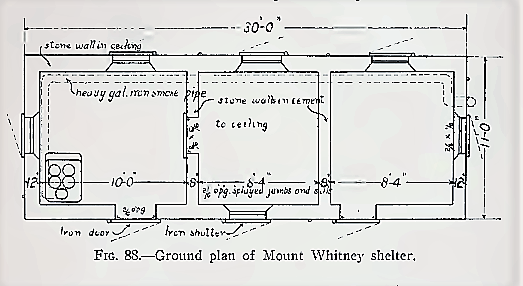 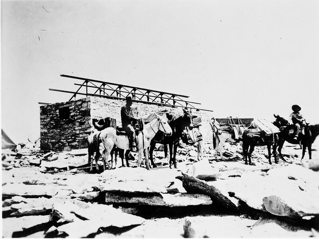   Abbot presented Campbell's plans to Secretary Charles D. Walcott of the Smithsonian, and on October 30, the Smithsonian approved a grant for the shelter. Abbot hired the firm Speiden and Speiden to create the construction plans. Then, through the Smithsonian, he got government permission to construct the shelter on the summit, and funds to pay for it.
Campbell tackled logistics. He got estimates for cement and workers' tents and for the steel and glass parts from the United Sheet Metal Works in San Francisco. (No wood was to be used, as lightning could set it on fire.) Through Marsh, he got costs for packers to carry everything up the mountain and for a mason and helpers on the peak to assemble the hut. He sent Abbot an estimate of $2315. The enthusiastic Secretary Walcott approved a generous $2500 instead. 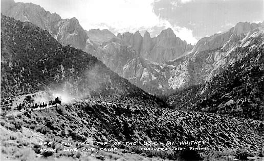  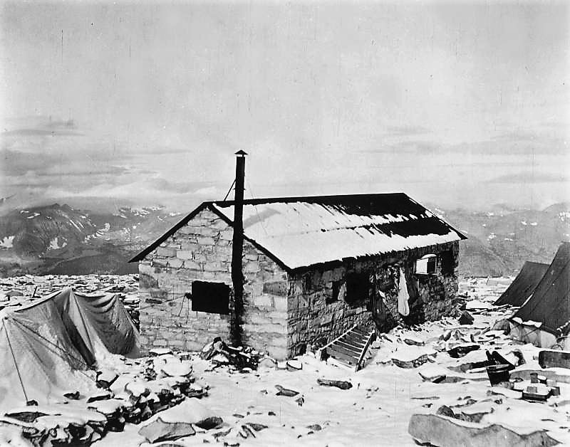 In 1909, the badly deteriorated east side trail had to be remade to enable pack stock to transport the building materials, supplies, and scientific instruments to the summit. On July 28, the first mule train reached the top, barely a month before the expedition's arrival, and work began on the shelter, with stone for the walls being broken, shaped, riveted, and cemented with hand tools.
By mid-June Campbell had inspected all the steel parts assembled for the hut in San Francisco, and supervised their actual trial erection. He shipped them, the cement, and the tents for the construction crew to Lone Pine while Marsh worked tirelessly at all the tasks on the summit.  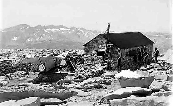 Campbell had also invited McAdie of the Weather Bureau to join the party as its meteorological observer. The main expedition party left Lone Pine on August 23. Abbot set up his 16-inch heliostat and spectrograph to compare the spectra of the Moon and Mars, and began his observations before the shelter was completed. Twenty-eight years after Langley made his observations on the summit, McAdie obtained continuous records of pressure, humidity, and temperature for the entire period on the peak.
On August 28, Campbell and the Lick group, including Messrs Albrecht, McAdie, the physician Dr. Miller, Hoover, and Skinner, arrived at noon, and the entire party got soaked in a thunderstorm. The storms continued until September 1, but on that night and the next, Campbell obtained a good series of exposures on Mars and the Moon. The spectrograms were developed at the summit as they were taken. Then the unusual, extremely adverse weather returned, precluding further observations, and sending the expedition back down the mountain. Campbell's findings substantiated that there was insufficient water vapor on Mars to support life as we know it on Earth. 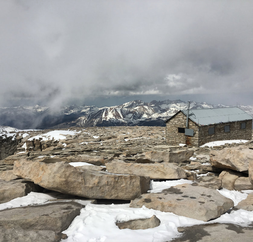 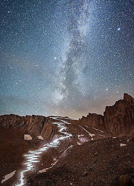 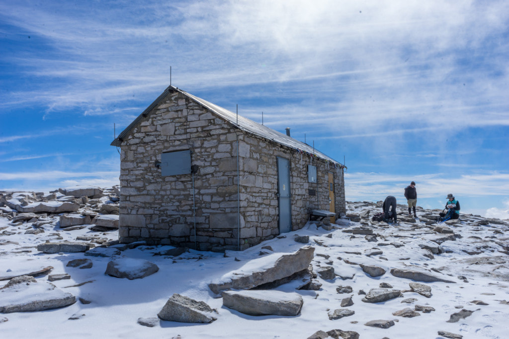 In August of 1910, the Smithsonian shelter was used again when Dr. Abbot and Mr. Marsh were back on the summit in an expedition organized to complete the scientists' work and confirm the 1909 results. The Smithsonian's final Whitney excursion was in 1913.
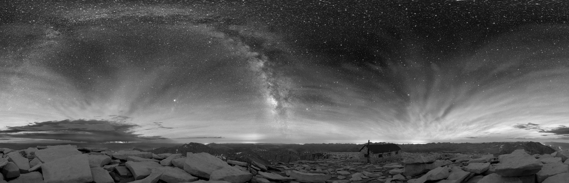
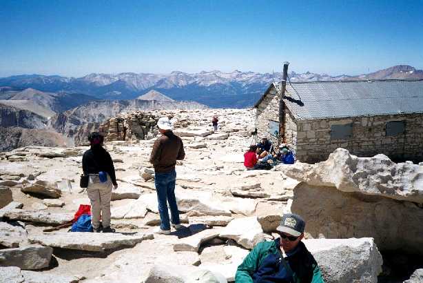
The National Park Service acquired title to the shelter in 1926, when Sequoia National Park was expanded to include its site. Those hiking the high trail at night can still experience the stunningly clear starry skies that drew the scientists to the great peak over a century ago. William Wallace Campbell designed the simple stone building well. In 1909, he told The New York Times that it "should last 500 years." December, 2020

|
Maps, Directions, and Site Details:
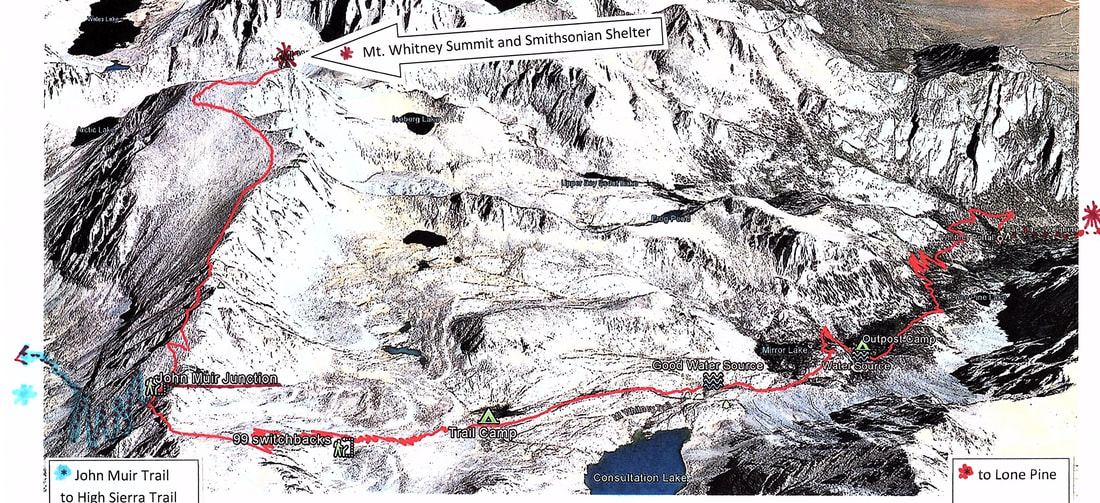
Click to enlarge map of east side trail to summit
|
Mt. Whitney lies on the boundary of Sequoia National Park and Inyo National Forest. Permits are required to hike in the Mt. Whitney Zone. Hikers are advised to carry crampons and ice axes when snow and ice may be on the trails. Those on the summit are warned against seeking shelter in the Smithsonian hut during lightning storms.
The shortest and most popular route to the summit is a 10.7 mile trail from Whitney Portal, 13 miles west of the town of Lone Pine on the east side of the Sierra, via Hwy 395. |
Permits: About 30,000 people per year want to hike Mt. Whitney, so hikers must secure a permit from the Forest Service in order to enter the Mt. Whitney zone. Permits are required year-round, for both day and overnight use, and a quota system is in effect between May 1 and November 1. Applications to reserve a backpacking trip on the Mt. Whitney trail or a day hike in the Mt. Whitney Zone are accepted in the Mt. Whitney Lottery from February 1 through March 15. Any space left over after those dates will go on sale April 1 at 10:00 a.m. Go to https://www.fs.usda.gov/detail/inyo/passes-permits/recreation/?cid=stelprdb5150055 for Inyo National Forest permit and trail information. Wilderness Office Information Line: 760-873-2485. Reservations can be made through www.recreation.gov.
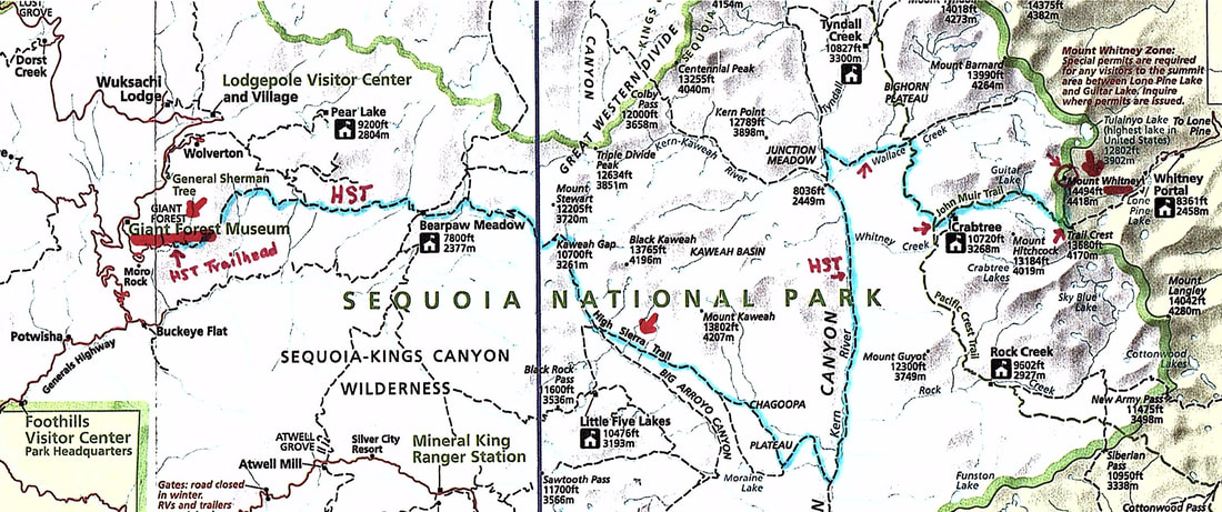
Click to enlarge map of west side trail to summit
|
Other routes to Mt. Whitney are less heavily used, but require a much longer hike to reach the summit. To start from the west side, the High Sierra Trail leaves from Giant Forest in Sequoia National Park and is about 60 miles (taking a minimum of 6 hiking days) one-way. A Sequoia National Park wilderness permit is required. https://www.nps.gov/seki/planyourvisit/whitney.htm https://www.nps.gov/seki/planyourvisit/high-sierra-trail.htm https://www.nps.gov/seki/planyourvisit/wilderness_permits.htm |
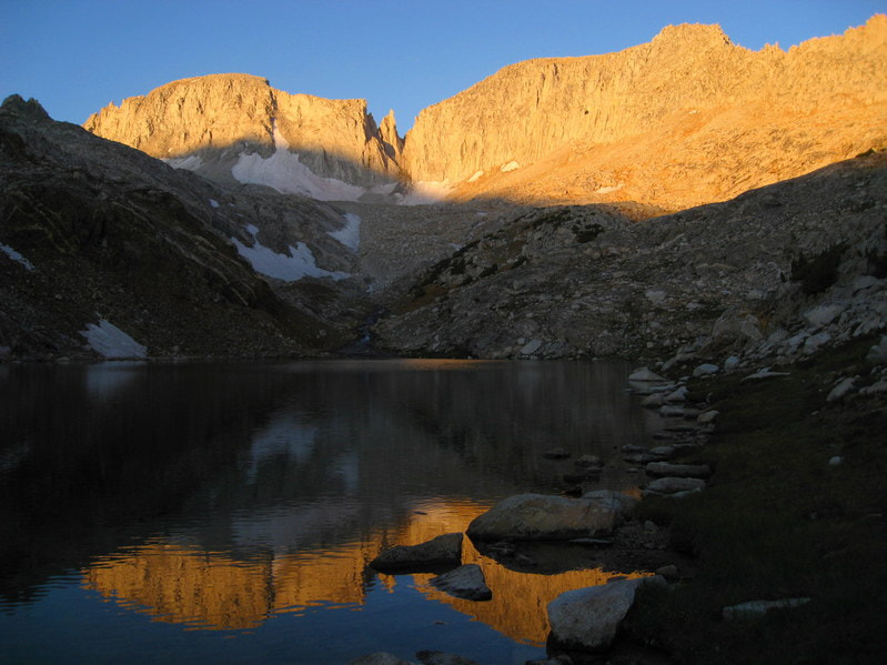
Environment: Mountains, summit of Mt. Whitney, Sequoia National Park (NOTE: the Smithsonian shelter can be visited only by foot trail; trailhead elevation is 8360', summit elevation is appprox. 14,500'.)
Activities: architecture study, backpacking, birding, camping (below the summit), hiking, history, photography, wildlife viewing
Open: Sequoia and Kings Canyon National Parks are always open, weather permitting, unless closed due to emergency conditions; park entrance fee; Wilderness Permit required for all overnight trips
Site Steward: National Park Service-Sequoia and Kings Canyon National Parks; 559-565-3341; www.nps.gov/seki
Opportunities for Involvement: Sequoia Parks Conservancy (SPC) membership, donate, volunteer
Links: National Register of Historic Places documentation;
https://www.nps.gov/seki/planyourvisit/wilderness_permits.htm:
https://www.mulemuseum.org/;
https://www.mulemuseum.org/building-mount-whitney-trails.html
https://www.mulemuseum.org/the-mount-whitney-trail.html
The Smithsonian Shelter was added to the National Register of Historic Places on March 8, 1977, because it is "a monument to the difficulty of high altitude research in the period before prolonged human flight was possible."
Photos for this article by: D. Appleton & Co., publ., Essays in Astronomy, 1900, public domain; Gary Ballentine, granitecliffs.com; base-medical.com; Bob Burd; Andrew Cox, backcountrysights.com; Arturo Crespo; Dark Sky Photography/Eastern Sierra Observatory; Bryan Feller; Google Earth; Alvis E. Hendley; Matthew Karsten, expertvagabond.com; Andy Lewicky, sierradescents.com; Library of Congress Prints and Photographs Division; Hector Macpherson Jr., in Astronomers of Today, 1905, public domain; Chuck McKeever; Meteorological Office Digital Library of Archives, in Symons's Monthly Meteorological Magazine, June, 1876; My Old Tulare County Pics; NASA/JPL-Caltech; NASA, Watch the Skies; National Park Service; National Portrait Gallery, Smithsonian Institution, CCO, object #NPG.92.61; OAC/UC Berkeley, Bancroft Library, Portrait Collection, photograph by Buck, Washington, D.C.; OwensValleyHistory.com; portrattarkiv.se, sj9PGLAlnmUAAAAABfm2g; Photographs by John Reece, copyright 2018; Andrew Piotrowski; Thor Riksheim/NPS; Matthew Saville, astrolandscapes; jon-schmid; Brandon Sharpe, brandonexplores.com; Smithsonian Institution Archives; Smithsonian Libraries; Smithsonian National Museum of American History; Brad Spiess, ihikesandiego.com; stock cover image; The Eastern California Museum, Frederick G. Harvey photo; University of California Santa Cruz, Special Collections; University of Pittsburgh Library System Digital Collections, George W. Tea photo; University of Southern California Libraries and California Historical Society, Hervey Friend photo; whitneyzone.com forum; Daniel and Timea K. Zilcsak
