Click on photo for more information.

Visiting Hospital Rock AKA Pah-Din in Sequoia National Park

by Laurie Schwaller

     Hospital Rock is an excellent stop along Sequoia National Park’s Generals Highway. “Pah-Din” provides panoramic foothill, mountain, and river views; short trails leading to Native American pictographs, bedrock mortars, and cupules; the huge Rock’s “hospital”; a captivating beach and seasonal waterfall beside the rushing Kaweah River; informative interpretive panels; bird and wildlife watching; and picnic facilities, restrooms, and drinking water. For many hundreds of years, Yokuts, Mono, and Tubatulabal people met, gathered, and lived in the large village on this site.  Savor, learn from, and remember this beautiful “place to go through.”

November, 2025

NOTE: The Project Team will be conducting research for a full article as volunteer time allows.  Contact us if you’d like to help research, write about, and/or illustrate this Treasure!  


Maps & Directions:


From Visalia, go east on Hwy 198 through Three Rivers to the Sequoia National Park entrance station (fee), where Hwy 198 becomes the Generals Highway. Hospital Rock is about 6 scenic miles farther up on the Generals Highway.


Site Details & Activities:

Environment:  Foothills, abundant oak woodland, Kaweah River, long a large Native American village site (later a Sequoia National Park campground – with store, dining, and ranger station, and a Civilian Conservation Corps work site), Kaweah River access, scenic views, interpretive panels, picnic area, restroom and water fountain, short trails to pictographs, bedrock mortars, cupules; abundant wildlife and diverse plant life; nearby campground (seasonal) and hiking and backpacking trail to Redwood Meadow giant sequoia grove
Activities:  birding, botanizing, camping (nearby), fishing (license required), hiking, history, interpretive panels, Native American artifacts, photography, picnicking, river access, wildflower and wildlife viewing (NOTE: this is a bear area; store all food securely and dispose of all waste properly; never feed wildlife – keep wild animals wild for your safety and theirs. The Kaweah River’s current can be deceptively fast and strong and nearby rocks extremely slippery; use great caution near, on, and in this river, and never leave children unattended near the river.)
Open:  daily, weather permitting, except in emergency conditions; park entrance fee
Site Steward:  National Park Service, Sequoia National Park, 559-565-3341
Opportunities for Involvement: Sequoia Parks Conservancy
Books:  1) Challenge of the Big Trees -The Updated History of Sequoia and Kings Canyon National Parks, rev. edition,  by William C. Tweed and Lary M. Dilsaver (University of Virginia Press, 2017)
2)  A Guide to the Sequoia Groves of California, by Dwight Willard (Yosemite Association, 2000)
3)  King Sequoia: The Tree That Inspired a Nation, Created Our National Park System, and Changed the Way We Think About Nature, by William C. Tweed (Heyday, 2016)
4)  Images of America Sequoia National Park, by Ward Eldredge (Arcadia Publishing, 2008)


Click on photos for more information.

Sequoia National Park’s Incomparable High Sierra Trail

by Laurie Schwaller

     Sequoia National Park’s fabulously scenic High Sierra Trail, “the most ambitious trail ever built by the National Park Service in the southern Sierra,” leads you in 62 rugged, up and down miles from lush, giant-sequoia-ringed Crescent Meadow, elevation 6700′, to the all-rock top of Mt. Whitney at 14,505′, the highest point in the lower 48 states. (It’s about 75 miles if you hike on down the east side to road’s end at Whitney Portal.) Built in 1928-1932, this classic, incomparable trail challenges and rewards its travelers with sights and experiences they never forget.

November, 2025

NOTE: The Project Team will be conducting research for a full article as volunteer time allows.  Contact us if you’d like to help research, write about, and/or illustrate this Treasure!  

High Sierra Trail from Giant Forest to Mount Whitney Summit


Maps & Directions:

From Visalia, go east on Hwy 198 through Three Rivers to the Sequoia National Park entrance station (fee), where Hwy 198 becomes the Generals Highway. About a mile up the road, stop at the Wilderness Office near the Foothills Visitor Center to pick up your required Wilderness Permit for the High Sierra Trail (see Links in the Site Details section below). Continue up the mountain on the Generals Highway to just before the Giant Forest Museum and turn right onto the Moro Rock/Crescent Meadow Road. Follow it to its end at the Crescent Meadow parking lot. Find the HST trailhead sign near the restroom.

HST hikers typically make this a shuttle trip. Most travel the HST from west to east, culminating in summiting Mt. Whitney, then descending the 11-mile trail to Whitney Portal on the east side to meet a vehicle that will take them home (or back to the car they left at the start of their trek).

NOTE: You must obtain a Wilderness permit for the High Sierra Trail before you hike it. If you wish to complete your trip by hiking out down the east side to Whitney Portal, the Inyo National Forest will accept your Wilderness permit issued by Sequoia National Park as long as you meet the requirements for continuous wilderness travel.

(See our Smithsonian Institution Shelter on Mt. Whitney page for a sketch map of the trail down to Whitney Portal.)


Site Details & Activities:

Environment:  Mountains, forests, rivers, streams, lakes, high passes, huge canyons, major elevation gains and losses, summit of Mt. Whitney (elevation 14,505′); carry good High Sierra Trail maps
Activities:  backpacking, birding, botanizing, camping, hiking, history, photography, stargazing, wilderness, wildflower and wildlife viewing; this is a very strenuous adventure: plan it far ahead and prepare and pack carefully
Open:  Sequoia and Kings Canyon National Parks are always open, weather permitting, unless closed due to emergency conditions; park entrance fee; High Sierra Trail Wilderness Permit required
Site Steward:  National Park Service, Sequoia National Park, 559-565-3341
Opportunities for Involvement:  Donate, Volunteer, Sequoia Parks Conservancy
Links:
Books:  1)  Granite Pathways: A History of the Wilderness Trail System of Sequoia and Kings Canyon National Parks, by William C. Tweed (Sequoia Parks Conservancy, August, 2021)
2)  A number of books about hiking the HST are advertised online. (There are also many blogs and videos about hiking the HST.) Be informed and prepared; a successful hike on the HST takes careful planning and conditioning well in advance of your journey.
See also: High Sierra Trail Gentle Ribbon of Rock  Excellent film on the planning and construction of the High Sierra Trail, narrated by WilliamTweed; on You Tube


Click on photo for more information.

Giant Forest Historic Districts

by Laurie Schwaller

     At their peak, in about 1940, Sequoia National Park’s concessionaire’s historic Giant Forest Lodge, Camp Kaweah, and Giant Forest Village had spread 400+ structures through a large part of the Giant Forest. continually increasing tourism and the concessionaire’s interest in building still more. In 1978, the Park qualified 71 of the most architecturally, culturally, and historically significant of these buildings for listing on the National Register of Historic Places.

     But two years later, the park’s 1980 Development Concept Plan officially addressed the incompatibility of the sprawling facilities with the health and meaning of this world-famous forest that the Park had been created to protect. The plan proposed removing from the Giant Forest all of these structures, along with the neighboring Park-provided campgrounds, and all the roads and other infrastructure connecting and servicing these attractions and accommodations. The Park’s concessionaire, many Tulare County and Valley residents, and others from much farther away, decried the Park’s plan and the prospective loss of the beloved facilities that had hosted so many of them for decades.

     It took almost two decades of preparing and presenting more detailed plans and alternate plans, public and private meetings, difficult negotiations, the siting and construction of new facilities outside of the Giant Forest, and years of hard physical and mechanical labor, but by 1999, only three of the historic structures remained. Virtually all the rest of the evidence of the many decades of development was gone, enabling the restoration of the Giant Forest we treasure today to begin.

     And those three surviving structures? They’re still in use today. The Giant Forest Market, designed by renowned architect Gilbert Stanley Underwood, and built in 1928-1929, was extensively remodeled inside, to become the welcoming and enlightening Giant Forest Museum. The nearby comfort station (nowadays generally called “restroom”) still stands in service next to the Museum. And just a short walk away, and a little uphill, the iconic ranger residence continues to house park rangers.

     These timeless examples of Parkitecture, constructed with native materials — wood and stone, and of a size and shape and coloring to blend and harmonize with their natural surroundings, are as attractive and admired today as they’ve been for nearly a hundred years already. Inside the Museum, you can learn when, where, why, and how all these momentous changes occurred in the life and character of the world’s irreplaceable Giant Forest. Then walk the Big Trees trail circling nearby Round Meadow and see what you think about the results.

November 2025

NOTE: The Project Team will be conducting research for a full article as volunteer time allows.  Contact us if you’d like to help research, write about, and/or illustrate this Treasure!  


Maps & Directions:


From Visalia, go east on Hwy 198 through Three Rivers to the Sequoia National Park entrance station (fee), where Hwy 198 becomes the Generals Highway.

Continue up the mountain on the Generals Highway to the Giant Forest Museum (formerly the Giant Forest Market), on your right. Park in the big lot across the road on your left and you’ll be able to easily walk to the only three remaining structures of the hundreds that thronged the Giant Forest by the 1940s.

If you can, take the time to walk the all-accessible trail around Round Meadow, and the trail out to Sunset Rock.  Imagine what your experience would be if this forest were still filled with roads, cars, shops, motels, cabins, campgrounds, signs, litter, trash cans, artificial lights, outdoor cooking, cacophonous radios, wires, poles, parking lots, many beaten paths, and wildlife jonesing for snacks.  

Nearby Treasures Moro Rock Stairway is just a short loop drive down the Moro Rock/Crescent Meadow Road, starting at the west end of the parking beside the Museum.  Tharp’s Log and the Squatter’s Cabin are two lovely walks away from the Crescent Meadow parking lot/trailheads.


Site Details & Activities:

Environment: Mountains, Giant Forest, giant sequoia groves, mixed conifer forest, lush meadows, creeks, rock outcrops, wildflowers, wildlife, many trails; carry a good Giant Forest trails map
Activities: birding, botanizing, camping (nearby, at Lodgepole), educational facilities, talks, and tours, hiking, history, photography, stargazing, wildflower and wildlife viewing; water and restrooms are available at the historic restrooms near the Museum (and near Moro Rock and at Crescent Meadow); camping and picnicking facilities are available nearby; overnight lodging and restaurant available at Wuksachi
Open: daily, weather permitting (Crescent Meadow/Moro Rock road closed to vehicle traffic in snow season), except in emergency conditions; park entrance fee
Opportunities for Involvement: donate, volunteer, Sequoia Parks Conservancy
Links:
Books:
1) Challenge of the Big Trees -The Updated History of Sequoia and Kings Canyon National Parks, rev. edition, by William C. Tweed and Lary M. Dilsaver (George F. Thompson Publishing, L.L.C.,, 2016)
2) Images of America – Sequoia National Park, by Ward Eldridge (Arcadia Publishing, 2008)
3) King Sequoia: The Tree That Inspired a Nation, Created Our National Park System, and Changed the Way We Think about Nature, by William C. Tweed (Heyday, 2016)


Click on photo for more information.

Visiting the Domeland Wilderness

by Laurie Schwaller

     Spectacularly diverse Domeland Wilderness, in southeastern Tulare County, offers outdoor adventurers 45 miles of trails (with 7 miles of the Pacific Crest National Scenic Trail) into over 130,000 acres of overlapping ecosystems (elevations ranging from 2,800′ to 9,977′) including the Wild and Scenic South Fork of the Kern River, deep gorges, perennial streams, big meadows, pine forested mountains, high desert areas, abundant wildlife, striking granite outcroppings, and namesake huge smooth domes that are magnets for rock climbers, hikers, backpackers, equestrians, fisher folk, birdwatchers, botanizers, and lovers of wild spaces, marvelous night skies, and solitude.

November, 2025


NOTE: The Project Team will be conducting research for a full article as volunteer time allows.  Contact us if you’d like to help research, write about, and/or illustrate this Treasure!  


Maps & Directions:


lat/long: 35.79541389, -118.1397 (BLM)


Directions: NOTE: There is no quick way to get to Domeland from our side of the Sierra.


From Visalia, go east on Hwy 198 and exit right onto Hwy 65 south toward Porterville. At Porterville, exit onto Hwy 190 east toward Springville. Continue on Hwy 190 as it curves south as the Western Divide Highway and eventually reaches the junction with Forest Road 23S03.

Take this Forest Road to Johnsondale and continue east onto FR 22S06 (Sherman Pass Road) to exit south on FR 22S12 (Cherry Hill Rd.) to the trailheads for Manter Meadow and Rockhouse Meadow.  Or go farther east on Sherman Pass Road to get to other rails entering this Wilderness from the north.


Site Details & Activities:

Environment:  130,081 acres, rugged topography, elevation 2,800′ – 9,977′, pinyon and mixed conifer forests, perennial streams, Wild and Scenic South Fork Kern River, many granite domes and outcroppings, overlapping ecosystems supporting unique plant and animal communities, large meadows, riparian habitats, brilliant night skies, about 45 miles of trail
Activities:  backpacking, birdwatching, botanizing, camping (free campfire permit required for gas lanterns, stoves, and campfires), dogs must be kept on 6′ leash and must not harass wildlife, fishing (with valid licenses and in compliance with state and local regulations), hiking (including 7 miles of Pacific Crest National Scenic Trail, along the valley of the South Fork Kern River, with the Rockhouse Trail continuing 4 more miles along the river), horseback riding and packing, hunting (with valid licenses and in compliance with state and local regulations), mountaineering, photography, rock climbing, stargazing, wildflower and wildlife viewing (watch for rattlesnakes, especially in the river area)
Open:  The Wilderness is always open, depending on weather, except when closed due to emergency conditions; low water levels and very hot temperatures in the summer
Site Stewards:  Sequoia National Forest, Kern River Ranger District, 760-376-3781; 661-391-6000; and BLM Bakersfield Field Office and email BLM_CA_Web_SO@blm.gov  
This Wilderness can be accessed from numerous Sequoia National Forest trailheads, and several more remote BLM trailheads.
Opportunities for Involvement:  Visit your local National Forest or BLM office for information on opportunities near you. Volunteer with the Sequoia National Forest or BLM Bakersfield Field Office


Click on photo for more information.

Visiting the Dillonwood Grove and Dillon Mill Site in Sequoia National Park

by Laurie Schwaller


     In 2001, the 1540-acre Dillonwood Giant Sequoia Grove and its historic Dillon Mill remains became part of Sequoia National Park, reuniting Dillonwood with its other half, the Garfield Grove, which had been protected in the park since its establishment in 1890.  Straddling the north and south flanks of Dennison Ridge respectively, Garfield and Dillonwood comprise one of the five largest of all the Big Tree groves.  But these two halves have very different histories: privately vs. publicly owned, logged vs. unlogged, almost unscathed vs. recently badly burned (NPS is planting restoration seedlings in the Dillonwood grove in 2025) — providing tremendous research opportunities and very different visitor experiences, with hope that Dillonwood may once again thrive anew.

November, 2025

NOTE: The Project Team will be conducting research for a full article as volunteer time allows.  Contact us if you’d like to help research, write about, and/or illustrate this Treasure!  


Maps & Directions:

NOTE: Dillonwood is hard to get to, and two extreme wildfires have destroyed almost all the remains of the mill structures and many of the trees, so you may want to delay visiting until some restoration results can be seen. You’ll need a high-clearance, 4-wheel-drive vehicle to navigate the mostly unmaintained Forest Road 19S09 (which may become impassable) toward the National Park’s closed gate, beyond which you’ll have to walk a few miles to get into the Dillonwood grove. 

Contact Sequoia National Park for current conditions before planning your trip.

The shortest driving route to Dillonwood is via Yokohl Drive/M-296 to its junction with Balch Park Drive, but it’s probably faster to go the longer route through Springville:

From Visalia, go east on Hwy 198 to take Hwy 65 south (left) near Exeter.  Exit Hwy 65 left (east) onto Rd. J28 toward Strathmore and Springville.  When Rd. J28 reaches its junction with Hwy 190, turn east (left) to Springville. Go through Springville to turn north (left) just before the really big white barn on your left, onto Balch Park Dr./Rd. J37.  At the junction with Yokohl Drive, stay right on Balch Park Dr., but do NOT follow Balch Park Dr./J37 when it turns sharply right toward Mountain Home Demonstration State Forest. Instead, go straight ahead on Rd. 276 until you quickly reach little-maintained Forest Road 19S09 on your right.  This is where you’ll need high-clearance four-wheel-drive to get toward the Park’s locked gate, beyond which you’ll have to hike a few miles to get into what’s left of the Dillonwood Grove and the very few remaining fragments of Dillon’s mill.

Nearby Treasures: McCarthy Blue Oak Ranch Preserve, River Ridge Ranch & Institute


Site Details & Activities:

Environment: Mountains, 5400′-8000′, resilient giant sequoia forest (repeatedly logged for a century, added to Sequoia National Park in 2001), source of the North Fork of the Tule River, creeks, meadows, cultural resources – Native American activity sites, site of the large Dillon’s sawmill and extensive logging operation, followed by the Dillon Wood Corporation, extensive regrowth of young sequoias after logging ceased, followed by devastating wildfires in 2020 and 2021
Activities: birding, botanizing, hiking (mostly cross-country, virtually no trails), history, photography, wildflower and wildlife viewing (NOTE: no facilities at Dillonwood; water in creeks, etc. must be purified before drinking)
Open: daily, weather permitting, except in emergency conditions (note that you cannot drive all the way to Dillonwood; the Forest Road is basically unmaintained and the Park gate is locked, so you must hike the last few miles up to the grove area).  Contact Sequoia National Park for current conditions before planning your trip.
Opportunities for Involvement:  donate, volunteer, Sequoia Parks Conservancy
Books: 1) Challenge of the Big Trees -The Updated History of Sequoia and Kings Canyon National Parks, by William C. Tweed and Lary M. Dilsaver (University of Virginia Press, 2017)
2) A Guide to the Sequoia Groves of California, by Dwight Willard (Yosemite Association, 2000)
3) King Sequoia: The Tree That Inspired a Nation, Created Our National Park System, and Changed the Way We Think about Nature, by William C. Tweed (Heyday, 2016)
54 The Men of Mammoth Forest: A Hundred-year History of a Sequoia Forest and its People in Tulare County, California, by Floyd L. Otter, 1963 (printed by BookCrafter’s, Inc., 1963, 1964, 1976, 1982, 1986, 1995)


Click on photo for more information.

The Fountain Springs Stop on the Butterfield Stage Trail

by Laurie Schwaller

     The famous Butterfield Overland Mail Stage’s route through Tulare County in 1858 to 1861 included a station at Fountain Springs, where a small settlement arose some time before 1855, about 1-1/2 miles northwest of its California historical marker (#648, erected in 1958).  At the junction of the Stockton-Los Angeles Road, followed by the Butterfield stage, and the route south to the gold strikes made in the early 1850s on the White and Kern rivers, the Fountain Springs stop slaked tired travelers’ thirst and offered brief relief from the rigors of the road.

       [There’s basically nothing left to see of the Fountain Springs settlement, but the springs there do still produce some water (on land not open to the public).]

October, 2025

NOTE:  The Project Team will be conducting research for a full article page as volunteer time allows.  Contact us if you would like to help research, write about, and/or illustrate this Treasure!


Maps & Directions:


Coordinates: 35 53.559′ N, -118 55.112′ W

From Visalia, take Hwy 198 east and exit left (south) onto Hwy 65 toward Porterville.  At Porterville, exit Hwy 65 onto Hwy 190 east and then go right onto Plano Road south to a sharp left onto Avenue 116, then bear right (south) onto M109-Old Stage Road to Fountain Springs at the junction with Avenue 56/County Road J22, where you’ll park to read the several historical markers. This is the southernmost Butterfield stage station marker in Tulare County.

*NOTE: There are several other Butterfield Overland Mail Stage markers and sites from Visalia to Fountain Springs along this route. See Butterfield Overland Mail Stage Route for other stops you might wish to make on your way to Fountain Springs.

For a quicker trip back to Visalia from this junction, you may want to take Avenue 56/Rd. J22 straight west to Ducor and then take Hwy 65 north back to Hwy 198 west to Visalia.

OR you may want to continue south about 8 miles on Old Stage Road/M109 to see Tailholt/White River, site of Tulare County’s gold rush in 1853.


Site Details & Activities:

Environment: Valley, pastoral landscapes, historical markers, no facilities (except when the small nearby store/bar/restaurant is open)
Activities: history, photography, rural drive, wildflower viewing (seasonal)
Open: The marker site is always open. Please do your best to leave the markers clean and unimpaired. The land behind the fences is private. No trespassing, please.
Opportunities for Involvement: Donate, Membership, Volunteer


Click on photos for more information.

The Classic 1912 Elster Building, Springville’s Retail Center Then & Now

by Laurie Schwaller

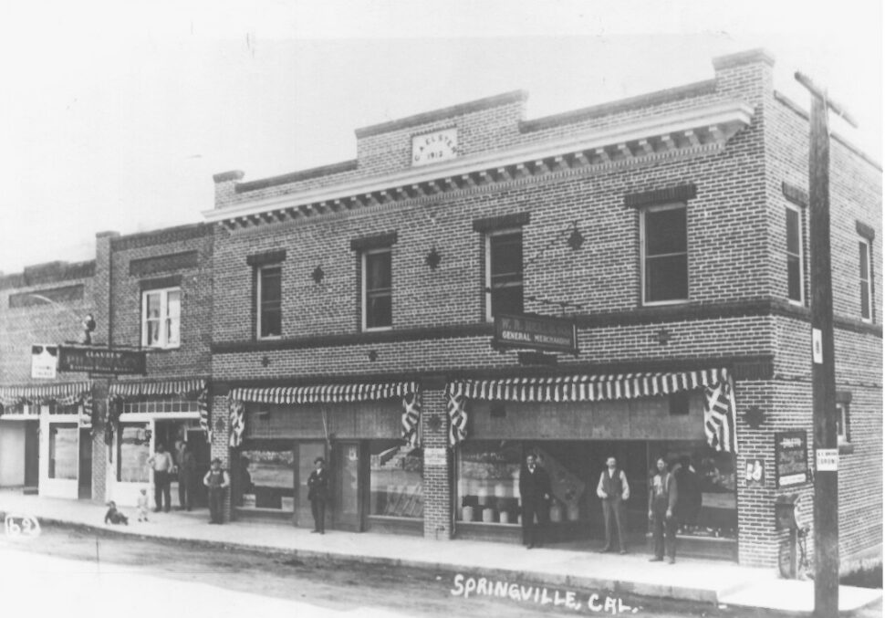
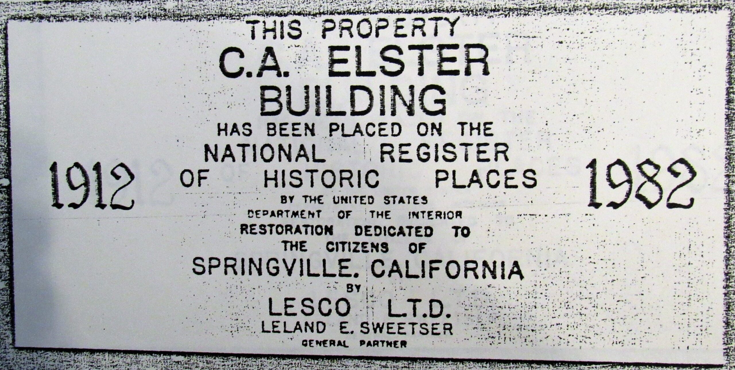
     Charles Augustus Elster built a two-story brick business block on Main Street in the little foothill community of Springville in 1912. For well over a hundred years now, this classic structure has anchored Springville’s “downtown.” It has had many different owners and tenants and survived two fires, but its handsome Main Street exterior remains almost unchanged from the long-ago day of its grand opening, and it continues to house a variety of businesses serving locals and visitors alike.

     Charles’s parents, Alonzo and Rebecca Elster, arrived in Tulare County with their eight children in 1866, when Charles was three. They settled first in Visalia, then moved to the foothills of the Tule River watershed to engage in logging, milling, and ranching, which, for over forty years, through booms and busts, were staples of the area’s industries.

     Charles bought his first land claim before he was 21, labored hands-on and learned his way up through the hard jobs in the forest, and in 1903, built his own mill just a few hundred yards above the old Mountain Home Hotel.

     In 1888, he wed 20-year-old Eva May Hubbs, daughter of local pioneer timber man James R. Hubbs. Two years later, Eva May died soon after birthing Charles’s only son, Irvy. In 1892, he married Eva’s younger sister, Mary Arminda “Minnie” Hubbs, age 17, who bore Charles’s only daughter, Lora, in 1894.

     Despite financial difficulties as the area’s timber industry began shutting down in 1904, the amputation of most of son Irvy’s right leg in 1902, and the death of daughter Lora, age 13, in 1907, Charles and his family persevered. Charles turned to ranching and stock raising and became active in large enterprises, including developing reliable water supplies and distribution, rail transportation, electric power — and Springville as a business center — all essential to the commercial success of these industries and the Springville region.

     He and other visionaries formed the Tulare County Power Company and secured valuable water rights on the Middle Fork of the Tule, which would be developed to provide electricity to the growing town. Their corporation also worked to bring an electric railroad to Springville, but a competing, steam-powered line, the Porterville Northeastern Railroad, got there first, with its inaugural engine rolling into town on September 9, 1911.

     The advent of electricity and rail transport boosted Springville into the modern age. In 1911, the community’s first “permanent” structure, the Wilkinson Building (now the Springville Inn) was erected on Main Street (now Highway 190). In 1912, Charles, having acquired 47 acres of property in the townsite, built the prominent, two-story, brick Elster Building right across the street.

     Springville became a weekend resort destination as the train and improving local roads sped visitors from the valley up to the dance halls on Main Street and at the nearby Soda Spring, tennis courts in town, and regular baseball games that drew large crowds. The new Elster Building became the retail center of Springville, and Charles became one of the largest taxpayers in the community. (He also owned an olive nursery, an orchard, and a large, comfortable residence near by.)

     Located on a main corner, the 48′ x 60′ Elster building cost $12,000. It was designed in an impressive architectural style found in many small California towns of the period, and its handsome front and east facades remain virtually unchanged today.

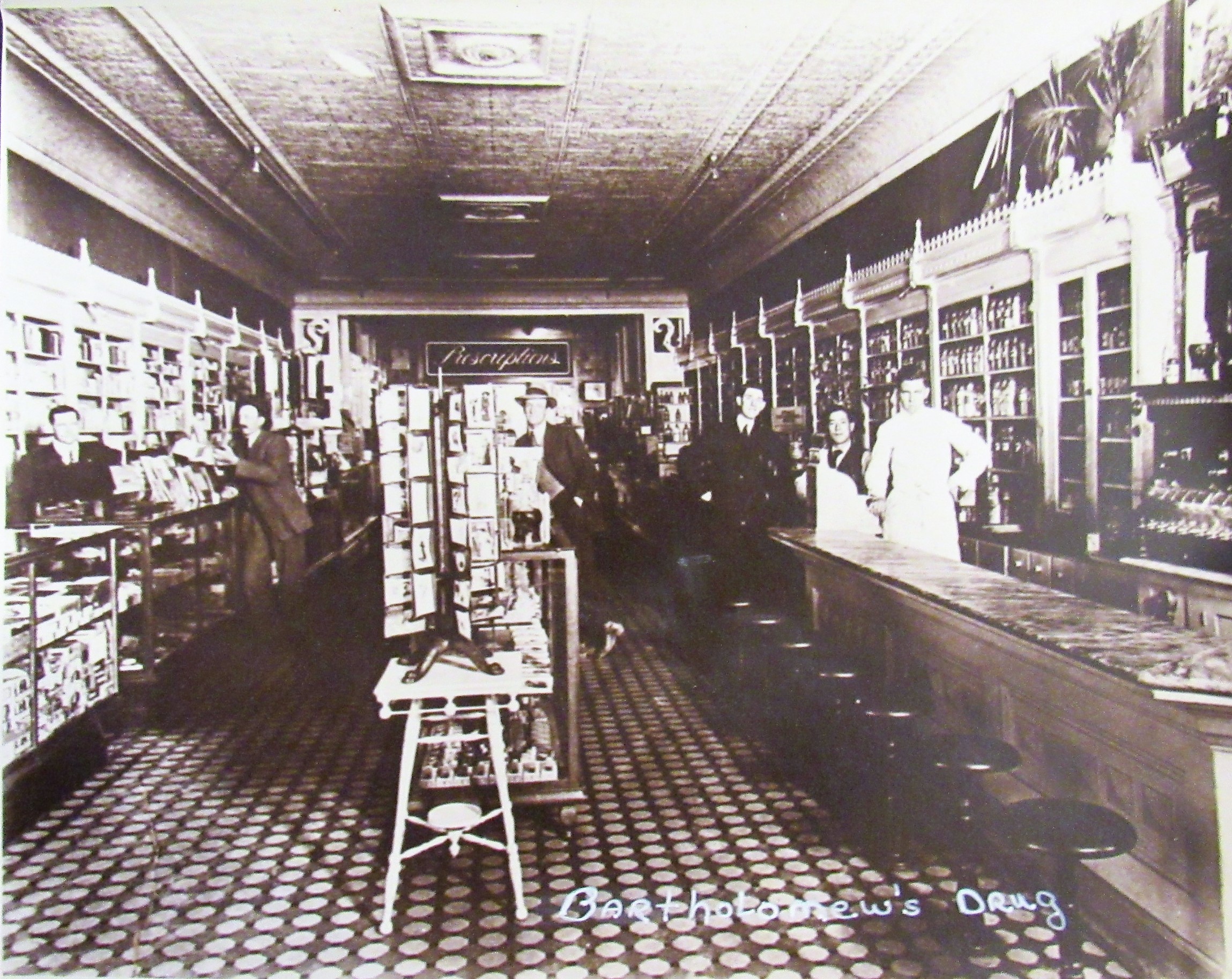
     Its various tenants have included the Pioneer Bank (1912-1918), the post office, the Odd Fellows Fraternal Hall, a drug store, the first telephone in town (1912), a meat market, a restaurant, many different professional offices, a bar, a drywall company, a real estate office, a personal trainer, a grocery store, and the Springville Visitors Center. Its basement housed the first ice plant in town. Its second floor provided lodging for tourists and new arrivals to Springville. The solid, attractive, busy building marked the prosperity and growth of its community and rural Tulare County.

     Charles got back into the lumber business with his Hot Springs sawmill by 1914, and then, in 1920, a new sawmill at Harper’s Point, near Mountain Home, that he established with A.M. Coburn. But hard times came again. Coburn died in an auto accident in 1921. Charles’s wife, Minnie, only 54, died of pneumonia in 1929. Less than three weeks later, the Elster Building was owned by the J.D. Miller Realty Company.

     As America sank into its Great Depression in 1930, Charles and his son, Irvy, were regularly receiving delinquent tax notices on their Springville properties, including the Elster Building, which they no longer owned. Charles sold his mill property in 1941 and died two years later, at age 84. (Irvy, known today mostly as the storied “Hermit of SCICON,” never married; he was found dead in his mountain cabin in 1965.)


     The Elster Building continued to change hands, in 1930, 1931, 1932, 1939, 1959, and 1964. In 1974, it was acquired by Leland E. Sweetser, an officer of Lesco Ltd., of Compton, California (who may have been urged by Springville residents to save the town’s principal building by acquiring and restoring it), and then by Lesco Ltd. in 1976.

     When Lesco purchased the Elster, then known as “the old Palace Hotel,” it had been condemned by the County and required major renovation to meet building codes for safety, plumbing, structural, and electrical requirements. Lesco spent over $250,000 on a new foundation, exit stairwells, structural support, and reconstructed office space, ensuring that the work would comply with the standards of the National Register of Historic Places, on which it got listed in 1982.

     Fire damaged the building in 1983, but Lesco again restored it to NRHP standards, and in 1985 quitclaimed the deed back to Sweetser. In 1997, Robert Gillett of Porterville purchased the Elster, then sold it in 2003 to Max and Valerie Walden, the developers of Hanford’s Courthouse Square.

     The Elster Building is currently owned by Bob Tucker, who had been coming to Springville since boyhood and loved the small community. In the 1970s, he bought a ranch nearby, and in 2019 he bought the building that he had long admired and considered to be a Springville focal point. “The building has good bones,” says Bob, who taught Industrial Decoration Arts for decades and enjoys doing historical restoration work himself. Bob’s nephew, Derrick Usher, a realtor, is managing the Elster from his upstairs office onsite. And so it appears that this classic edifice is once again in good hands for the next chapter of its long life as Springville’s landmark commercial center, still linking its community’s past to its future.

September, 2025


Maps & Directions:


The Elster Building is located on the southeast corner of Hwy 190 and Tule River Dr. in Springville, 32588 CA-190, Springville, CA 93265.


From Visalia, go east on Hwy 198 to its junction with Hwy 65 (near Exeter). Go right (south) on Hwy 65 to its junction with Hwy 190. Exit onto Hwy 190 and go east toward Springville. In Springville, see the Elster Building on the right (south) side of the highway, at its junction with Tule River Drive.


Nearby Treasures Springville Historical Museum, River Ridge Ranch & Institute, McCarthy Blue Oak Ranch Preserve, Circle J-Norris Ranch, SCICON, Success Lake.


Site Details & Activities:

Environment: At the historic center of the small foothill town of Springville, 2 blocks north of the Tule River, across the street from the Springville Inn (built in 1911)
Activities: Architecture study, history, photography, picnic facilities nearby in Veterans Memorial Park, 35638 CA-198 (Main Street)
Open: The various businesses in the Elster Building have various open hours.
Site Steward: Derrick Usher, a realtor, is managing the Elster Building from his upstairs office onsite 559-719-0304
Books: The Men of Mammoth Forest, A Hundred-year History of a Sequoia Forest and its People in Tulare County, California, by Floyd L. Otter; printed by BookCrafters, Inc., 1963, 1964, 1976, 1982, 1986, 1995


Click on photos for more information.

A Stroll Through History

by Amy L. King-Sunderson

     Nestled within the oak preserve protected by Visalia’s Mooney Grove Park, the Tulare County Museum complex holds a vast collection of our county and state’s history, including one of the largest Native American basket collections in California. It also displays a great variety of artifacts of the pioneer era, a trove of historic agricultural equipment, dozens of restored structures from the late 1800s on, and many other treasures, appealing to all ages, that tell the history of Tulare County.

     The seed of the Museum was planted in 1934, when Hugh Mooney and his family donated five thousand dollars to fund the building of a museum in Mooney Grove, which had itself been sold to the county in 1909 by his parents and is the oldest county park in California. But it wasn’t until 1947 that approval was given by the county Board of Supervisors to begin building the museum on the specified site.

     In 1948, construction began with the laying of corner stones and a dedicatory address by Dan McFadzean, who was one of the County Historical Society’s first members and also the attorney who had prepared the legal papers for the County’s acquisition of the park from the Mooneys in 1909. The museum was opened to the public on July 1, 1949, and the Tulare County Historical Society ran its operations from 1948 to 1956, when the county took over that responsibility.

     For almost three quarters of a century, the Tulare County Museum has actively partnered with the County Board of Supervisors, the County Historical Society, members of the county’s varied and historic cultures and communities, and many other local organizations and institutions “To protect, preserve and promote a shared understanding of Tulare County’s past and its place in the future by providing the community with innovative, diverse, and engaging exhibits and events.”

     The 1948 structure was originally a single gallery, now known as the Middle Room. Today, it houses a military display, tractor exhibit, Sequoia and Rankin fields aviation display, a Visalia Electric Railroad model train, and the Mountain Connection exhibit, which highlights the Sierra Nevada mountains.

     The East Wing, holding the native basket collection, was added in 1956 and the West Wing, or Annie Mitchell Room, with displays of living styles and early county families was added in 1967, making a total of three galleries. Around 1970, the Gun and Saddle gallery was added onto the main gallery to house the growing collection of firearms and tack, including several of the famous Visalia Saddles.

     The beautiful Masonic Building Façade was donated in 1961 and placed behind the original museum building to create an enclosed space for the Main Street gallery, which holds life-sized replicas of historic business establishments. During the 1960s, many structures, such as the Surprise School, the Emken House, and Visalia’s first jail, were added to a Pioneer Village of original historic buildings and preserved on the museum grounds.

     The museum’s newest addition is the History of Tulare County Farm Labor & Agriculture Museum. This building’s displays include a large steam tractor and a Hackney Auto Plow, along with a reconstructed Linnell Camp house that was used to shelter migrant farm workers. But the main focus of this Museum is its cultural gallery that highlights, one at a time, each of sixteen different cultural groups and their contributions to our county’s agricultural history.

     Each new exhibit brings new involvement in the museum as members of each group provide many of the photos and items on display. The Tulare County Office of Education also produces a video to accompany each exhibit, featuring interviews of local members of the highlighted group. An opening reception with food, guest speakers, and often music offers another opportunity for the Museum to connect with each community in a wonderful way.

     Over the years, the Museum has collaborated closely with the Tulare County Historical Society to acquire historical items for display and to host fundraising events that support vital restoration projects throughout the museum complex. The Clocktower that houses the clock that used to be in the Bank of Visalia building downtown, the Southern Pacific Caboose that was used on the Visalia Electric Railroad, the facade of the Masonic Building that used to be in downtown Visalia, the Main Street gallery, and recently the Agricultural Equipment project have all been funded by these events.

     The Agricultural Equipment Project has been in the works for several years with two components – restoration of displayed equipment, and construction of a building in which to showcase it. Don Vieira and Carl Switzer, members of the Tulare County Historical Society, have been integral in the conception of the project as well as bringing it to fruition.

   Through their efforts, the Museum has partnered with local high schools whose students have been working to restore several pieces of equipment from the collection that have been weathered by the elements over the years. The students’ research on each piece of restored equipment will contribute to the timeline of the history of local agriculture, a main focus of the new building.

     As the Tulare County Museum continues to expand its collection and its educational programming — including yearly classroom tours, lectures, publications, and events — community engagement is vital in making those efforts successful. The Main Street Jamboree is one such free and fun event for the whole family that has helped to connect the museum to the community. Held each year on the last Saturday in April, the Jamboree provides many new and fun ways for visitors to learn about Tulare County history and its important part in the life and growth of California.

     The Tulare County Museum, with its constantly growing and improving displays and events, lies at the core of our county’s history. Set in one of the most beautiful oak groves in Tulare County, it is the perfect place to discover the wonderful preservation of our fascinating past. History can be intriguing. It can be fun. Come join us!

March, 2021


Slideshow:


Quotes & More Photos:

“The location itself is historic, being part of the great oak forest that extended from the foothills to old Tulare Lake along the delta of the Kaweah River.” — Joseph E. Doctor

“A statue depicting Mooney and his favorite hunting dog was dedicated to his memory in June, 2006, by the Tulare County Historical Society.” — Visit Visalia

Entering the museum, one is met by a seven-and-a-half-foot tall statue of Minerva, the goddess of wisdom. She stood atop the dome of the old Tulare County courthouse from when it was built in 1876-77 until it was razed after the 1952 Tehachapi earthquake. — from Terry Ommen and Tulare County Historical Society, in Los Tulares, March, 1968

Alsalio Herrera and Ricardo Mattley worked with Juan Martarel at his Visalia saddle shop in 1869. Martarel radically changed the Mexican stock saddles used by the California vaqueros, making them lighter, stronger, and more comfortable for both rider and horse. Herrera, a skilled silversmith, made bits, spurs, ornaments, and metal parts for saddles and bridles, while for 20 years Mattley made all of the saddle trees used by Martarel and his successor, David E. Walker, who bought the business in 1870. — from Annie R. Mitchell, in Los Tulares, September, 1959

“D.E. Walker . . . was something of a merchandising genius and made ‘Visalia’ a by-word among stockmen.” — Tulare County Historical Society, in Los Tulares, March, 1968

“The Yokuts Indians were among the best basket weavers and until recent years a few were still being made. In other cases are displayed arrow points, charm stones, arrow straighteners, ceremonial blades, [and]. . . portable rock mortars and metates. In the center case is a display showing how acorn flour was prepared . . . .” — Tulare County Historical Society, in Los Tulares, March, 1968

“”[T]he old Masonic building in Visalia . . . was constructed in 1873 and 1874 and at the time was the largest building between Stockton and Los Angeles. It was a social, political, fraternal, and governmental center for much of the county and the valley. . . . It represents a noble type of architecture which has virtually disappeared from California. . . . a magnificent example of the work of the old-time builders in wood . . . constructed almost entirely of redwood . . . .” — Joseph E. Doctor, President, Tulare County Historical Society, 1957

“The Tulare County Historical Society was privileged in 1961 to receive a donation of the Emken house from Marcus and Victor Emken. This lovely typical farm house was moved [from its original location west of Strathmore] into the historical village. The village is a delight to history buffs and is greatly used by various schools in Tulare and surrounding counties.” — Tulare County Historical Society, in Los Tulares, March, 1994

“The Farm Labor and Agriculture Museum recognizes the importance of the farmers . . . those special hardy men, women, and children from the many cultural and ethnic groups that tilled the soil. Well worth a visit.” –Terry Ommen

“It is difficult for the present generation to realize how people lived without high speed automobiles, TV, radio, even without electricity for any purpose. When chores meant filling the wood-box after school every day, when mom had to wash and polish the lamp chimneys and when kids’ spending money might be a penny or two.” — Tulare County Historical Society, in Los Tulares, March, 1968

“From the beginning, the Tulare County Historical Society has been involved in the development of the museum, donating money for additions and repairs to the museum, as well as members’ time and effort. It would be impossible to think of the Tulare County Museum without thinking of Annie Mitchell. In 1947, . . . [she] was appointed Museum Curator. She was a member of the Board of Directors longer than anyone, and it was with regret that she resigned in January 1998 due to ill health.” — Tulare County Historical Society, in Los Tulares, September, 1998

“A historical society . . . fundamentally . . . is a trustee of the past and its culture. As such, it faces the challenge of preserving not only what obviously has value now, but also what will have significance in the future.” — William B. Osgood; June, 1957

The first Surprise School dated back to 1876. It was replaced in 1906. When use of the 1906 school was discontinued in 1962, the Surprise Community Club raised money to move it from near Woodville to the Museum. “The belfry was lifted off and the roof removed to avoid cutting utility lines.” — Tulare County Historical Society, in Los Tulares,  March, 1968


Maps & Directions:

Directions:


Address: 27000 South Mooney Blvd., Visalia, CA 93277


From Visalia, go south from Hwy 198 in downtown Visalia on Mooney Blvd./Hwy 63 for 3.5 miles and turn left (east) into Mooney Grove Park.

Follow the park road to the original Museum building, which will be on your right.


NOTE:  Admission to the Museum (as well as the Farm Labor & Agriculture Museum) is via the office in the original Museum building (except during special events).


Site Details & Activities:

Environment:  Valley, outskirts of City of Visalia, inside Mooney Grove Park
Activities:  Pioneer village, cultural center, tours of museum for schools, special events
Open:  Thursday – Monday 10:00 a.m. – 4:00 p.m. April through October; in November through March weekend hours are reduced to noon — 4:00 p.m. School tours can be arranged by calling the office during open hours at 559-624-7326, or email aking1@tularecounty.ca.gov (reservations are required for school field trips; admission fee: $1.00/student [no charge for teachers or chaperones], plus $6/vehicle other than school bus).  Admission: free for the public (included in Mooney Grove Park entrance fee:  $6/vehicle, $3 for seniors, collected at park entrance gate Friday-Sunday during March-October).  Donations greatly appreciated.
Site Steward:  Amy L. King-Sunderson, curator, 559-624-7326, aking1@tularecounty.ca.gov
Opportunities for Involvement:  Donate, volunteer
Links:


Click on photos for more information.


The Story of the James K. Herbert Wetland Prairie Preserve

by Laile Di Silvestro

     On the first planting day of the 2013-2014 rainy season, several students from College of the Sequoias spent hours bent over soil scoured by a prescribed burn. They dug holes and patted small seedlings of oak, willow, cottonwood, and elderberry into the ground before watering them thoroughly.

     The students’ activity might not have seemed unusual to the Yokuts, the indigenous peoples of the Tulare Basin who lived off the land for thousands of years. They actively managed it by setting fire, by pruning dead undergrowth, by tending seedlings, and by transplanting some edible flora. Their resource management supported a diverse diet of seeds, roots, herbs, and meat, and helped them to maintain an adequate food supply despite variations in weather and water availability.

     Less than 150 years ago the Tulare Basin held the largest freshwater lake west of the Mississippi. The shallow lake, the rivers that fed it, and the miles of tule marshes and wetland prairie around it nurtured a rich diversity of plant species and wildlife.

     The first Euro-American settlers, who arrived in the 1850s, recognized the land’s agricultural potential and proceeded to drain the lake and marshes and divert its water sources to irrigation canals. By the early twentieth century, the lake had been reduced to small seasonal pools, and the basin was divided into a vast grid of intensively farmed land.

     Yet, about four percent of the original landscape remains, and an invaluable portion of that is enclosed within the fences of the James K. Herbert Wetland Prairie Preserve. This 725-acre site lies to the east of the vanished Tulare Lake shore, between the Kaweah and Tule Rivers, and protects the largest remaining piece of natural prairie in Tulare County.

     Its preservation is due to the efforts of biologist Robert Hansen, and the vision of farmers James and Carol Herbert. The Herberts hired Hansen in 1992 to assess the potential of the property. Hansen found a remnant of the land as it was before the Euro-American settlers arrived. It was ideally situated to serve as an important segment of the Oaks to Tules Wildlife Corridor and, if restored, could help preserve threatened plant and animal species while mitigating local flood and fire risk.

     After several years of study, Hansen recommended that the land be conserved, rather than converted into a dairy farm or orchard. The Herberts embraced the idea of protecting this vanishing habitat, which they fondly called their “wilderness.” In 2000, a coalition of government and private organizations provided the funds necessary for the Sequoia Riverlands Trust to purchase the land from the Herberts at less than market value.

     Two years later, the Trust took on restoration of the land with a rigorous scientific approach. With the help of the National Resource Conservation Service and the California Wildlife Conservation Board, the Trust began returning 83 acres of the site’s irrigated pasture to wetland.

     They restored vernal pools, dug three shallow ponds, constructed a meandering slough, and seeded the slough with native grasses. From 2005 to 2010, with a grant from the Central Valley Project Conservation Program, the Trust and dozens of volunteers continued wetland restoration while systematically monitoring how the native species respond to management programs that include prescribed fire and livestock grazing.

     The results are astounding. The diversity and abundance of native wetland prairie plants has increased. As a result, western spadefoot and freshwater invertebrates abound (seasonally). With the restored habitat, the long-tailed weasel, coyote, Golden eagle, and Swainson’s hawk come to forage. Ducks, grebes, and redwing blackbirds have returned to feed and nest. In all, the number of bird species on the property, including burrowing owls, has increased from 76 to 153.

     Of the animals that have returned to this land, perhaps none are more important than humans. Volunteers tend to return to the site again and again to see how the plants are doing and to enjoy the beauty of a thriving wetland prairie. “Human beings are a huge piece of the puzzle,” says project biologist Bobby Kamansky, “because we value biodiversity, and we, as a society, derive direct benefit.”

July, 2014

Note:  Now read Rob Hansen’s SOME BIRDS OF THE HERBERT PRESERVE and MYSTERIOUS LIFE OF VERNAL POOLS.  For more about hogwallows (Mima Mounds), see THE STORY OF THE HOGWALLOW PRESERVE.


Slideshow:


Quotes & More Photos:

“Good farmers, who take seriously their duties as stewards of creation and of their land’s inheritors, contribute to the welfare of society in more ways than society usually acknowledges, or even knows. These farmers produce valuable goods, of course; but they also conserve soil, they conserve water, they conserve wildlife, they conserve open space, they conserve scenery.” — Wendell Berry

“When the re-contouring work was done in October 2002, the 83-acre site was devoid of vegetation, but a new meandering channel (since dubbed Sellers Slough in honor of Carol Sellers Herbert, one of the original owners) and three ponds had been excavated and were just awaiting a ‘wetting’ invitation. Native grasses had been planted along Sellers Slough and needed rain and a christening flow of water down the new channels into the new ponds in order to green up the restoration site.” — Rob Hansen

“Young riparian trees and shrubs (valley oaks, willows, cottonwoods, button willow, elderberry, and blackberry) that have been planted along Sellers Slough near the northwest corner of the preserve are now getting tall enough that I fully expect that on one of my next birding visits, I will be lucky enough to find a western wood-pewee, a western bluebird, phainopepla . . . or a black-headed grosbeak perched in these plants (which are irresistible to migrating songbirds like these).” — Rob Hansen

“During the entire post-wetting and restoration/re-vegetation period (November 14, 2002 to July 27, 2011) 75 additional bird species have been added to the avian inventory at the Preserve. This is a remarkable testament to the effectiveness of ecological restoration: if you build it, if you wet it, they will come!” — Rob Hansen

“It’s so great to be able to walk along the edge of the preserve and look over the mounds where the vernal pools are and see flocks of mallards and widgeons and green-winged teal, sometimes even Canada geese out in the wetlands.” — Rob Hansen

“If you truly love nature, you will find beauty everywhere.” — Vincent Van Gogh

“The land around the Herbert Preserve . . . will change as crops change and as communities grow. But we’re hopeful that this large patch of wild open land will continue to provide recreation and solitude and scenic beauty and all the things that go along with wild land and the organisms, the critters that live there.” — Rob Hansen


Maps & Directions:


Address: On Hwy 137 (the Tulare-LIndsay Hwy), at its junction with Road 168, between Tulare and Lindsay.

Coordinates: 36.2113518, -119.1989383


From Visalia, take Hwy 198 east four-and-a-half miles to the Farmersville exit.

Turn south on Farmersville Boulevard (AKA J23/Road 164).

Several miles south, this road becomes Road 168, and ends (after eight miles total) at its T-junction with Hwy 137.  The Preserve is directly across Hwy 137, on the south side of the highway.


Site Details & Activities:

​Environment: Valley, prairie, mima mounds (hogwallows), wetland, vernal pools (seasonal)
Activities: birdwatching, botanizing, guided tours (contact SRT), hiking, photography, wildlife and wildflower viewing
Open: Due to the rarity and fragility of its ecosystem, the Herbert is open to the public primarily on only one or two days each year, for special tours and events.  Individuals or organizations wishing to visit at other times must contact SRT for permission to access the Herbert.  There is no fee for access, but donations are greatly appreciated.  And NOTE:  Birders can enjoy good birding opportunities from outside the Herbert’s long fence almost anytime.
Site Steward: Sequoia Riverlands Trust, 559-738-0211, info@sequoiariverlands.org
Opportunities for Involvement: donate, volunteer
Links:


Click on photos for more information.

Its Mighty Wurlitzer Still Sings

 Adapted from “Porterville First Congregational Church Pipe Organ History,” by Eleanor Foerster

    The First Congregational Church’s pipe organ is considered to be the oldest functioning Wurlitzer in California. It was built in 1916 to accompany silent films of the day in a Los Angeles movie house.

  That day passed when “talkies” took over in the late 1920s. The only large market left for the theater organs would be churches. But it was then considered “improper” for churches to use theater organs which had provided music for entertainment and sometimes risqué vaudeville shows.

     With their sales value rapidly dropping, the now almost worthless organs were stripped of their “toy ranks” that produced the sound effects — such as drums, whistles, and horns — for the movies. Their remaining ranks were renamed to sound more ecclesiastical, their consoles were stained darker to look more ecclesiastical, and the instruments were rebranded as “Robert Hope-Jones Concert Organs” and given false provenances that would make them more saleable to conservative churches.

     The First Congregational Church’s pipe organ was delivered in 1931, church officers having been told that it came from a large church in Chicago. But when the Crome Organ Company of Los Angeles came to rebuild the organ after it was damaged in the 1936 fire, the workmen recognized it as the old Wurlitzer from the Los Angeles Deluxe Theater.

     In 1963, a four-manual [keyboard] Moller console with a full AGO pedal board was purchased from Pomona College’s Little Bridges Hall of Music. Famous organists have played on this console: Albert Schweitzer and E. Power Biggs. Over the years, the church has methodically added back the stripped toy ranks so that silent films can be shown in the sanctuary with full accompaniment for the community’s enjoyment.

     A major organ funding drive in 1991 raised over $45,000. In addition to upgrades, an endowment fund for future maintenance was established. The organ now has 24 ranks (rows of pipes) which can be expanded to thirty eight in the future. While false pipes have been added as architectural features behind the choir loft and pulpit, operating pipes are spread throughout the sanctuary.

     Many generous congregation members — musicians and technicians, fundraisers and donors — have worked tirelessly to keep this great organ singing. Its magnificent voice may well resound for another hundred years.

April, 2017


Click on photos for more information.

First Congregational Church of Porterville — An Important Feature in the City’s Life for Over 125 Years

by Shirley Kirkpatrick

     As the peals of the carillon bells from the First Congregational Church steeple drift over Porterville’s downtown, residents are reminded daily that the church is a longstanding element in the city’s life.

     The nationally recognized structure sits on three city lots east of downtown at the southeast corner of Mill and Fourth streets. With no nearby buildings, the church is clearly visible with its distinctive Late Gothic Revival architecture, arched stained-glass windows, cedar shingle siding, native stonework, and soaring steeple. It was approved for recognition on the National Register of Historic Places in 1998, ninety years after its construction.

   Still, the story of the First Congregational Church dates farther back and is uniquely linked to the history of the Porterville. A cornerstone marker on the building is dated 1891-1908, marking the church’s establishment before construction of the current facility.

     Church member Joe Faure is a frequent tour guide for visitors who want to see inside the building. As he explains it, the city was first just a cluster of houses, saloons, and shops serving as a stopover for land schooners carrying newcomers eager to search the gold fields farther north. When Royal Porter Putnam, a shopkeeper and owner of 40 acres on the banks of the Tule River, began laying out a grid for streets and lots for a new town in 1864, his wife, dismayed by the “wild west” feel of the village, insisted he set aside three lots for churches.

     As settlement in the area by farmers began, it brought an influx of mid-Westerners, many of them of the Congregational faith. Sharing similar theological views, they merged with a dwindling Presbyterian church at the site, and in 1891 the congregation became affiliated with the Congregational Church. It was identified as an “institutional church” — providing not only religious services but multiple uses for the entire community, with culture, education, recreation, and respectable entertainment – meant to help tame the rough and tumble town.

  Thus, they built a multi-level edifice in 1908 where young people could develop body, mind, and spirit with physical fitness, mental training, religious ideals, citizenship, and service. They brought the first daily kindergarten to the area, provided an indoor swimming pool with a gymnasium on the second story – the first in southern Tulare County, and a 250 seat sanctuary that doubled as the town’s only auditorium. The church even bought two additional lots south of the building in 1915 to construct the first tennis courts in town for public use.
     Some alterations have been made over the years, but the church building today is essentially unchanged from its original plan, as attested to by the framed blueprints on display, the work of San Francisco Bay Area architects George C. Meeker and Francis W. Reed. Its design is in the Shingle/Bay Tradition of the Gothic Revival style. It is now the only site representative of this architectural style in the south San Joaquin Valley – others of the era having been mostly destroyed by fire.

     However, fire did significantly change the church in 1936, burning the south wall of the sanctuary, a portion of the altar and recessed chancel, and the entire gymnasium. Since area high schools were now providing swimming, gymnasium, and tennis venues to the public, the Congregationalists replaced theirs with a social hall, complete with a modern kitchen and raised stage over the original swimming pool. This lower level addition adjoins the Fireside Room, a large area with comfortable seating and a fireplace.

     In 1961, a separate building south of the church was built for classrooms; and in 1978, an elevator was installed from the ground level Mill Street entrance side to the upper vestibule for wheelchair access. The church still provides a home for gatherings of community groups such as Girl and Boy Scout troops, quilters, and Alcoholics Anonymous, and for entertainment in the form of plays and musical concerts.

     Music has been an important part of the Congregational church since its beginning. The church maintains two Steinway pianos, a magnificent pipe organ, and its original pump organ, which is still used for special occasions, such as the church’s 125th anniversary celebration in 2016.

     Another source of pride and contributory factor in the church’s selection for National Register recognition are its outstanding stained glass windows. The unique windows were designed by a San Francisco artisan who was unfamiliar with the region and was fascinated by its changing seasons and the emerging citrus industry on the nearby hillsides. Thus, the windows feature the greens and golds of spring and fall, and each is anchored at the bottom by a panel featuring a cluster of three oranges and leaves. This motif, many congregants believe, suggests the Christian doctrine of the Trinity.

     This brings us full circle in our tour of the church and back to the carillon system. It, too, has a story. The sound system was a gift to the church in memory of Richard Moore from his family and friends. It was first installed in 1957 by the Maas-Rowe Company of Escondido. It served well for twenty two years, when the installing company was re-hired to upgrade the parts and system. Once again the carillon sounds marked the passage of time for the city, with songs at 8 a.m., noon, and 5 p.m., and chimes on the hour in between — a fix that lasted until 2001.

     After 15 years of silence from the carillon, the family of the late Harry and Virginia Falconer pledged the entire sum for the carillon replacement project in their memory, providing a modern, digital system with over 600 songs to choose from. And so, just before Christmas 2016, the familiar musical interludes once again emanated from the First Congregational Church spire daily and for special occasions. It is an audible indicator that the church continues to serve its community well into its second century.

April, 2017


Slideshow:


Quotes & More Photos:

“‘W.T. GARRATT & CO. SF CAL 1870’ is cast around the top of a[n] 18 inch high, 24 inch diameter bell, which is still rung by hand for celebrations such as the church’s centennial in 1991. This bell is from the earlier 1873 church on this site. . . . The 1873 church was torn down and construction of the present church, finished in 1908, began at this bell tower corner.” — Joe Faure

“Lavish use of elegantly crafted wood in interiors also reflects the New England heritage of early families.” — Joe Faure

“The grand space [of the nave], 54 feet by 74 feet, is flanked on both sides by an arched colonnade and narrow aisles. … The floor is tongue and groove vertical grain [D]ouglas fir. All woodwork throughout this auditorium displays elegant craftmanship.” — Joe Faure

“Blacksmiths were essential in a community that depended on horses. . . . Local craftsmen were available to provide church ornaments such as the light fixtures.” — Joe Faure

“Several local rock quarries provided roughly cut blocks and slabs such as were used on the front face, and for the foundation and steps of the church. The cornerstone itself was hauled from a nearby hillside.” — National Register of Historic Places (NRHP) Nomination Form

“You could never rebuild this church the way it is now. The craftsmen aren’t available. The construction materials aren’t there. You could not afford to build this today.” — Joe Faure

“Periods of architecture like this one, and like the Art Deco period that the post office represents . . .”

“. . . and the Victorian era that Zalud House represents, those periods aren’t going to come again. We’re fortunate in Porterville:  we have three of those periods represented, going clear back to the 1890s. They need to be preserved if at all possible.” — Joe Faure


Maps & Directions:

Directions:

Address: 165 E. Mill St., Porterville, CA 93257

From Visalia, take Hwy 198 east to Hwy 65 south to Porterville. Exit east onto W. Olive St., then go north (left) on N. 3rd St. and turn east (right) to 165 E. Mill St.


Site Details & Activities:

Environment: Valley, historic church in Porterville
Activities: attend services, arrange tour
Open: for worship services (Sunday, 10:30-11:30 a.m.) and study, and for tours by appointment only
Site Stewards: First Congregational Church, 559-784-5340, 559-784-5340; portervillefcc@att.net
Opportunities for Involvement: donate, volunteer
Links:  


Click on photos for more information.

The Story of the Hogwallow Preserve

by Delora Buckman

     The Buckman family were Tulare County pioneers, arriving here in the late 1800s. The journey of those early settlers in covered wagons through mile upon mile of rough, uneven primitive land is an important part of our heritage; and it led to the creation of the Hogwallow Preserve – to protect in perpetuity some of that wild hogwallow land as it appeared for hundreds of thousands of years before intensive farming began.

     My father, Dr. Phil Buckman, purchased 40 acres of hogwallow property near Lindcove sight unseen in 1943. But he knew what he was getting. He knew the region well, having traveled through it every summer from his boyhood home in Exeter to the cool High Sierra country of Mineral King. He supported his college education by operating the Mineral King Pack Station during the summer months before graduating and eventually returning to Exeter to practice medicine.

     To him, the hogwallow land was much more than just a piece of property. It was one of his favorite places. He was humbled by the panoramic view of the Sierra Nevada that included Homer’s Nose and Sawtooth Peak. He used the clay soil to make the adobe bricks for his impressive home. He grazed livestock on the hogwallows’ mounds and swales and hunted quail. He appreciated the unique land’s rare plants, animals, and vernal pools, and its changing beauty in each season. He enjoyed its peace where he could sit quietly and hear birds sing.

     Hogwallows, also called mima mounds, are land forms of mounds and swales; some of the mounds are three or four feet high. Vernal pools appear in the low areas between the mounds in wet seasons, producing uncommon vegetation and providing habitat for wildlife. Mariposa lilies and brodiaea bloom during the spring; in the summer months the hogwallows are mostly covered with dried grasses.

View Toward High Sierra

     When we were children, my brother, sister, and I loved playing there, running up and down the mounds and discovering treasures like four-leaf clovers, frogs, and tiny, delicate plants. In really wet years when the vernal pools were very full, our hired man built a Tom Sawyer-type raft that we navigated across the pools by pushing with a long stick.

     As nearby property owners leveled their parcels of native land to plant grapes and citrus, my father grew even more appreciative of the hogwallows. They once had covered thousands of acres in Tulare County, and soil scientists estimated them to be as much as 150,000 years old. He knew the mounds and swales were disappearing and he wanted to preserve an example of them for future generations. To him, the land was more valuable in its natural state than a cash crop or the profit from a sale.

     And so, on a beautiful day in April, 1979, the Hogwallows were formally dedicated to the Tulare County Historical Society to be preserved in perpetuity, through the generosity of Dr. Phil Buckman and his daughter, Carol Buckman.

     I am very appreciative that my father and sister had the foresight to donate the ten acres of hogwallows to the Historical Society. Soil scientists continue to visit the preserve to study and evaluate the phenomenon of this ancient and remarkable landform. I hope that you, too, will visit the Hogwallow Preserve and enjoy seeing this piece of Tulare County as it once was.

June, 2013

UPDATE:  In December of 2022, Greg Collins purchased the Hogwallows Preserve from the Tulare County Historical Society.  A life-long resident, with a strong affinity for the land, Greg spent his career in city planning and promoting sustainable land management policies and practices.  Upon retiring, he fulfilled his dream of buying and protecting some natural Valley land, and greatly enjoyed many days spent exploring and studying the Hogwallows’ ten acres.  In December, 2024, Greg donated the preserve to Sequoia Riverlands Trust, as he had always intended, for its permanent preservation.  SRT is working on a management plan for this special habitat and is currently allowing the public to view the preserve only from the perimeter and the viewing point outside the perimeter fence.  The preserve itself is not open to the public.

                                                    Note: For additional information, see the Origins of the Hogwallows.

                                                      Read more about vernal pools at Mysterious Life of Vernal Pools.


Slideshow:


Quotes & More Photos:

“For years people have said that a little patch of good ‘hog wallows’ ought to be preserved. They used to cover a considerable part of the valley near the foothills, but at the present rate of leveling they will soon be gone. The Society has done some work looking toward securing a few acres of these mysterious mounds. Should this effort be intensified?” — TCHS “Los Tulares,” #1, October 1948

The Buckman family were pioneers, coming to Tulare County in the late 1800s, and homesteading property; the whole family farmed.” — Delora Buckman

“If future generations are to remember us with gratitude rather than contempt, we must leave them something more than the miracles of technology. We must leave them a glimpse of the world as it was in the beginning, not just after we got through with it.” — Lyndon B. Johnson

“[O]ne’s first appreciation is a sense that the creation is still going on, that the creative forces are as great and as active today as they have ever been, and that tomorrow’s morning will be as heroic as any of the world. Creation is here and now. . . . It is as impossible to live without reverence as it is without joy.” — Henry Beston

“Through the generosity of Carol Buckman and her father, Philip E. Buckman, M.D., this ten acres of primitive land, never cultivated, has been donated to the Tulare County Historical Society for preservation in its natural state in perpetuity. The rough, mounded land is typical of what much of the Tulare County prairie along the base of the Sierra looked like before farming began . . . . [T]hese peculiar structures the pioneers called hogwallows.” — Tulare County Historical Society, Preserve dedication plaque, 04/22/1979


Maps & Directions:


Directions:

From Visalia, take Hwy 198 east to turn left onto Road 245 north; turn right (east) onto Avenue 314 and in about 1.5 miles see the Hogwallows on the south (right) side of the road (note dedication plaque).


Site Details & Activities:

Environment: Valley, hogwallows landforms (AKA mima mounds), seasonal vernal pools
Activities: birdwatching, photography viewing mima mounds and vernal pools (pools are seasonal)
Access:  SRT is working on a management plan for this special habitat and is currently allowing the public to view the preserve only from the perimeter and the viewing point outside the perimeter fence.  The preserve is not now open to the public
Site Steward: Sequoia Riverlands Trust (SRT), 559-738-0211
Opportunities: donate, membership, volunteer
Links:


Giant Forest

Click on photos for more information.

The Story of The Giant Forest of Sequoia National Park

by William Tweed

     For more than a century, the people of Tulare County have had a special relationship with the Giant Forest, the giant sequoia grove that is the most-visited single feature in Sequoia National Park. Over the years, local residents have involved themselves in the grove in many different ways, and this involvement has made a real difference. The story reminds us that just because a place is “saved,” our responsibility for it is far from done.

     The giant sequoia trees of the Sierra Nevada grow only in very limited geographical areas called groves. The entire Sierra Nevada contains only about seventy-five such places, which vary in size from less than an acre to several square miles. Tulare County provides a home for over three-quarters of these groves, and most are to be found within either Sequoia National Forest or Sequoia and Kings Canyon National Parks.

     Only a handful of groves are larger than the Giant Forest, which covers about three square miles and contains about 2,000 sequoias larger than ten feet in diameter. Of the ten largest sequoias, five are found in this single grove, including the General Sherman Tree, the largest of them all. No other grove even comes close.

     As detailed in our Sequoia National Park story, the addition of the Giant Forest to Sequoia National Park came as a surprise to those who had campaigned in the summer of 1890 to convince Congress to create that park. George Stewart of the Visalia Delta newspaper, who led the campaign that year, knew how special the grove was but believed that the government had already made a commitment to sell the forest to the Kaweah Colony.

     A week after the original Sequoia National Park bill was signed by President Benjamin Harrison on September 25th, a second bill arrived on his desk. Among other things, this second bill, signed by the president on October 1st, added the Giant Forest to the new national park. At the time, no one stepped forward to take credit for the second wave of legislation, but modern historians give credit to attorney and railroad land agent Daniel K. Zumwalt of Tulare. In the fall of 1890, when Congress was considering these questions, Zumwalt was visiting in Washington, D.C. After his death in 1905, Zumwalt’s family felt comfortable giving him public credit for the creation of General Grant National Park, which was another part of that same bill. Without Zumwalt’s likely involvement, it is quite possible that the Giant Forest would ultimately have been sold and logged.

     A century later, it’s easy to assume that everyone immediately understood the significance of Sequoia National Park, but for the first decade of its existence, Congress allocated no money whatsoever to make the park accessible to visitors. Frustrated by this obvious omission, the residents of Tulare County sought to correct the situation. In the summer of 1899, the Visalia Board of Trade (we now call similar organizations “chambers of commerce”) organized a political pack trip into the park to show off both its potential and its needs. Playing a key role was Ben Maddox, publisher of the Visalia newspaper known as the Tulare County Times (an ancestor of the modern Visalia Times-Delta). Out of this came an annual appropriation to build roads and trails within the park.

     In 1903, using this money, the park completed a wagon road into the Giant Forest. Almost immediately, Tulare County residents started visiting the cool, green grove, especially during the hottest part of the year. Farmers and businessmen alike would take their wives and children up to the forest to camp for a month or two while they stayed in the valley to earn a living. By the 1910s, the Giant Forest sheltered a sizeable contingent of local residents each summer. To this day, old-time local families still remember stories of the many happy months they spent beating the heat in the shade of the towering sequoias.

Camp Sierra Campfire, Giant Forest, 1910

     After 1926, additional connections linked Visalia and the Giant Forest. That summer a new road opened, the Generals Highway. Suddenly, it was easy to drive an automobile up to the grove. The trip took less than three hours in a car versus the two to three days the same journey had taken in a wagon via the original road.

     Visitation soared, and a park concessioner known as the Sequoia and General Grant National Parks Company built hundreds of cabins and tents in the heart of the grove. The company would make its headquarters in Visalia for the next forty years. In these same years, Visalia adopted the descriptive slogan “Gateway to the Sequoias,” a title it maintains to this day in its municipal marketing efforts.

     In the 1970s, the size and scope of the human development within the grove became an issue. Simply put, many worried that the human footprint within the Giant Forest had become too large. In response, the National Park Service developed a proposal to remove all commercial development from the grove and relocate it a few miles away in new buildings outside the giant sequoia area.

     In August 1974, the Park Service took this proposal to the residents of Tulare County in the form of a public meeting in Visalia. At that meeting, the Park Service heard both that relocating the lodges made sense and that preserving park campgrounds was of the highest importance. This proved a key turning point in the development of the final plan. In the years to follow, all commercial development did leave the Giant Forest, to be replaced by the modern Wuksachi Lodge some six miles away. And as many Visalians had advocated, the nearby campground at Lodgepole was retained and remodeled.

     Today, the long-established relationship between Visalia and the Giant Forest continues to find new expressions. Since 2007, the city has operated a summer shuttle service between the transit center in Visalia and the Giant Forest Museum. Each summer day, buses connect these two destinations and provide an easy way for local residents to continue to do what they have done for so long – enjoy the Big Trees.

     The many residents of Tulare County continue to take a very strong interest in the Giant Forest. Since the late nineteenth century, this special place has kept its hold on the hearts of its lowland neighbors. Visitors from all over the world would agree the Giant Forest, in many ways, is Tulare County’s ultimate sequoia grove.

July, 2015


SEE related articles:  Moro Rock Stairway, Tharp’s Log, Sequoia National Park


Slideshow:


Quotes & More Photos:

“When the Mayflower arrived on the eastern shore of this continent, the great sequoias were already here. When the seal was fixed on the Magna Carta, the great sequoias were already here. They were here when the Roman Empire fell, and they were here when the Roman Empire rose. And had Christ himself stood on the spot, He would have been in the shade of this very tree.” — George W. Bush

“After a general exploration of the Kaweah basin, this part of the Sequoia belt seemed to me the finest, and I then named it ‘the Giant Forest.’” — John Muir

“It extends, a magnificent growth of giants grouped in pure temple groves, ranged in colonnades along the sides of meadows, or scattered among the other trees, from the granite headlands overlooking the hot foot-hills and plains of the San Joaquin back to within a few miles of the old glacier-fountains at an elevation of 8400 feet above the sea.” — John Muir

“Go where I would, sequoia ruled supreme. Trees of every age and size covered the craggiest ridges as well as the fertile, deep-soiled slopes, and planted their colossal shafts along every brook and along the margins of spongy bogs and meadows.” — John Muir

“. . . I discovered the majestic dome-like crowns of Big Trees towering high over all, singly and in close grove congregations.” — John Muir

There is something wonderfully attractive in this king tree, even when beheld from afar, that draws us to it with indescribable enthusiasm; its superior height and massive smoothly rounded outlines proclaiming its character in any company, and when one of the oldest attains full stature on some commanding ridge it seems the very god of the woods.” — John Muir

“Of all the forces on Earth, only man is capable of cutting down a sequoia, and only man is capable of fully appreciating its beauty. And fortunately, more than a century ago, the Government of the United States stayed the hand of all who would destroy this place and these trees. That decision . . . reflects an ethic of respect for the natural world that was once shared only by a few but is now a basic commitment of American life.” — George W. Bush

“We should boldly ask ourselves whether we want the national parks to duplicate the features and entertainments of other resorts, or whether we want them to stand for something distinct, and we hope better in our national life . . . . ” — Col. John R. White, Superintendent, 1936

“[T]here is danger unless all plans are subordinated to that atmosphere which though unseen, is no less surely felt by all who visit those eternal masterpieces of the Great Architect which we little men are temporarily protecting.” — Col. John R. White, Superintendent, 1936


Maps & Directions:

Directions:

From Visalia, take Hwy 198 east through Three Rivers to the Park entrance (entrance fee). Continue up into the Park on Generals Highway to the parking area across from the Giant Forest Museum. Giant Forest is entirely within Sequoia National Park.

Plan your visit: vehicle restrictions


Giant Forest Map


Site Details & Activities:

Environment: Mountains, giant sequoia grove, Sequoia National Park, elevation approx. 6500′-7000′
Activities: backpacking, birding, botanizing, camping (nearby at Lodgepole), educational activities (Giant Forest Museum, Ranger-led programs), hiking, photography, picnicking, scenic driving, skiing (cross-country, seasonal), snow play (seasonal), wildflower and wildlife viewing
Open: daily, year-round, weather permitting, unless closed due to emergency conditions
Steward: National Park Service, Sequoia National Park, 559-565-3341
Opportunities for involvement:  donate, volunteer; Sequoia Parks Conservancy (SPC) membership
Links:
Books:
1) Challenge of the Big Trees -The Updated History of Sequoia and Kings Canyon National Parks, by William C. Tweed and Lary M. Dilsaver (University of Virginia Press, 2017)
2) A Guide to the Sequoia Groves of California, by Dwight Willard (Yosemite Association, 2000)
3) Kaweah Remembered, the Story of the Kaweah Colony and the Founding of Sequoia National Park, by William Tweed (Sequoia Natural History Association, 1986)
4) Images of America – Sequoia National Park, by Ward Eldridge (Arcadia Publishing, 2008)
5) King Sequoia: The Tree That Inspired a Nation, Created Our National Park System, and Changed the Way We Think about Nature, by William C. Tweed (Heyday, 2016)


Click on photos for more information.

The Story of Dry Creek Preserve

by Paul Hurley

     Nature rules again at Dry Creek Preserve.

     Situated on 152 acres of a former gravel quarry on a mostly dry stream bed north of Lemon Cove, Dry Creek is ecologically significant as a sycamore alluvial woodland. It is one of only seventeen such environments scattered through Central California and one of the largest. It was home to a thriving settlement of the Wukchumne tribe in pre-European-American times. Then it was used for cattle grazing. More recently, it was a rock and gravel mine for twelve years until that use was nearly exhausted by the end of the twentieth century.

     Dry Creek was restored to its natural – although not original – condition by a partnership led by Sequoia Riverlands Trust (SRT). It is the first such mining reclamation site in Tulare County and is singular because the restoration effort used the damage caused by the mining operations to create unique and enhanced habitat.

     Hilary Dustin, conservation director of Sequoia Riverlands Trust, worked on the restoration from its beginning in 2004. The first time she saw Dry Creek, it was so desolate and gloomy it reminded her of Mordor in “Lord of the Rings.”

     “This mine had affected virtually every square foot of the property,” Dustin said in an extensive video interview with Tulare County Treasures. “You would think, this is devastation, you know, it’s ruined; we can never do anything with it.”

     The multi-year mining operation at Dry Creek had never been popular with the neighbors. When the owner, Artesia Mining Company, eventually foundered, one of its creditors, California Portland Cement, took over the property and was considering what to do with it. One of the neighbors urged Sequoia Riverlands Trust to talk with the new owner. The land trust contacted the cement company and initiated a meeting.

     No longer viable as a mine, the property was subject to expensive reclamation work mandated by the state of California. After only weeks of deliberation, California Portland Cement decided to turn the property over to SRT. Both sides had seen an opportunity: California Portland Cement shed its obligation to clean up the mine site, and SRT saw a chance to restore a unique natural habitat. That was in 2004, and it began more than eight years of restoration to return Dry Creek to something resembling its natural state.

     Shortly after acquiring the property, SRT received a $200,000 grant from a private foundation to begin planning and restoration. That same year, the trust added another $100,000 from the Natural Resources Conservation Service, a federal agency, to pay for the reclamation. More assistance arrived in short order: The Nature Conservancy offered its services and connected SRT with experts at University of California, Berkeley and UC, Davis.

     Landscape students from California State Polytechnic University, Pomona supported the project. Kaweah Delta Water Conservation District extended its expertise. Two grants from the state of California helped pay for visitor amenities such as signs and restrooms. Volunteers showed up to help move rocks, clear trails, and plant trees.

     Dustin estimates that about $1.2 million in donations contributed to the Dry Creek Preserve restoration, and of that about a half million dollars was from in-kind donations of professional and volunteer work.

    “The vision for the reclamation was not just to get back to the way things were before mining,” Dustin said, “which was essentially open grazing land, but to actually do what we could to enhance the values out there for wildlife habitat and also for people to come and enjoy the place and to make it a wonderful outdoor classroom as well.”

      The restoration created opportunities to improve upon what nature had created. In some cases, the restoration project removed berms and ditches so that the water returned to its natural courses. Mining had also disrupted the water table, and some deep quarries created pools, including a small lake that wasn’t there before. With the natural habitat restored, oaks and sycamores began to return. Bird and animal species took hold in the newly restored environment.

    “There’s a lot of volunteer cottonwoods, willows, and other vegetation that came back on its own, once mining stopped,” Dustin said. “But we’re kind of nudging it along, trying to help the sycamore alluvial woodland come back a little faster than it might otherwise.”

     It’s a case of nature getting by with a little help from its friends.

   “We actually have more native plants out there now than we did before and we have a more natural stream flow,” Dustin said.

     Dry Creek was also established as a kind of open-air laboratory, with nature as the scientist in charge. SRT envisions it is as a place for field study and natural experiments. The trust has already established a native plant nursery and a native plant demonstration garden.

     The preserve welcomes what Dustin calls “citizen scientists”: visitors who make observations about habitat or wildlife and record them. It also encourages students to use the site as a classroom.

     Dry Creek has been a tribal village site, a cattle grazing site, a unique natural habitat, and a mine. Now a reclaimed site, it still shows evidence of all those uses in its past. And all of them have something to teach people.

    “Many people would have considered this place trashed, if they had gone out to Dry Creek ten years ago,” Dustin said in 2014. “If they go out there today, I think they would say, Wow, look what happened when we sort of got back out of the way of nature, and we helped a little bit to do some restoration.”

July, 2014


Slideshow:


Quotes & More Photos:

“This family of sycamores (Platanus racemosa) is among the largest Sycamore Alluvial Woodlands in the Sierra Nevada ecoregion and one of 17 stands over 10 acres remaining on the planet.

It is connected by a common root ball. Rarely exposed, some root balls measure 15 feet in diameter and have been pushing new stems for centuries. Some stems here are three to four hundred years old—alive, perhaps when Sir Francis Drake claimed California for Spain. Imagine how old the root balls must be!” — John Dofflemyer

“Mining is a necessary art, but it does not tend to beautify the face of nature.” — Horace Greeley

“Mountains of white and empty pits where the gravel miners quit pulling the last dollar out of ground we irrigated for thirty years, when it cost too much to dig.” — John Dofflemyer

L-R: Sopac Mulholland McCarthy, John Dofflemyer, Scott Spear, Hilary Dustin

“One of the neighbors who had been very involved in the opposition to the mine came to Sequoia Riverlands Trust and said, ‘Hey, we ought to go talk to them. They’re not going to be able to make money on this mine. . . .  Maybe they should just give you the property.'” — Hilary Dustin

“We started a native plant nursery at Dry Creek. And we got to thinking. We’ve got restoration going on at Kaweah Oaks Preserve, at the Herbert Preserve, why don’t we start growing more things? And then NRCS, which works with other land owners doing restoration projects, asked if we would raise plants for them. So now we are providing tens of thousands of plants to these other projects.” Hilary Dustin

“He who plants a tree plants hope.” — Lucy Larcom

“Now we’re really shifting our focus to ways that people can continue to be involved out there, whether it’s in a formal learning setting, like school tours for kids, or a service learning project, helping kids meet their community service hours, but also getting them outdoors and learning the story of our area and how they can become involved in conservation, in caring for the land.” — Hilary Dustin

“The environment is where we all meet; where all have a mutual interest; it is the one thing all of us share. It is not only a mirror of ourselves, but a focusing lens on what we can become.” — Lady Bird Johnson

“Earth laughs in flowers.” — Ralph Waldo Emerson


Maps & Directions:

Directions:

Address: Dry Creek Preserve, 35220 Dry Creek Drive, Woodlake, CA 93286

GPS Coordinates: 36.43188, -119.02469300000001

From Visalia, take Hwy 198 east to Lemon Cove. Turn left onto Hwy 216 toward Woodlake. Cross the bridge in 1/2 mile and turn right onto Dry Creek Drive. The Preserve is 2 miles north, on the right.


Site Details & Activities:

Environment: Foothills, sycamore alluvial woodland, seasonal stream, pond
Activities: birding, botanizing, disc golf, dog walking (on leash; scoop poop), educational activities, hiking, native plant nursery and trail, photography, picnicking, wildflower and wildlife viewing
Open: daily 8:00 a.m. to sunset, EXCEPT open on weekends only during summer months due to fire danger (check dates with Site Steward)
Site Steward: Sequoia Riverlands Trust (SRT), 559-738-0211
Opportunities for Involvement: donate, volunteer
Links:


Click on photos for more information.

The Story of Homer Ranch Preserve

by John Greening

     Big Trees, the magnificent giant sequoias growing between 5,000 and 7,000 feet in our skyscraping Sierra Nevada, have made Tulare County world famous, and justifiably so. But our county is home to some other big trees that are also well worth visiting, beautiful in all seasons, and very easy to get to, with no mountain driving required. Head north from Lemon Cove for just a few miles on a scenic rural road and discover Homer Ranch Preserve, where majestic valley oaks and splendid sycamores enhance a picturesque foothill environment conserved and managed by Sequoia Riverlands Trust.

     Spreading across 1,819 acres along Dry Creek Valley, the preserve protects one of California’s rarest habitats, a sycamore alluvial woodland, and provides critical habitat for native species such as the bald eagle, acorn woodpecker, and western pond turtle. The preserve combines historic land preservation with modern habitat-sensitive cattle ranching on its extensive grasslands and blue oak woodlands. In springtime, in most years, a spectacular display of wildflowers splashes the green hillsides with brilliant fields of yellow, orange, and purple.

     Running through the valley is Dry Creek, a seasonal stream which drains approximately 25 square miles of watershed extending from the western edge of Kings Canyon National Park to its junction with the Kaweah River. The stream is shallow and dries up in the hot months, because it is not fed by any snowpack, but in wet winters it can produce startling, rejuvenating floods.

     For many centuries, the Wukchumni Yokuts lived on and managed these lands. They used fire to stimulate the growth of useable plants. The men hunted small game such as squirrels and rabbits, and the women collected bulbs, seeds, and blue oak acorns. You can still see some of their mortar holes for grinding the acorns in two granite boulders just south of the preserve entrance. Remnants of campsites and villages in the valley give evidence of a stable, enduring population.

     In 1882, the great-great-grandparents of Richard Homer settled and began ranching here. For 120 years, generations of the family raised cattle along Dry Creek. Then, in 2002, Richard and his wife, Stephanie, inspired by a visit to the Kaweah Oaks Preserve, approached Sequoia Riverlands Trust (SRT) about selling the ranch. They were moving out of state and wanted to ensure that their land would continue the Homer heritage as a working cattle ranch, but also that it would allow people to visit and enjoy its beauty.

     SRT was immediately interested in the Homers’ offer to sell the ranch because the creek area along its western edge hosts such a significant sycamore alluvial woodland. Only 17 areas in the state still support this habitat, and Dry Creek is the second largest of these. The large size of the property prompted SRT to partner with The Nature Conservancy to raise funding for the $1.5 million purchase price. Generous support from the River Parkways program of the California Resources Agency and from the David and Lucile Packard Foundation met the goal.

     In June, 2004, SRT, in partnership with The Nature Conservancy, announced the enduring protection of the Homer Ranch lands. Cattle grazing would continue under a conservation plan as an integral part of managing the preserve, to ensure that invasive, non-native grasses would not out-compete and overwhelm the native species.

     After acquiring the land, SRT’s initial challenge was to upgrade the fencing and to develop several water sources for the cattle to keep them away from the overgrazed creek area, where they were even eating the sycamores. By 2012, the fence work was completed, and three springs and ponds in the hills to the east had been rehabilitated, allowing the cattle to be moved away from the creek in summer.

     Before cattle came to the San Joaquin Valley, elk would intensively graze an area and then move on, often not returning for several years. The elks’ hooves broke up the ground, allowing seeds, including the sycamores’, to become established. To learn what grazing patterns will be most effective today, SRT is partnering with Point Blue Conservation Science and the National Resources Conservation Service (NRCS) to establish sustainable grazing practices that are compatible with preserving the native species present.

     After completing baseline inventories of native and non-native species distributions, the land trust and Point Blue, working with the preserve’s grazier, will experiment with modern rotational grazing patterns. The results will be shared with interested ranchers, so that they can evaluate options for their own land.

     SRT completed another important project in 2012, the construction of a parking lot and a network of trails on the ranch, open on weekends all year except in summer and early fall, when fire danger is too high.

     Late November is one of the nicest times of the year to enjoy the Homer Ranch trails. Fall storms and cooler weather then are turning the grasses green and coloring the big, leathery, five-lobed sycamore leaves yellow and red-orange, striking against the trees’ sinuous white trunks and limbs mottled with exfoliating bark. Dry Creek swells and sometimes floods, bringing new alluvial soil and sycamore seeds to higher ground, and recharging the aquifer.

     At the western edge of the floodplain, live oak trees shade granite boulders. To the east, an extensive blue oak woodland climbs the foothills, densest in the rocky canyons and on the north-facing slopes, while the south-facing slopes and flatter areas are covered with native perennial bunch grasses and annual non-native grasses.

     Watch for birds and small animals, black Angus cattle, and high-soaring hawks. Savor the solitude and the aromas of autumn as you walk where Wukchumni people once flourished.

     Be sure to come again in spring, when California poppies, lupine, fiddleneck, popcorn, clarkia, madia, and other wildflowers spread sensational patches of color across the grasslands and up the hillsides. At pastoral, historic Homer Ranch, you can still experience an exceptional Tulare County landscape that is little changed from when the first European settlers arrived.

     (History Note: When Richard Homer’s great-great-grandparents and other European-American settlers such as the Pogue family arrived in their covered wagons and established homesteads there, Dry Creek and Dry Creek Valley were known as Limekiln Creek and Limekiln Valley, as they were named in Thompson’s Atlas of 1892.)

November, 2015


Slideshow:


Quotes & More Photos:

“The Dry Creek Watershed supports one of the most extensive stands of nearly pure California sycamore woodland in the world.” — Bobby Kamansky

“California’s critical watersheds count on oaks to hold soil and filter the water supply needed for a growing population. Oak woodlands — those densely wooded areas where the dominant trees are oaks — support a surprising variety of wildlife.” — Janet Cobb

“If you want to feel whole again, sit with the creek and its meanderings through the old sycamores here.” — John Dofflemyer

“It comes to me only now/That time is short for natives/Unless you are an oak/ Making shade and acorns/For the future/Adding more than/You take away /From this earth /– this tilted plain/ Of clay and rock — /sacred places/ Under oaks where we can talk.” — John Dofflemyer

“The truth is: the natural world is changing. And we are totally dependent on that world. It provides our food, water, and air. It is the most precious thing we have, and we need to defend it.” — David Attenborough

“There is new life in the soil for every man. There is healing in the trees for tired minds and for our overburdened spirits, there is strength in the hills, if only we will lift up our eyes. Remember that nature is your great restorer.” — Calvin Coolidge

“[Forests are] the ‘lungs’ of our land, purifying the air and giving fresh strength to our people.” — Franklin D. Roosevelt

“I think having land and not ruining it is the most beautiful art that anybody could ever want to own.” — Andy Warhol

“[A] group of about 120 volunteers donated their time and muscle to complete a scenic hiking trail at the Homer Ranch Preserve . . . . The trailblazing event brought together groups of volunteers from the local business community — Southern California Edison and Kawneer — as well as student groups from CSET, Redwood High School’s Pro-Youth HEART program and COS Upward Bound, in addition to other committed volunteers from the community.” — Niki Woodard

“Autumn is a second spring, when every leaf is a flower.” — Albert Camus

“A short and easy fall between summer and winter, oak trees heavy, woodpeckers overstocked for cold, every crack and post full, a left over crop drops in circles beneath the trees.” — John Dofflemyer

“Open spaces between scattered oaks hoard a springtime wealth, wildflowers flourishing with bright prodigality.” — Elna Bakker


Maps & Directions:

Directions:

Address:  37628 Dry Creek Dr., Lemon Cove, CA, 93244

Latitude:36.4724488

Longitude:-119.0245483

From Visalia, take Hwy 198 east to Lemon Cove. Turn left onto Hwy 216 toward Woodlake. Cross the bridge in 1/2 mile and turn right onto Dry Creek Drive (J21). The Preserve is 5 miles north, on the right.


Site Details & Activities:

Environment: Foothills, 1,819-acre preserve, seasonal stream, oak and sycamore alluvial woodlands; working cattle ranch
Activities: birding, botanizing, dog-walking (on leash; scoop poop), educational activities, hiking, photography, picnicking, wildflower and wildlife viewing
Open: On weekends only, from sunrise to sunset, during the cooler, wetter months (usually November 1-June 1); closed all summer and into autumn as necessary due to fire danger (phone or check SRT website for open/closed dates); free entry, with suggested donation of $3/adult and $1/child
Site Steward: Sequoia Riverlands Trust (SRT), 559-738-0211, info@sequoiariverlands.org
Opportunities: donate, volunteer
Links:


Click on photos for more information.

The Hockett Trail, Meadow, and Ranger Station – Enduring Southern Sierra Legacies

by Laurie Schwaller

     For countless centuries, Native Americans in what is now Tulare County traveled into and across the vast, rugged southern Sierra Nevada to avail themselves of its abundant resources. Following the courses and canyons of its streams and rivers, the blue and green chains of its little lakes and lush meadows, and the purposeful paths of its wildlife, they hunted and fished, gathered useful plants and seeds, escaped the San Joaquin Valley’s scorching summer heat, and visited and traded with the people who lived in the huge Owens Valley on the other side of the range.

     In the 1800s, new groups of people from far away began coming into these mountains to exploit their resources on a much greater scale. Prospectors, miners, hunters, trappers, cattlemen, sheepmen, loggers, and mule packers transformed the ancient trails and the landscapes they traveled through.

     In the 1860s, two men, John Jordan and then John Benjamin Hockett, contracted to build trans-Sierra pack trails under the authority of the Tulare County Board of Supervisors. The Jordan Toll Trail, constructed in 1861-62, extended almost 100 miles from Yokohl Valley to near Olancha at the southern end of Owens Lake. Hockett’s Toll Trail was authorized in December, 1862, and built in 1863-64 to connect Visalia to Lone Pine. It traveled up the South Fork of the Kaweah, crossed the Hockett Plateau, incorporated parts of the Jordan Trail, and finally descended near Cottonwood Pass to the Owens Valley. For the next forty years, it served as the principal trail route across the Southern Sierra.

     Harry O’Farrell, a meat-hunter for the Hockett Trail crew, discovered the Mineral King valley in 1864 while searching for game to feed the workers. Union Army troops traveled the trail from Camp Babbitt in Visalia to help protect the Coso silver mines and Camp Independence in the Owens Valley. Ranchers drove their livestock up the trail to feed on mountain meadows in the summer.

     In the 1870s, these trails and the new Mineral King road, built in 1873, were being used by increasing numbers of recreationists — campers, mountaineers, adventurers, fishermen, hunters, and nature enthusiasts. Most traveled with pack trains. Tremendous overgrazing, especially by herds of thousands of sheep, caused extensive erosion, depleted or eliminated plants and forage, and severely damaged the trails. Those who thought of the future believed that uses of the mountains and their resources would have to be regulated and even halted in some areas if their destruction were to be avoided.

     In 1890, Sequoia National Park was established (initially, only one-third its current size). Its mission was to protect the land and resources within its boundaries to provide “a public park, or pleasure ground, for the benefit and enjoyment of the people.” Clearly, the unregulated, unfettered exploitation had to be stopped inside the park. This became a chief duty of the U.S. cavalry troops assigned to administer Sequoia starting in 1891.

     Patrolling the big, rugged park meant good trails were needed. The Hockett Trail was ready-made for use by the troops guarding the park’s southern boundary. To facilitate the soldiers’ work, four civilian rangers had been hired and a series of cabins began to be envisioned along the patrol routes. By the summer of 1906, two had been constructed on the trail to Giant Forest and one was underway at Hockett Meadow, about 3-1/2 miles north of the Hockett Trail at an elevation of 8500 feet.

     This prime location was directly south of Atwell Mill and Silver City, where the Army troops were headquartered for the summer. It provided good water from Whitman Creek, good fishing, plenty of deer in the broad, lush meadow, and fine forage for pack and riding stock. The original sturdy cabin, with its shake walls and roof, glazed windows, and large rock outside the front door, served the park’s rangers until 1934, when Civilian Conservation Corps workers built a new ranger station to the east of it. The 1906 building continued to provide accommodations for work crews until it was badly damaged by the heavy winter of 1968-69, and then razed by the Park Service.

     In 1934, along with the new ranger station, the CCC constructed an adjacent barn and, in the forest near Hockett Meadow, a trail camp for tourists and a short-term (“stub”) camp for work crews. The 1934 ranger station continues in use today, serving backcountry rangers, trail crews, snow surveyors, and weather station and meadow monitors. Its companion barn provides storage space and houses tack and feed for ranger and crew livestock.

     The Hockett cabin measures 23 x 33 feet, with two bedrooms and a kitchen-living room. The wood-burning cooking range also heats the interior and vents through the stone chimney in the center of the roof. The log walls rest on a concrete foundation veneered with native stone. An inviting stone-floored porch, 12.5 feet long and 7 feet wide, frames the entry door. The gable roof was originally made of shakes. Later it was covered with aluminum, but the metal has since been replaced with shakes, returning it to its original appearance.

     The barn stands just northeast of the cabin. It, too, is built of logs supported on a stone foundation and capped with a shake roof. It measures 17 x 26 feet outside and 13 x 17 feet inside (the battered pattern of the log corner joints adds to the exterior dimensions).

     Both structures are excellent examples of National Park Service rustic architecture, also called “Parkitecture.” The natural, native materials of their exteriors — the lodgepole pine logs, hand-cut shakes, and granite rock facings on the concrete foundations — enable them to harmonize with their surrounding landscape. Their design and workmanship are compatible with the work of early pioneers in the Sierra Nevada. Recognized for their significance in both architecture and landscape architecture, the two buildings were listed on the National Register of Historic Places in 1978. They are also culturally significant, because they were constructed by workers in the CCC, the most concerted social program ever to occur in the area.

     Today’s visitors can still hike or ride on the old Hockett Trail to admire these iconic buildings. Carefully maintained and restored over the years by Park craftsmen, the cabin and barn continue to look just as they did when skilled CCC workers built them in 1934. Deer still graze together with pack and saddle stock on verdant Hockett Meadow. And the Park’s backcountry rangers continue to protect the park and its visitors, just as they have for over 100 years, by patrolling from Hockett Meadow’s ranger station

May, 2020


Slideshow:


Quotes & More Photos:

Hockett Meadow Ranger Station is centrally located on the Hockett Plateau in the southeast section of Sequoia National Park, about 11 miles south of Silver City as the crow flies. The thick dark line marks the park boundary.

“With discovery of silver in the Coso Range almost directly east of Visalia the desirability of a short cut across the mountains was obvious.” — Los Tulares, #64, March, 1965

“There is no longer a shadow of doubt that by the time the next crop is ready for market, there will be a rich, industrious population across the mountain, ready to buy and pay for everything which this valley can produce . . . . [They] . . . will be delving and blasting in these mines, taking out gold and silver in millions, and calling on the Tulare Valley to receive it, in exchange for flour, barley . . . potatoes, beef, pork, green and dried fruits, beans, eggs, butter, cheese, honey, and in fact everything which is consumed by American miners.” — Visalia Delta, November 6, 1862

John Benjamin Hockett, an Alabama native, at age 22 in 1849 when the California Gold Rush began, “wasted no time in hooking up with a westward-bound wagon train to seek his fortune. . . . Although Hockett tried his hand at mining, he quickly turned to another enterprise — packing supplies from Stockton to the mining camps, . . . ‘a business which he found very lucrative.'” — The Porterville Recorder, May 24, 2002

“By 1859, Hockett had relocated again and was running a business in Visalia. . . . He died at the age of 71 in May 1898, 10 years after bringing the railroad through town [Porterville, to which he had moved in 1864], and four years before Porterville was incorporated as a city.” — The Porterville Recorder, May 24, 2002

“The Tulare County Board of Supervisors issued a franchise December 11, 1862, to Henry Cowden, Lyman Martin and John B. Hockett ‘to build a pack trail at a point in the Tulare Valley near where the Kaweah river leaves the foothills and thence easterly across the Sierras to the foot of Big Owens Lake between Haiwee Meadows and Lone Pine.'” — Annie R. Mitchell, Sites to See, 1983

“On August 5, 1864, Cowden presented a sworn statement that the three men had finished the trail at a cost of $1,000 and asked permission to charge tolls. The supervisors set the tolls at: mule or horse, fifty cents each; head of cattle, twenty-five cents each; sheep or hogs, five cents each; man on foot, twenty-five cents each. The Hockett Trail was well marked and shortened the earlier Jordan Trail.” — Annie R. Mitchell, Sites to See, 1983

“The Hockett Plateau includes vast rolling forests of lodgepole pine surrounding spectacular subalpine meadows. The area is a favorite destination for equestrians, backpackers and anglers, people who, like all of us, like to enjoy our mountains. . . .” — House of Representatives bill H.R. 3022, March 10, 2008

“The Hockett meadows, containing about one hundred sixty acres of land lying on the plateau region near the head waters of the south fork of the Kaweah, are desirable camping places. The elevation is about eighty-five hundred feet and in consequence the climate during the summer is cool and bracing. Lake Evelyn, one of the most beautiful of mountain lakes, is distant about three miles.” — Eugene L. Menefee and Fred A. Dodge, 1913

“There is excellent trout fishing in Hockett meadow creek, in Horse creek, one and one-half miles away, and in the waters of the south fork, two miles away. The park line is distant but a mile and a half, so that hunting for deer, which are here numerous, is within easy reach.” — Eugene L. Menefee and Fred A. Dodge, 1913

“[F]ive ranger cabins have been built, horse pastures for the use of rangers fenced, and one hundred and twenty-nine miles of streams stocked with trout. . . . The first ranger for park duty was appointed in 1900 [sic], and the force has since been increased to five . . . .” — Eugene L. Menefee and Fred A. Dodge, 1913

“Hockett Meadow . . . is a lush, subalpine gem that attracts an abundance of wildlife. The nearby ranger station, itself a historic structure, houses a friendly ranger who can offer support and suggestions. . . . [P]rovided you time your arrival correctly (usually late June through July), you should see a dazzling array of wildflowers. Mule deer browse through this buffet, and black bears occasionally amble by.” — modernhiker.com

“Before you spreads the impressive expanse of verdant Hockett Meadows. The vast spread of grass beyond the fenced area attracts large gatherings of deer, most often seen at dusk.” — J.C. Jenkins and Ruby Johnson Jenkins, 1995


Maps & Directions:

Directions:

NOTE: Hockett Meadow Ranger Station is accessible only by foot/stock trail. Trailheads at several starting points provide access. The ranger station is about 12 miles in from most of these trailheads. NOTE: Wilderness Permit required for overnight trips: Plan your visit/wilderness  permits

A) Most visitors start from the Mineral King area and travel via the Atwell-Hockett Trail or the Tar Gap Trail. For this approach, from Visalia, take Hwy 198 east through most of Three Rivers. Two miles before the main Sequoia park entrance, watch for the National Park mileage sign on your right, at the junction with Mineral King Road. NOTE that Mineral King Road is narrow (sometimes single lane), steep, winding, and partly unpaved, and is not recommended for RVs or trailers. It is about 19 miles from this junction to Atwell Mill campground, trailhead for the Atwell-Hockett Trail; it’s about 23 miles to Cold Springs campground, trailhead for the Tar Gap Trail. Proceed past these campgrounds to the Mineral King Ranger Station (on your left, just beyond Cold Springs campground) where you must pick up your Wilderness Permit prior to overnight stays in the Wilderness, then backtrack to the appropriate campground and your trailhead.


Directions:

B) Hockett Meadow Ranger Station is also accessible via the Garfield-Hockett Trail, which begins at South Fork campground, reached via South Fork Drive in Three Rivers.

From Visalia, take Hwy 198 east to Three Rivers and note the junction with South Fork Drive, on your right. However, do not exit here. You must first drive 5 more miles east on Hwy 198 to the main Sequoia park entrance (fee) and then continue to park headquarters, to the Wilderness Office, near the Foothills Visitor Center, to pick up your Wilderness Permit prior to any overnight stay in the Wilderness.

Then return to South Fork Drive and follow it east for 12.3 miles. The paved road ends a short distance before you reach South Fork Campground, and a rough dirt road, not recommended for vehicles with low clearance, continues to the campground area, where you will find the sign for the Garfield-Hockett Trail.


NOTE:  South Fork campground and its access road were heavily and extensively damaged by floods and landslides from 2022-2023 winter storms.  The campground is closed until further notice, the dirt road is completely impassable to vehicles, no potable water is available, and trucks and RVs are not permitted.


Site Details & Activities:

Environment: Mountains, subalpine meadow, lodgepole pine forest, elevation: about 8500 ft., Sequoia National Park (NOTE: Hockett Meadow Ranger Station is accessible only by foot/stock trail.)
Activities: Architecture and landscape architecture study, backpacking, birding, botanizing, camping (nearby; Wilderness Permit required), fishing (license required), history, photography, wildflower and wildlife viewing
Open: Sequoia National Park is always open, weather permitting (unless closed due to emergency conditions); park entrance fee; Wilderness Permit required for all overnight trips. NOTE: Park Ranger Stations serve as residences for rangers and backcountry crews. Therefore, while you may knock on the door, please respect the privacy of the cabin occupants. Knock on the door when park employees are present if you need assistance or information or have information to report (e.g., wildfire, hazardous conditions, etc.). You may also leave a note.: website https://www.nps.gov/seki/
Opportunities for Involvement: donate, volunteer; Sequoia Parks Conservancy membership
Links: 
NRHP Nomination Form
Books: 1) Challenge of the Big Trees -The History of Sequoia and Kings Canyon National Parks, a revised edition, by William C. Tweed and Lary M. Dilsaver (George F. Thompson Publishing in association with Sequoia Parks Foundation and American Land Publishing Project, 2016)
2) The Mule Men, A History of Stock Packing in the Sierra Nevada, by Louise A. Jackson (Mountain Press Publishing Company, 2004)
3) The Sierra Nevada Before History – Ancient Landscapes, Early People, by Louise A. Jackson (Mountain Press Publishing Company, 2010)

Click on photos for more information.

The Story of Grant Grove

by William Tweed

     Every big story starts somewhere, and it is up in the Sierra at General Grant Grove that we find the first example of Tulare County citizens taking action to protect natural resources they care about. The saga of how the Grant Grove came to be protected for public use more than 140 years ago is chapter one in a story that is still progressing today.

     By the 1860s, cattlemen, miners, and mountaineers had explored enough of the Sierra Nevada to know that the southern third of the range – located largely in Tulare County – contained numerous stands of giant sequoia trees. Of all these groves, perhaps the easiest to access were the stands located on the divide between the Kaweah and Kings rivers. Wagon roads were pushed into these woods in the middle 1860s, when logging first began in the region, and those primitive routes soon also provided access for summer visitors seeking to escape the extreme summer heat of the San Joaquin Valley.

     Tulare County residents so enjoyed camping in the cool green forests around the General Grant Tree that they began to develop protective feelings about their summer camping grounds. In 1870, when Mariposa County resident William Snediker came to the area looking for a large sequoia to cut down and remove for display purposes, local residents reacted negatively. Editor R. H. Shearer of the Tulare Weekly Times (an ancestor of the modern Visalia Times-Delta) came out against the project and talked Edward Willett, registrar of the federal General Land Office branch in Visalia, into taking action to stop Snediker.

     The Mariposa County man had already selected a tree and begun preparing it for felling. When ordered to stop, Snediker walked away from the tree, which had already been damaged sufficiently to cause it ultimately to die. The towering remains of the dead tree still stand today, more than 140 years after it was first attacked. The snag is known as the Dead Giant.

     Though Snedicker had been stopped, threats to the grove continued to multiply. In 1872, brothers Thomas and Israel Gamlin built a log cabin near the General Grant Tree and filed papers to purchase the surrounding land. Government officials apparently talked them out of the claim on the grounds that the area should be preserved for public use. (The Gamlin Cabin still stands today.)

     Worried that they would lose their summer camping grounds, Visalians began to organize to give the area better protection. Several newspaper editorials about the value of the sequoias appeared, and in January 1880, the General Land Office withdrew from sale four square miles of land in and around the General Grant Tree. A resulting field inspection disclosed that the best Big Trees were not quite where they had been thought to be, however, and on June 1st 1880, the withdrawal was shifted to better protect the trees. The boundary separating Tulare and Fresno counties now split the reserved tract in half.

     The withdrawal from sale of these 2,560 acres marked the first formal step in the preservation of what would ultimately become modern Kings Canyon National Park. For the next ten years, the four square miles around the General Grant Grove remained in government hands while nearly all the surrounding lands were sold to private parties. Ultimately, most of the land that was sold would be logged.

     In 1881, California Senator John Miller proposed a bill that would have laid a large national park over the southern Sierra, including the Grant Grove area, but the bill had little support and died. It was not until 1890 that the withdrawn lands around the General Grant Tree received permanent protection. In the summer of that year, Visalians George Stewart, R. E. Hyde, Frank Walker, Tipton Lindsay, and Daniel K. Zumwalt began agitating for the creation of a national park in the Kaweah River watershed to protect giant sequoias. Santa Barbara congressman William Vandever (who also represented Tulare County) submitted a bill to do just that. Vandever’s Sequoia National Park bill passed and became law on September 25, 1890.

     One week later, a second bill made it through the Congress. This one had as its primary purpose the creation of Yosemite National Park, but it also contained a provision to give permanent national park status to the four square miles surrounding the General Grant Tree. On October 1, 1890, this relatively small area became General Grant National Park, the nation’s fourth such reservation.

     General Grant National Park endured under that title for the next half century before it was merged in 1940 with the new and much larger Kings Canyon National Park. Since that time, the area has been known formally as the General Grant Grove Section of Kings Canyon National Park.

     Today, this island of virgin forest, together with its visitor center, campgrounds, and lodge, is one of the most-visited destinations in the southern Sierra Nevada. Numerous local residents still enjoy visiting this magnificent green forest that Tulare County residents worked so long ago to protect from destruction.

June, 2014


Slideshow:


Quotes & More Photos:

About 1650 years ago, as the Roman Empire declined and fell, the giant sequoia that is now the world’s third-largest tree began to rise toward the sky. Known since 1857 as the General Grant, this splendid tree may yet be only half way through its life span. What kind of world will it be living in 1650 years from now?

1862 — Joseph Hardin Thomas, Visalia resident, while operating a lumber mill at Shingle Flat (now the site of Sequoia Lake) “discovers” this majestic sequoia (known by then for hundreds of years to the Yokuts and Monache Indians visiting hunting and trading camps nearby).

1867 — Mrs. Lucretia P. Baker, member of a pioneer Porterville family and married to a Visalia merchant, camps with a party in the “Visalia Big Tree Grove” in August; she measures a huge sequoia and names it General Grant to honor Civil War General Ulysses S. Grant (18th President of the U.S. as of 1869).

Mrs. Baker writes to General Grant in Washington, D.C.; he replies October 4, 1867, thanking her for the “box containing branches etc. from the largest tree in California, and no doubt in the world” and for her “kind expressions of regard.”

1873 — John Muir stops at Thomas’s mill, likely visits the Grant Tree, returns in 1875 and 1887; horrified by the ever- accelerating destruction of the sequoias, he works and writes tirelessly to rally support for their protection.

1890 — U.S. Congress creates General Grant National Park, the nation’s fourth, comprising four square miles.

1907 — Visitation to General Grant exceeds 1,000 for the first time. The tremendous tree, 267 feet tall, then thought to be 3,000 to 5,000 years old, is touted as the biggest tree and oldest living thing on earth.

1922 — Over 30,000 visit.

1924 — A small girl inspires R.J. Senior, Sanger Chamber of Commerce president. While admiring the General Grant, he hears her say, “What a lovely Christmas tree that would be.”

1925 — Along with Charles Lee, Sanger Chamber Secretary, Senior starts the tradition of holiday services in the snow beside the Grant Tree.

1926 — Responding to a campaign led by Lee, President Coolidge officially designates the General Grant as the Nation’s Christmas Tree (April 28). Ever since, people have gathered beneath this giant sequoia in December “to stimulate the spirit of ‘Peace on Earth, Good Will to All Men'” and to pay tribute to this wonder of nature, with members of the National Park Service placing a big wreath at the foot of the great tree. These services (re-enacted simultaneously at Fresno radio station KMJ) were broadcast over nation-wide hookups, and Presidential messages constituted part of the program.

1936 — Internationally-renowned American composer Charles Wakefield Cadman, visiting his friend Grace Osborn Wharton at her Grant Grove cabin, composes music on his portable organ at the base of the inspiring Grant Tree. He writes “Star of the East, A Christmas Song” for the holiday celebration; Wharton writes the words.

1937 — The United Press announces that “The designation of the General Grant Tree as the nation’s Christmas Tree has added significance in the fact that a survey by the American Forestry Association revealed that the sequoias were overwhelmingly the most popular tree in the United States and the sequoia gigantea thereafter was honored as the official tree of the nation.”

1956 — By joint resolution of Congress (March 29), President Eisenhower proclaims the Grant Tree a national shrine (our only living shrine) to those who have died in service to our country. Fleet Admiral Chester Nimitz presides beside the great tree at its dedication ceremony (November 11). “Today this shrine takes its place in equal stature with that other great shrine in Arlington Cemetery — the Tomb of the Unknown Soldier.”

1990 — Grant Grove celebrates the centennial of General Grant National Park, along with Sequoia National Park (in September), while Kings Canyon National Park celebrates its Golden Anniversary (March 4).

An icon for the ages, the General Grant is truly an exceptional tree. It now stands just over the Tulare County line, but its recorded history is so entwined with Tulare Counteans that we’ve made an exception to include it as one of our Tulare County Treasures.


Maps & Directions:

Directions:

Latitude/Longitude: N36.74661 and W-118.97594

Start and end at Visalia, CA. A loop trip is a good way to travel Generals Highway through the park to visit Grant Grove.

From Visalia head east on Hwy 198, through Three Rivers to Sequoia National Park Ash Mountain Entrance Station (fee), where the road becomes the Generals Highway. Drive into and through the park on Generals Highway north to Grant Grove and Kings Canyon National Park. 

After visiting Grant Grove, you may also wish to drive on to Cedar Grove in Kings Canyon National Park.

Return to Visalia by leaving the park via Hwy 180 west and then, in about 23 miles, turning left onto Hwy 63 south to Visalia.

(Note: Hwy 245 is a scenic alternative, but it is narrow and very winding, not recommended for large RVs and trailers.)

If you don’t want to drive the loop, just take Hwy 63 north from Visalia to Hwy 180 east to Grant Grove and return via the same roads.


Site Details & Activities:

Environment: Mountains, sequoia grove, conifer forest, Kings Canyon National Park
Activities: birdwatching, botanizing, camping, cross-country skiing (seasonal), educational activities (visitor center, ranger-led programs, signed nature trails), hiking (General Grant Tree trail paved, handicapped accessible), historical sites, museum, photography, picnicking, wildflower and wildlife viewing, snow play (seasonal)
Open: daily (unless closed due to weather or emergency conditions; roads may be temporarily closed by snow in winter); park entrance fee
Site Steward: Sequoia and Kings Canyon National Parks; 559-565-5341
Opportunities for Involvement:  donate, volunteer; Sequoia Parks Conservancy membership
Links: 
Horseback riding
Books: 1) Challenge of the Big Trees -The Updated History of Sequoia and Kings Canyon National Parks, by William C. Tweed and Lary M. Dilsaver (University of Virginia Press, 2017)
2) King Sequoia: The Tree That Inspired a Nation, Created Our National Park System, and Changed the Way We Think about Nature, by William C. Tweed (Heyday, 2016)

>

Click on photos for more information.

Mounds of Mystery

by Delora Buckman

     From the scientific perspective:

     Hogwallows. Mima Mounds. Pimpled Plains. All are names of similarly described land formations existing in great numbers in many locations in North America, South America, and Africa. In the United States the principal locations of these mounds are from Missouri to southern Texas, the plateau regions of Colorado, the northwestern states, and the Great Central Valley and southern coastal regions of California. In 1966, some 665 acres of mima mounds near Little Rock, Washington, were protected under the National Natural Landmark program of the National Park Service.

     Soil scientists around the world have spent untold hours studying these mounds and swales, resulting in more than 30 theories being posited to explain what caused their formation. These range from earthquake or glacial action, to ancient fish nests, to flooding due to giant tsunamis raised by asteroid impacts at sea. Nevertheless, their origin remains an unsolved mystery.

     One of the dominant theories of their formation is that the mounds are the work of pocket gophers, as cited in an article in “Soil Science Society Proceedings 1954,” by Rodney Arkley and Herrick Brown of the Soils Department of the University of California, Berkeley. After extensive study of hogwallows in the Merced area, they concluded that “the pocket gopher is responsible for the mounds, but he builds them only on soils where the thickness of soil is suitable for burrowing and root growth is restricted.” Thus, generation after generation of gophers, from the prehistoric to the present day, may keep building nests near the crest of any high spot in the land surface, forming the characteristic hogwallow mounds above the hardpan swales.*

     * See also: https://www.science.org/content/article/mima-mound-mystery-solved

Pocket Gopher at Work

     From the Native American Perspective:

     As part of the Creation Story related to historian Frank Latta by a Wukchumni (Yokut), this is how the hogwallows were formed: In the very old days, after the Eagle made the world, there was only Tulare Lake and the plains. Eagle called the People and told them to build a new place for him. The People got together to build high mountains for Eagle. They used their carrying baskets to take the dirt from the San Joaquin Valley and pile it up to make the mountains. When Eagle saw that the mountains were high enough to have snow on their tops, he called to the People to stop. The People took their baskets off their backs and emptied the remaining dirt onto the ground, making the little round mounds that White People call Hogwallows. The Wukchumni word for hogwallows is Pawkawkwitch.

June, 2013


Click on photos for more information.

THE STORY OF THE GOLDEN TROUT WILDERNESS

by William Tweed

     Perhaps the most remote and least known of all the major geographical features of Tulare County is to be found in the county’s southeastern quadrant. Here, near the southern end of the Sierra Nevada, the range takes on a distinctive character found nowhere else. Instead of raising high peaks against the sky, this part of the Sierra takes the form of an extensive uplifted plateau. Those who know the Sierra call this region the Kern Plateau. No other part of the Sierra Nevada looks anything like it.

     A combination of altitude and aridity makes this part of the Sierra unique. Much of the undulating surface of the plateau lies between 7,000 and 9,000 feet. Usually, altitudes of this height would guarantee generous winter snowfall, but the Kern Plateau finds itself within the rain shadow of the Great Western Divide, the north-south ridge that forms the headwaters of the Kaweah and Tule rivers. To the east of the divide, exhausted winter storms deposit only a fraction of the water they dump on the mountains immediately to the west. No other part of the High Sierra is so dry.

     Those who have visited the Kern Plateau know how all this comes together. Open sandy meadows, covered with sparse grass and sagebrush, run for miles. Around them, rolling hills support open stands of Jeffrey, lodgepole, and foxtail pines. Small streams flow across the sandy landscape, and it is here that the golden trout – California’s state fish – evolved. The bright colors of the golden trout mimic the shining flakes of mica and quartz in the stream bottoms.

     Getting to the Kern Plateau country has always been difficult. Travelers coming from the San Joaquin Valley must surmount the Great Western Divide, then cross the rugged and deep canyon of the main stem of the Kern River before they can climb onto the plateau. To the east, a row of peaks — including 12,700-foot Olancha Peak, and a mile-high escarpment separate the plateau from the northwestern edge of the Mojave Desert near Ridgecrest.

     The history of the plateau reflects its remoteness. Like all the surrounding mountain country, the Kern Plateau was first set aside as public land when the Sierra Forest Reserve came into being in 1893. In 1908, when the reserve lands were re-designated as national forests, the Forest Service divided the plateau between the Sequoia and Inyo national forests, a condition that continues today.

     For the first half of the twentieth century, the Forest Service essentially left the plateau alone. Cattle ranchers’ herds grazed the meadows each summer, and hunters and fishermen packed in to enjoy the solitude. Most of these visitors arrived on horseback. Over time, the secluded country earned a small cadre of dedicated fans, people who enjoyed the quiet and beauty of this often-stark high country retreat.

     Foremost among these were Ardis Walker and his wife, Gayle Mendelssohn Walker, who grew up in Tulare County. By the early 1950s, Ardis and Gayle lived in Kernville, the southern entrance to the Kern Plateau region. There, they owned and operated the Kernville Inn. The two pursued many interests. They worked hard to establish CSU Bakersfield, and Ardis wrote poetry. The High Sierra, however, always stayed near the top of their personal lists. Year after year, they traveled into the mountains and especially into the Kern Plateau country.

     As early as the 1930s, Walker had begun to worry that the beauty of this wilderness retreat might eventually be compromised by road building and logging. In 1947, he persuaded a high-ranking Forest Service official, Regional Forester Pat Thompson, to accompany him on a prolonged trip through the heart of the Kern Plateau. Thompson was so impressed that he issued an order reserving the country for wilderness recreation.

     A decade later, however, at the height of the economic boom of the 1950s, the Forest Service reversed itself and announced that it would allow the plateau to be logged. By the early 1960s, roads were being pushed into the plateau from both east and west, and truckloads of logs were spilling out of the region.

     Ardis Walker was appalled. Now in his 60s, he recruited a new generation of activists to help him protect the landscapes he so appreciated. Schoolteacher Bob Barnes of Porterville played an important role, as did Joe Fontaine, who lived in Tehachapi. The campaign to preserve at least a portion of the plateau as wilderness went on for a full twenty years, until finally, in 1978, Congress gave protection to the northern portion of the Kern Plateau, designating more than 300,000 acres as the Golden Trout Wilderness, about 80% of it in Tulare County.

     The wilderness also included much of the rugged eastern slope of the Great Western Divide, as well as a major portion of the canyon of the Kern River. Ardis Walker celebrated the wilderness he had worked so hard to create and lived another dozen years before he passed away in 1991 at the age of 90.

     Today, the Golden Trout Wilderness protects the High Sierra country immediately to the south of Sequoia National Park. Within this Forest Service-administered wilderness, life goes on much as it has for more than a century. Cattle graze the meadows during the summer months, hikers, hunters, and fishermen come to enjoy the solitude, and the beauty of the land remains for all to enjoy.

December, 2014


Slideshow:


Quotes & More Photos:

“I pray that golden trout still haunt their magic stream.” — Ardis Manly Walker

“The largest and arguably most splendid wilderness area in the [Southern Sierra] is the Golden Trout Wilderness.” — Joe Fontaine

“I’ve never found an area I like as much as the Sierra. The granite, the light, the high elevation, the good weather, the open aspect of views — I haven’t seen that combination anywhere else. To many people, . . . the Sierra has a mystique . . . If they’ve seen it, they know it’s worth saving.” — Ardis Walker

“You could see the forest cut and not growing back, and I realized that too much would be gone if we didn’t do something about it. . . . It was a long battle, and it often seemed that we had lost. I worked on that for forty years, but other people carried [it] out. Thank God we have people like Bob Barnes and Joe Fontaine.” — Ardis Walker

“The plateau of the golden trout with its little streams, grassy meadows, and tiny boiling canyons should be preserved forever and its great old trees kept as cathedrals of the spirit. To do otherwise is to disregard its real value. The region has a vital role to play, one involved with intangible values and dreams of mankind. Here is part of America as it used to be.” — Ardis Walker

“. . . the Congress finds and declares that it is in the national interest that . . . these endangered areas be promptly designated as wilderness . . . to preserve . . . as an enduring resource . . . managed to promote and perpetuate the wilderness character of the land and its specific multiple values for watershed preservation, wildlife habitat protection, scenic and historic preservation, scientific research and educational use, primitive recreation, solitude, physical and mental challenge, and inspiration for the benefit of all of the American people of present and future generations . . . .” — Endangered American Wilderness Act of 1978

“As we topped the pass, we looked to the north over a sweep of scraggly, wind-tortured pine and fir . . . . Far beyond was Mt. Whitney, brooding as always over the plateau. Unchanged from when the mountain men came through, this is still a land of silences, ancient trees, and far vistas.” — Sigurd F. Olson

“We deeply need the humility to know ourselves as the dependent members of a great community of life, and this can indeed be one of the spiritual benefits of a wilderness experience.” — Howard Zahniser

“We simply need that wild country available to us, even if we never do more than drive to its edge and look in. For it can be a means of reassuring ourselves of our sanity as creatures, a part of the geography of hope.” –Wallace Stegner


Maps & Directions:


 NOTE:  The GTW is far too large for a useful map of it to appear on this page. USDA’s Forest Service map of Sequoia National Forest is a good aid for trip planning, and the Forest Service suggests the Golden Trout Wilderness map by Tom Harrison.

The GTW can be accessed from Tulare County via Sequoia National Park (Mineral King) on the north, and via Mountain Home Demonstration State Forest on the west. Trails for hikers and horses can be accessed from Hwy 190 (east of Porterville) near Quaking Aspen via Forest Service Road 21S50, which leads to Summit, Clicks, and Lewis Camp trailheads; Lloyd Meadow Road (Road 22S82), which leads to Jerkey and Forks of the Kern trailheads; and Balch Park Road to Mountain Home Demonstration State Forest, Shake Camp trailhead. From the south, access is via Sherman Pass Road via Nine Mile Road to Blackrock trailhead, north of the Black Rock Ranger Station, to hike down to Casa Vieja Meadow. (Horseshoe Meadow above Lone Pine is the best roadhead from the east, in Inyo County.) NOTE: These roads are closed in winter. Many of the Forest Service roads are dirt.

Scenic drives offering views of the GTW: Western Divide Highway (M107) travels 15 miles of the dramatic ridgeline that divides the Kern River watershed from the Tule River watershed, beginning at Quaking Aspen Campground and ending at the junction with M50 (take Hwy 190 east from Porterville to connect with M107 at Quaking Aspen; you can also go south from Porterville on Hwy 65 to Ducor, where you will take J22 east through Fountain Springs to California Hot Springs and Road M50 north). The Sherman Pass Road (22S05) provides access to the Kern Plateau, and a view of Mt. Whitney from Sherman Pass from the south end of the Western Divide Hwy; go east on M50 and M99 past Johnsondale and onto 22S05 over the pass. NOTE: These roads are closed in winter and are often steep, narrow, and winding; check conditions before driving.


Site Details & Activities:

Environment: Mountains, Kern Plateau, mixed conifer forest and areas above timberline, wild and scenic rivers, elevation from 4,700′ to over 12,000′
Activities: backpacking, birdwatching, botanizing, camping, fishing (license required; artificial lures with barbless hooks only), hiking, horseback riding, horse packing, hunting (license required), photography, rock climbing, skiing and snowshoeing (seasonal), wildflower and wildlife viewing.
Open: daily, year-round; free Wilderness Permit required for overnight stays; permit required for campfires; mechanized vehicles and mountain bikes are prohibited in the wilderness; note that livestock may be grazing in this wilderness area.
Site Steward:
contact steward for current, detailed information and required permits.
Opportunities for Involvement: donate, volunteer
Links:
Books: 1) Exploring the Southern Sierra: West Side, by J.C. Jenkins and Ruby Johnson Jenkins (Wilderness Press, Berkeley, revised third edition, 1995)
2) The Golden Trout Wilderness, The Forty Year Struggle to Preserve the Ancient Territory of the California Golden Trout, by Larry M. Holochwost and Gene Verbeet (Kern River Valley Historical Society, Walker Endowment, 2015)

Click on photos for more information.

THE STORY OF GIANT SEQUOIA NATIONAL MONUMENT

by William Tweed

     Without doubt, one of the most contested and argued-about pieces of Tulare County in recent times has been the portion of the Sequoia National Forest that since 2000 has been conserved as the Giant Sequoia National Monument. The story of how these more than 300,000 acres came to be a national monument provides an almost textbook example of how land management issues are defined, debated, and eventually resolved in our society. The process can be messy, to say the least.

     To understand the origins of Tulare County’s only national monument, one must know something about the Sequoia National Forest. As documented elsewhere in this website, Tulare County residents fought hard in the early 1890s to withdraw the forest lands of the Sierra Nevada from sale by the federal government and to have them instead set aside permanently as public land. This was done to protect the mountain watersheds that local farmers thought were essential to their agricultural futures. Originally a part of the immense Sierra Forest Reserve, the area was defined and named the Sequoia National Forest in 1908.

     The federal agency known as the USDA-Forest Service has now managed the Sequoia National Forest for more than a century. From the beginning, national forest policy has always called for sustainable utilization of the land, with possible uses including not only watershed protection but also timber production, wildlife management, grazing, mining, recreation, and wilderness. For the first half of the twentieth century, management of the national forest system generally proceeded in a very conservative manner, with relatively little development or logging taking place. After the Second World War, however, national expectations about national forests evolved, and management of forest lands across the nation became more active. Logging, in particular, became much more heavily emphasized on most forests.

     The Sequoia National Forest did not escape this trend. In the 1960s and 1970s, the forest became a major timber producer, a role that was confirmed in 1988 when the Forest Service issued a new management plan for the forest that established an annual timber production target of 97 million board feet. (This number equals approximately 18,300 miles of 1” by 12” boards.) At that time, the Forest Service was already achieving annual sales totals of over 70 million board feet.

     The annual production of so large a volume of lumber required that the Forest Service analyze all the forest’s acreage to determine where it could produce timber. This analysis led the forest’s managers into a consideration of the future of the forest’s thirty-three groves of giant sequoia trees. Until the 1970s, federal managers had left these groves essentially alone, allowing them to exist as de facto preservation enclaves within the larger forest. (Some of the groves had been logged much earlier by private parties prior to their being included within the national forest.)

     Meanwhile, scientific research taking place outside the national forests had reached a surprising conclusion: giant sequoia reproduction required forest disturbance. Put another way, this meant that giant sequoia trees, which grow only from tiny seeds, survived best when their seeds sprouted in bare mineral soil in open sunny places. In times past, the primary disturber of the conifer forests of the Sierra Nevada had been fire, and scientists concluded that fire had played an essential role in allowing young sequoias to sprout naturally and prosper. But logging is another form of forest disturbance, and the Forest Service knew that young sequoias also sprang up after older trees were cut. Out of this fact grew an idea — one that would both allow young sequoias to germinate and help meet the forest’s timber production goals — why not log in the Sequoia National Forest’s thirty-three sequoia groves?

     In 1981, the Forest Service began logging in the groves, and the program lasted for five seasons before it was suspended. During those years, the Forest Service conducted thirteen timber sales covering about 1,000 acres within the groves. The intensity of logging varied from site to site, but in several areas the Forest Service authorized the removal of all standing trees except a handful of large, specimen-sized sequoias.

     Logging within the sequoia groves produced sharply divided public opinion. Some appreciated the economic activity that resulted from the program. (During these years up to 240 persons worked at a sawmill in Terra Bella that received the logs cut on the Sequoia National Forest.) Others were deeply disturbed by the destruction taking place within the groves, places some saw as having near-sacred status. The controversy soon went political, and by 1986 the critics had applied enough pressure to cause the Forest Service to suspend the program.

     When the Forest Service issued a new management plan for the Sequoia National Forest in 1988, however, that document called for yet higher levels of timber harvests. As a result, the battle over the forest’s giant sequoia groves intensified. Numerous organizations filed appeals of the 1988 forest plan and, under considerable pressure, the Forest Service agreed to negotiate a mediated settlement to the dispute. The resulting agreement (signed in 1990) ended logging within the groves but did not significantly reduce timber harvest on the surrounding lands.

     By now, the fight had gone national. The Tulare County Audubon Society actually went so far as to place a full-page ad in the New York Times challenging the management directions chosen by the Forest Service. The next several years saw congressional hearings on the subject (1991), a Forest Service public symposium on giant sequoia management (1992), and a visit to the region by President George H. W. Bush (also 1992), who signed a presidential proclamation guaranteeing that sequoias would not be cut.

     The fight continued, however, with local activists like Carla Cloer, Charlene Little, and Ara Marderosian working with national environmental groups. Increasingly, the goal was to end logging both within the groves and over the larger region that surrounded them. Inevitably, a political fight of this scale reached the highest levels of government. Resolution came in the late 1990s when President Bill Clinton concluded that the preferred outcome would be one that strictly limited logging on the Sequoia National Forest.

     On April 15, 2000, Clinton visited the Sequoia National Forest and signed a proclamation that designated some 327,000 acres (27%) of the Sequoia National Forest as a national monument. Making its purpose very clear, the proclamation specified that the lands in question would no longer be subject to commercial logging and that trees could be cut within the monument only for reasons of safety or ecological management.

     Like the Mineral King controversy of the 1960s and 1970s, the creation of the Giant Sequoia National Monument deeply split the people of Tulare County. The county’s board of supervisors even filed suit to overturn the monument, a case that ultimately failed. Others, who valued the groves for their inspirational beauty, celebrated the new direction as long overdue.

     Many years after the creation of the monument, some local residents still argue about whether it represents the right direction for the management of more than a quarter of the Sequoia National Forest. What emerges from this debate with great clarity, however, no matter which side of the argument one supports, is the great power that the giant sequoia trees and the forests in which they grow exercise over us all.

     Truly, we care about these trees and their future.

March, 2014


Slideshow:

v>


Quotes & More Photos:

“For centuries, groves of the Giant Sequoia have stimulated the interest and wonder of those who behold them. The Giant Sequoia is a tree that inspires emotion like no other and has mystically entered the hearts of humanity everywhere.” — President George H. W. Bush

“[S]equoias, kings of their race . . . poised their brave domes and spires in the sky three hundred feet above the ferns and lilies…towering serene through the long centuries, preaching God’s forestry fresh from heaven.” — John Muir

“This Nation’s Giant Sequoia groves are legacies that deserve special attention and protection for future generations. It is my hope that these natural gifts will continue to provide aesthetic value and inspiration for our children, grandchildren, and generations yet to come.” — President George H. W. Bush

“Ancestors of Giant Sequoia trees have existed on Earth for more than 20 million years. Naturally occurring old-growth Giant Sequoia groves located in the Sequoia, Sierra, and Tahoe National Forests in California are unique national treasures that are being managed for biodiversity, perpetuation of the species, public inspiration, and spiritual, aesthetic, recreational, ecological, and scientific value.” — President George H.W. Bush

“Sequoias are distributed in a small number of isolated concentrations, traditionally called ‘groves’ in a narrow strip less than twenty miles wide on the west slope of the Sierra Nevada. . . . Sequoias naturally occur on an infinitesimal fraction of the earth’s forested surface…The global rarity of old growth sequoia forest cannot be overstated.”– Dwight Willard

“Two local women, Charlene Little and Carla Cloer, stumbled onto … a logged-out Giant Sequoia forest in 1986, in what they had believed were protected groves. The environmental organizations they alerted mediated for a year and a half with the Forest Service, cattlemen, millowners, and recreationists involved. . . . This logging controversy of the late 1980s was a surprise throwback to the days a century earlier, before national and state parks existed, when Giant Sequoias were heavily logged in the the southern Sierra.” — Verna R. Johnston

“. . . for over 100 years, beginning with the residents of Visalia, California, Americans have sought to save these giant sequoias. . . . We’re doing our part today to make sure that the monarchs will be here after we’re long gone, rooted strong in the web of nature that sustains us all.” — President William J. Clinton

“This is not about locking lands up; it is about freeing them up for all Americans for all time.” — President William J. Clinton

“The giant sequoia groves in Sequoia National Forest are now protected from commercial logging by the new Giant Sequoia National Monument.  . . . Future management of these groves . . . is still largely dependent upon the administrative planning processes of the U.S. National Forest Service. . . . an interested and informed public is still essential to their preservation and restoration over the long term.” — Dwight Willard


Maps & Directions:


Directions:

Giant Sequoia National Monument,

Coordinates 36.0400° N, 118.5044° W


The Monument is most easily accessible via three main highways (198, 180, and 190).


Northern Portion:

From Visalia, take either Hwy 198 east into the National Park and continue north on the Generals Highway to the Monument, or take Hwy 63 north to Hwy 180 east into the Monument.


Southern Portion:

From Porterville, take Hwy 190 east into the Monument.


Note: The monument is in two sections. The northern section surrounds General Grant Grove and borders other parts of Kings Canyon National Park and Sequoia National Park.  It is administered by the Hume Lake Ranger District.

The southern section, administered by the Western Divide Ranger District, includes Long Meadow Grove, and borders the south boundary of Sequoia National Park and the eastern portion of the Tule River Indian Reservation.


Detailed directions, maps, and additional information can be found at this link: The Giant Sequoia National Monument.


Site Details & Activities:

Environment: Mountains, forests, sequoia groves, rivers
Activities: backpacking, birding, botanizing, camping, educational activities (Trail of 100 Giants), dog walking (on 6′ leash; scoop poop), fishing, hiking (all abilities on Trail of 100 Giants; parking fee for this trail, $12/vehicle), horseback riding and camping, hunting, mountain biking, OHV (off-highway vehicle) riding and camping, photography, picnicking, scenic drives, skiing, snowshoeing, snowmobiling, snow play, wildflower and wildlife viewing
Open: seasonally (roads subject to snow closure during winter)
Site Steward: U.S. Forest Service, Hume Lake Ranger District (northern portion of Monument), 559-338-2251; Western Divide Ranger District (southern portion of Monument), 559-539-2607
Opportunities for involvement: volunteer
Books: 1) A Guide to the Sequoia Groves of California, by Dwight Willard (Yosemite Association, 2000)
2) Challenge of the Big Trees -The Updated History of Sequoia and Kings Canyon National Parks, by William C. Tweed and Lary M. Dilsaver (University of Virginia Press, 2017);
3) Giant Sequoias, by Harvey Harteveldt, Shellhammer and Steckler (Sequoia Natural History Association, 1981);
4) To Find the Biggest Tree, by Wendell Flint and Mike Law (Sequoia Natural History Association, 2002);
5) King Sequoia: The Tree That Inspired a Nation, Created Our National Park System, and Changed the Way We Think about Nature, by William C. Tweed (Heyday, 2016)


Click on photos for more information.

Treasures Beneath Your Wheels

by Laurie Schwaller

     Two beautiful bridges anchor the Generals Highway Stone Bridges Historic District in Sequoia National Park. Standing about a mile apart, the Marble Fork (Lodgepole) and the Clover Creek bridges are fine examples of the National Parks’ famous “rustic architecture” (or “Parkitecture”), which aims always “In the construction of roads, trails, buildings, and other improvements . . . to the harmonizing of these improvements with the landscape.” In their functionality, character, and quality, these bridges fulfill the Park Service’s dual mission of providing access for the enjoyment and protection of the park’s resources while leaving the park’s scenery unimpaired.

     Constructed in 1930-31 as part of a 15-year project to link Sequoia and General Grant (now Kings Canyon) national parks by road, the bridges cross the Marble Fork of the Kaweah River and nearby Clover Creek. They were designed to fit “naturally” into their scenic landscapes, to endure, and to be easy to maintain.

     Both are sturdy concrete and stone arch bridges. Although produced during the major economic and social crisis of the Great Depression’s early years, they are models of timeless design and the work of highly skilled craftsmen, made to last. The first step in their construction was to build a concrete barrel vault one or two feet thick to span each waterway. Next, walls were added on both sides of the barrel vault and along its top.

     Then the concrete walls were covered (“faced”) with native stone. Instead of being cut to regular geometric shapes and laid in careful, even rows, the walls’ masonry was “uncoursed” so that the stones have a natural, “rustic,” unworked appearance and look almost as if they have just been stacked upon each other by some natural process. The uncoursed masonry overlays the modern construction methods and materials (e.g., rebar and concrete), creating the appearance of true stone arches.

     Finally, the space between the walls and over the top of the concrete vault was filled with earth, graded, and then paved to create the 25-foot wide roadway over the bridge.

     The bridges’ “natural” appearance and careful integration into their respective environments are the result of the visionary work of the Park Service’s structural and landscape architects, and the careful craftsmen who were contracted to build them. Each construction plan followed strict guidelines to preserve the natural landscape, and the plans were carefully checked on location to ensure that they would “fit the ground.”

     Extraordinary measures were taken to minimize damage to the park’s scenery. Blasting had to be limited (even though this was a hardship in the often sloped and rocky mountain terrain), and trees and other vegetation were left standing whenever possible. Debris was disposed of as inconspicuously as conditions allowed. Sites where rock was quarried and fill dirt excavated were located out of sight of the roadway in areas that would not be permanently scarred by the removals.

     The construction camps were set up in places that could tolerate hard use and be successfully restored. After construction was finished, damaged slopes were smoothed and rounded and then replanted with native species matching those in the area (often provided by the park’s plant nursery).

     To properly admire these long-lived historic structures in their very different, well-restored landscapes, you must get out of your car. Traveling north through Sequoia National Park, you’ll come first to the Marble Fork Bridge, which carries the Generals Highway over a lively, boulder-strewn branch of the Kaweah River. Just beyond the road turning into the Lodgepole area, you’ll cross the bridge and then immediately turn left into the Lodgepole Picnic Area. Importantly, this fine spot for lunch or a snack also offers easy access to the river and an excellent view of the bridge from the bank, or, when conditions permit, from in the stream itself.

     The Marble Fork Bridge spans a distance of 45 feet and is beautifully proportioned to its intimate forested setting. Outstanding masonry work melds the bridge with its landscape. The native stone was selected to match the surrounding rocks, and precisely cut to the architect’s specifications to create a natural look.

     Drive about another mile ahead and you’ll come to the waterway crossed by the 90-foot span of the Clover Creek Bridge. Here the terrain is wide open, with the stream slicing through sheets and slabs of bare granite. Walk over the bridge to enjoy the big views and marvel at how well this timeless, rugged structure suits its environment.

     A small third “bridge,” spanning Silliman Creek just beyond the Marble Fork bridge, is included in the Generals Highway Stone Bridges Historic District. Technically, this structure, which spans a distance of only 16 feet, is a culvert, not a bridge (which by engineering definition is over six meters in length). Nevertheless, even this minor construction, a reinforced concrete slab, features rubble masonry abutments and facing to harmonize it with the very rocky creek bed it traverses, and so provides another noteworthy example of Parkitecture.

     By the summer of 1935, the great vision of linking the two national parks and their iconic sequoias — General Sherman and General Grant — via a superbly scenic, easy to drive road had been realized, and on June 23, the newly-completed Generals Highway was dedicated to the public. Cars — 669 of them — drove in, from both the Sequoia and the General Grant park entrances, bringing 2,488 people to celebrate the great accomplishment. They met for the ribbon-cutting at the highway’s halfway point: the panoramic Clover Creek Bridge.

     NOTE: See our related articles on enduring “Parkitecture” Treasures: Ash Mountain Entrance Sign, Hockett Meadow Ranger Station, Moro Rock Stairway, and Redwood Meadow Ranger Station.

April, 2021


Slideshow:


Quotes & More Photos:

“The 1920s ushered in a new era filled with greater opportunities and a desire for travel through the introduction of the automobile. . . . . [National Park Service] Administrators were exceedingly excited about the possible benefits of a connecting road between Sequoia National Park and General Grant National Park, which became Kings Canyon National Park in 1940.” — National Park Service “When Two Parks Meet: The History of the Generals Highway”

“The linking of the two ‘general’ trees gave the highway its official name, the Generals highway. The name was recommended by Sequoia National Park Superintendent John R. White and approved by Assistant National Park Service Director Horace M. Albright on 23 July 1923. The engineers building the road had at first called it ‘Halawanchi,’ a Monache expression for anything foolish, referring to the twisting, climbing nature of the road.” — Historic American Engineering Record, National Park Service

“National Park roadways . . . are planned for leisurely sightseeing with extreme care. They are often narrow, winding, and hilly — but therein may lie their appeal.” — National Park Service Park Road Standards, 1984

“A distinctive feature of park roads from the 1920s to the present is how their design and construction has been deeply influenced by landscape architects. . . . When the Bureau of Public Roads, in agreement with the National Park Service, took over control of the construction of park roads in 1926, Park Service landscape architects retained final approval for all . . . work.” — Historic American Engineering Record, National Park Service

“[T]he visitor often does not realize the amount of planning required during road design to produce the road that seems now to integrate so effortlessly into its surrounding landscape.” — Historic American Engineering Record, National Park Service

“Numerous culverts were required along the entire length of the highway to convey mountain waters beneath the road. The majority of the culverts visible from the roadway were faced with masonry, blending with and adding to the rustic appearance of the highway.” — Historic American Engineering Record, National Park Service

“Stone, the landscape architects of the Park Service believed, was a material that offered high potential for non-intrusive structural design.” — William C. Tweed, NRHP Nomination Form

John B. Wosky, the designer of the Marble Fork and Clover Creek bridges, also designed NPS buildings for decades and played a role in developing the Park Service’s signature rustic architecture. “That style included a specific color of exterior paint, referred to as ‘Wosky Brown,’ on every building.” — University of Oregon School of Architecture and Environment and NRHP Nomination Form

“Bids for the construction of the two bridges and the nearby Silliman Creek culvert were received on July 15, 1930, and the contract was awarded to the W. A. Bechtel Company [which] subcontracted . . . work to C.D. DeVelbiss of San Francisco. DeVelbiss hired Finnish stone cutters from a quarry at Porterville, California. Each exterior stone had to be cut to precise measurements set forth in the architectural plan.” — William C. Tweed, NRHP Nomination Form

“Arches and supports of carefully cut and molded stone pleased the eye and suggested coordination with the rocky streambeds and towering cliffs nearby. They also called for backbreaking and expensive labor. Bechtel and the other companies suffered from drastic employee turnover that slowed the job . . . and exacerbated the cost overrun.” — William C. Tweed and Lary M. Dilsaver

“Eagerly awaited by officials and public alike, the occasion will be an outstanding history-making episode as it will mark the attainment of a long sought goal by park officials — that of connecting the two Big Tree Parks with an easy grade, modern mountain highway; and at a cost of 2 1/4 million dollars [a] tour of outstanding scenic splendor has been provided through both National Parks.” — National Park Service, for the Generals Highway dedication ceremonies at Clover Creek Bridge on June 23, 1935

“The bridges were and are monuments to the engineers and landscape architects who designed them and the craftsmen and laborers who built them. They are among the last manifestations of the age of large, hand-crafted highway structures.” — William C. Tweed, NRHP Nomination Form

“Dollars invested by taxpayers in the 1920s are still paying nice dividends today. Those two arches [the Marble Fork and Clover Creek bridges] ought to be as durable as anything the Romans built. I don’t think there’s much manmade in the park that will be there a thousand years hence, but I’d bet on the Clover Creek bridge.” — William C. Tweed, 2021


Maps & Directions:

Directions:


The bridges are just west of Lodgepole in Sequoia National Park.

From Visalia, take Hwy 198 east through Three Rivers to Sequoia National Park (entrance fee). Continue on the Generals Highway past the Giant Forest to Lodgepole (about 21 miles from the park entrance).

Immediately past the entrance to Lodgepole, you will come to the Marble Fork Bridge. Just after the west end of the Marble Fork Bridge, turn left into the Lodgepole Picnic Area; park and walk down to the river for good views of the bridge.

Back in your vehicle, you will cross the Silliman Creek Culvert shortly after you leave the Lodgepole Picnic Area, continuing northwest.

About one mile farther on the highway is the Clover Creek Bridge. Just after the west end of the Clover Creek Bridge there is a parking area on the left side of the road with good views.


Site Details & Activities:

Environment: Mountains, Sequoia National Park, historic bridges over Clover Creek, Marble Fork of the Kaweah River, and Silliman Creek (culvert)
Activities: architecture and landscape architecture study, birding, history, photography, picnicking (at Lodgepole Picnic Area), water play (when water flow is low and slow and safe at Lodgepole Picnic Area, Marble Fork; never leave children unattended)
Open: Sequoia National Park is always open, weather permitting, unless closed due to emergency conditions; park entrance fee
Opportunities for Involvement: Donate, volunteer
Links:


Click on photos for more information.

THE STORY OF THE FOX THEATRE

by Terry Ommen

  Movie theaters today are often built with little attention to ambiance or architectural sparkle, box-like on the outside and unadorned on the inside. But such disregard for cinematic splendor wasn’t always the case. When Visalia’s Fox Theatre was built in 1930, not only did the movie on the screen thrill the audience; the theater itself was enchanting, and an integral part of the movie-goer’s experience. Back then, just a few coins would buy a ticket to paradise.

     The story of the Visalia Fox Theatre began in January, 1928, when the well-known William Fox film company announced it had acquired all 250 theaters in the West Coast Theatres, Inc. chain. One of these was the Visalia Theatre, a playhouse on the northeast corner of Court and Acequia streets that had been built in 1889 as the National Guard Armory and remodeled several times since then. After examining the tired old building, Fox officials decided to replace it with a modern movie house suited to the glitzy golden age of motion pictures.

     Fox bought land on the northwest corner of Main and Encina streets. Los Angeles architects Floyd Stanbery and Clifford Balch drew the building plans, and by April, 1929, the site was cleared and ready for the contractor, Beller Construction of Los Angeles. Howard Sheehan, Fox’s Vice President, known for his keen eye for “the new, the better and the beautiful,” made all the design decisions.

     For nine months, Visalians watched Sheehan’s Spanish-style building take shape, and when it was finished, they marveled. The tall clock tower attracted the most attention. The Visalia Times-Delta reported that it looked “like a lighthouse above a seaport.” Mounted on its dominating height were three clock faces, each over six feet in diameter, ringed with neon lights, and each facing in a different direction. The wonderful clock, touted as the largest of its type ever built, captivated the community.

     The new building’s interior was equally dramatic, with an East Indian theme contrasting with the Spanish exterior. Sheehan wanted visitors to experience the feeling of entering the garden courtyard of an Indian ruler, stepping from the “streets of Visalia to the mystic shrines of the gods.”

     But there was more to the inside than just elaborate decor. In the new Fox Theatre, built for “talkies,” the most advanced Western Electric audio gear was installed. Even the walls were shaped with acoustics in mind. And the projection room, according to Fox officials, was the “most superbly equipped booth in the state.”

     On February 27, 1930, at 6:30 p.m., with Klieg lights beaming skyward, the Visalia Fox Theatre doors opened for the first time to the public. The 1,460 seats filled quickly, as the audience was welcomed with music from the new $20,000 organ. Those in attendance enjoyed several motion pictures, including “The Lone Star Ranger,” starring George O’Brien and Sue Carol; Movietone News; a Mickey Mouse cartoon; and “Night Owls,” a Laurel and Hardy comedy. Opening night was a sensation at the beautiful $225,000 theater.

     For decades to come, the Fox served as an important Tulare County social center under a variety of owners. Not only were films shown there, but many performers entertained live on its stage.

     By the 1970s, however, single screen theaters were losing money, and more and more of them were being replaced by multi-screen or multiplex houses. In 1976, the Mann Theater Corporation, owner of Visalia’s Fox Theatre at the time, announced that the Fox would be remodeled and converted into a triplex.

     Despite this change, the aging landmark continued to struggle financially, and maintenance problems began to accumulate. In late 1996, Cinamerica-Mann, the company leasing the Fox, surprised the community by announcing that they were closing the theater doors. They had built a new 12-plex in the Sequoia Mall and were giving up on the old movie house. Soon, the vacant Fox was for sale.

     This series of decisions reverberated throughout the community. In its 66 years, the grand landmark theater had amassed a loyal fan base, and many were concerned about its future. The Tulare County Symphony began eyeing the building as a possible new home. The Visalia Times-Delta weighed in editorially and supported efforts to make it an arts center. Visalia Mayor Mary Louise Vivier publicly said she wanted the theater preserved and restored. Downtown merchants worried about the impact of the vacant entertainment center on downtown business.

     When by the end of 1996 no serious buyer had come forward, a local grassroots group called “Friends of the Fox” formed. Organized and led by Rami Cherami, a teacher in the Visalia Unified School District, the non-profit group began working on a plan to acquire the theater, restore it, and reopen it to the public.

     Then came the “Miracle on Main Street.” In December, 1997, the owners of the theater thrilled the community by donating the Fox to the Friends. The new owners spiritedly continued fundraising for its restoration. By 1999, with the help of many donations and hundreds of volunteer hours, the Friends had been able to complete many major renovation projects and to fix most of the Fox’s cosmetic needs. The Fox was again ready to receive a theater audience.

     November 20, 1999, was the date set for the “Grand Re-Opening,” featuring well-known pianist and composer Marvin Hamlisch as the guest performer. The long-awaited evening was truly a grand occasion, and a grateful and excited community flocked through the doors of the historic theater made enchanting and new once more.

     Since 1999, the Fox has been operating regularly, thanks to the Friends of the Fox, who continue to solicit financial support for the numerous expensive restoration projects yet to be completed.

     In 2011, the Friends’ Board of Directors and Paul Fry, Theatre Manager, made the decision to pursue National Register of Historic Places listing for the iconic Fox building. Chris Brewer, the architectural historian hired to complete the long application process, reports that National Register status seems assured.

     Visalia’s fabulous Fox has stood at Main and Encina since 1930. A treasured historic building that was saved by citizens of its community for future generations, it stands as a tribute to those groups and individuals who have worked so tirelessly to protect and preserve it. Thanks to them, the Fox will continue to be a magical place where memories are made for many years to come.

November, 2013


Slideshow:


Quotes & More Photos:

“Saving old buildings and neighborhoods is an enormously effective way to provide continuity in the places where we live.” — Dwight Young

“These old buildings do not belong to us only, they belong to our forefathers and they will belong to our descendants unless we play them false. They are not in any sense our own property to do with as we like with them. We are only trustees for those that come after us.” –William Morris

“We shape our buildings; thereafter, our buildings shape us.” — Winston Churchill

“A country without a past has the emptiness of a barren continent; and a city without old buildings is like a man without a memory.” –Graeme Shankland

“It’s not good because it’s old, it’s old because it’s good.” — Anonymous

“Back in 2003, Porterville native Ruth Dresser made a pair of unique donations to the Visalia Fox Theatre: a 1919 Wurlitzer pipe organ insured for $1 million and a Baldwin grand piano.” —Visalia Times Delta, September 5, 2013

“The image of a community is fundamentally important to its economic well-being. If all places look alike, there’s no reason to go anywhere.” — Ed McMahon


Maps & Directions:

Directions:


Address: 300 W. Main Street, Visalia, CA

Latitude/Longitude: 36° 19′ 48.72″ N, 119° 17′ 41.28″ W

36.3302, -119.2948


Note: W. Main Street is one-way to the east in the vicinity of the Fox Theatre.


From Hwy 198 in Visalia:

Take the Hwy 63 north (Court St.) exit and go north (right) to Center Ave. (one block north  of Main St.).

Turn left (west) onto Center, go three blocks, and turn left (south) onto Floral St. for one block.

Then turn left (east) onto Main St. The Fox Theatre is ahead on your left.


Site Details & Activities:

Environment: Valley, downtown Visalia, historic theater
Activities: events, history, photography
Open: whenever events are scheduled
Site Steward: Friends of the Fox, 559-625-1369
Links:
Visalia Fox Theater; (Theater’s website)
Books: A Walk Around Visalia, by George Pilling (Sound Stones, 2011)

Click on photos for more information.

The Story of the Dinuba Southern Pacific Depot Museum

by Laurie Schwaller

   In the mid-1800s, people from all over the world began settling in the great fertile valley of Tulare County. Most hoped to make their living by farming or ranching. They needed reliable water supplies to grow their crops and cattle, and efficient transportation to get their produce to market. Soon they were forming irrigation districts to lead water from the rivers to their land. Thus, in the early 1880s, the 129,000-acre Alta Irrigation District was established in the northern end of what was then a much larger Tulare County.

     Meanwhile, communities sprang up and grew, and as construction of the Southern Pacific Railroad moved south down the valley in the 1880s, all the little towns’ boosters vied to become stops on the railroad line. Joining forces, the boards of trade in Dinuba, Sanger, and Reedley managed to change the route of the Southern Pacific to come through their communities, and when the trains began to run in February of 1888, Dinuba built a depot to accommodate them.

     That depot burned down in 1911, but it was promptly replaced. The handsome new depot served the town until the last stationmaster retired, in June, 1978. Fortunately, the Alta District Historical Society (ADHS), had been formed before then, in 1962, initiated by Dinuban W. N. Davis. Its purpose was to encourage and promote the study of the history and culture of the Alta District and surrounding environs, and to collect, classify, and publish related historical information, data, facts, and folklore.

     Recognizing the depot’s historic value, ADHS purchased it in 1979. However, as a condition of its sale, the building had to be moved. After an extensive search, in November of 1982, the society paid $40,000 for a large corner property, now known as Heritage Square, at Ventura and K streets in Dinuba, and in January, 1984, moved the depot to its new home. Having played such a critical part in the area’s history, the depot was to become the repository for that history — a museum for the Alta District, whose boundaries roughly followed those of the still-operating historic Alta Irrigation District and included the towns of Dinuba, Cutler, Orosi, Yettem, Monson, and Reedley.

   In July, 1984, Dinuban Evelyn Dopkins Corr donated the 1912 “White House” to the ADHS. She, too, required that her building be moved, but she included a $10,000 donation to cover the cost, so in January, 1985, this large historic home joined the Depot at Heritage Square.

     From 1976 through 1989, through volunteer and youth program efforts, as well as dues, donations, memorials, raffles, food booths, dinners, auctions, fireworks sales, and other fundraising efforts, ADHS was able to pay for substantial renovation work on the White House and the Depot, and numerous improvements on Heritage Square.

     Fundraising and construction projects have continued apace ever since. The White House gained a library, named in honor of donor Evelyn Dopkins Corr, in 1990. In 1991, Rose Ann Vuich of Dinuba (born in Cutler), the first woman to be elected a California State Senator (in 1977), donated $50,000 to ADHS, which greatly contributed to additional major work on the White House.

   This fine example of American Foursquare/Prairie architecture now serves as a cultural center for the community, and houses, in addition to the library, historical exhibits, art displays, and the ADHS offices. It hosts ADHS meetings and cultural and community celebrations, such as the annual Christmas at the White House.

   Exhibits have included photography, quilts, Depression glass, wedding gowns, art from local schools, and Japanese, Armenian, Filipino, Mennonite, Cowboy, Korean, and Native American cultures. An exclusive highlight is the striking private collection of textile art and art on paper created by Dinuba resident Katchidor “K” Boroian, which he donated to ADHS in 1983. The White House can also be reserved for public and private functions.

   The first display to be installed in the restored and refurbished Southern Pacific Depot Museum building was the Rutan Brothers Aviation Exhibit, in November, 1997. World-famous aviation pioneers Burt and Dick Rutan grew up in Dinuba, and graduated from Dinuba High School. Among many other innovations, Burt designed, and his brother Dick and partner Jeana Yeager piloted, the Voyager, the first plane to fly around the world without stopping or refueling. Burt also designed the sub-orbital spaceplane SpaceShipOne and the BiPod, a hybrid flying car.

     The Rutan brothers arrived for the 1997 grand opening of the Depot in Burt’s experimental “Boomerang” plane. Since that grand opening almost 20 years ago, many exhibits on a wide range of subjects have been installed. Community members have donated hundreds of interesting items, including those comprising a veterans’ display, a Native American display, the Orosi Room, a kitchen from the early 1900s, a Rose Ann Vuich display, and a blacksmith shop.

     Recently, ADHS began searching for more exhibit space. In 1997, Burt Rutan donated to the museum another of his experimental aircraft, the “Solitaire” sail plane, “a product of the genius who lived among us.” The Society hopes to find a place in which to permanently display this exciting gift where it can be seen by the public.

     Additionally, the Society partners with schools and other organizations, making the Heritage Square facilities available for events, such as the Dinuba Festival of the Arts sponsored by the ADHS, the Chamber of Commerce, and the city.

     ADHS has also been working with the school district, the city, and local service clubs to bring third-graders on field trips to Heritage Square. The service clubs finance the bus transportation, and volunteer docents guide the students through the exhibits and the blacksmith shop. The youngsters get introduced to 100-year-old technology such as wringer washing machines and to old-fashioned toys and games like jacks and horseshoes, then join in singing historical songs played by Brad McCord and Ron Jefferson on guitar and harmonica.

     Another innovative ADHS outreach project is volunteer Nancy Hoyt’s delightful “Museum in a Trunk.” Nancy visits classrooms with a trunk full of treasures to introduce students to the history and cultures that have created the community that they live in today.

  “Remembering the past, working for the future,” the ADHS strives “to preserve the cultures that have joined talents and customs to form the Alta District, and to educate and develop appreciation of their importance to present and future generations.”


                                                                                                                                                                                                                                    August, 2015

Slideshow:


Quotes & More Photos:

“The railroad depot was the social and commercial center of many small towns and villages across America. The fortunes of many cities would be made or broken by the passing of two steel rails through their limits.”–William J. Manon, Jr.

“The railroad provided a market for goods, grain and cattle and it brought the mail and other news of the outside world. It was also the primary mode of transportation in those pre-automobile days.” — William J. Manon, Jr.

“[T]oday, railroad depots are once again emerging as community centerpieces. After years of neglect, the buildings are being reclaimed, and now enjoy new lives as retail centers, museums and even transportation centers.” — William J. Manon, Jr.

“That’s why we have the Museum, . . . to remind us of how we came, and why: to start fresh, and begin a new place from what we had learned and carried from the old.” — Lois Lowry

“Museums provide places of relaxation and inspiration. And most importantly, they are a place of authenticity. We live in a world of reproductions – the objects in museums are real. It’s a way to get away from the overload of digital technology.” — Thomas P. Campbell

“She was sworn in at this desk, used it for her four terms and received it as a gift on her retirement. With her bell she wrought many changes in Senate procedures. Her work and her heart were always for her district.” — ADHS Rose Ann Vuich plaque

“The election of Rose Ann Vuich, the farm kid from the Central Valley, marked the beginning of positive change when subsequent women legislators joined her in shaping the past quarter century. She will forever remain as a symbol of great leadership to all women.” — Terry McHale

“Burt [Rutan] had a gift for being able to create model airplanes that were really works of art. His bedroom was a world full of Exacto knives, balsa wood, and glue. Lincoln School was our ‘airport,’ and helping Burt with takeoffs was the biggest thrill you could have.” — Richie Hachigian, Burt Rutan’s neighbor in the 1950s

“We knew that our friend was someone special, but we never guessed his creative genius would someday lead to aviation history.” — Richie Hachigian, Burt Rutan’s neighbor in the 1950s

“We can tell ourselves we will never forget and we likely won’t. But we need to make sure that we teach history to those who never had the opportunity to remember in the first place.” — Dan Rather


Maps & Directions:


Address: 289 South K Street, Dinuba, CA 93618

From Visalia, travel west on Hwy 198 to the Plaza Drive exit, just prior to Hwy 99. Exit north onto Road 80/J19/Alta Avenue. Proceed north about 15 miles to Dinuba. Continue north to W. Tulare Street. Turn right (east) and go to South K Street. Turn right (south) and proceed one and one half blocks to the museum at 289 South K Street, on the right.


Site Details & Activities:

Environment: Valley, downtown City of Dinuba
Activities: Tours of museum, cultural center, blacksmith shop, and grounds; special events; facility rental
Open: First Saturday of each month, 10:00-2:00; Tuesdays and Wednesdays, 9:00-noon and 1:00-3:00; or by appointment.
Tours can be arranged through the Alta District Historical Society (ADHS) office, which is open on Tuesdays and Wednesdays, 9:00-noon and 1:00-3:00: call 559-591-2144 or email altahistorical@yahoo.com.
Admission free; Donations greatly appreciated.
Site Steward: Alta District Historical Society–ADHS, 559-591-2144;
Opportunities: Donate, membership, volunteer
Links:
Publications: Dinuba Historical Tour Map (available at the museum)