Bridge Over the Kern River on the PCT in South Sierra Wilderness
Bridge Over the Kern River on the PCT in South Sierra WildernessClick on photo for more information.

Visiting the South Sierra Wilderness

by Laurie Schwaller

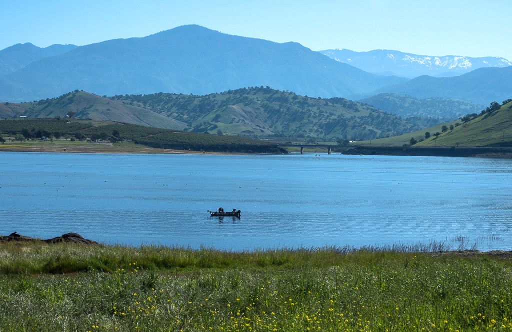
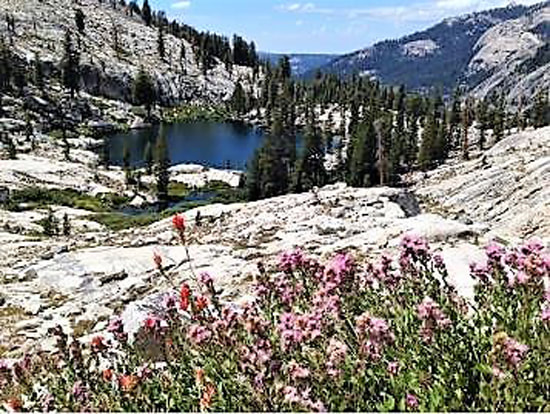
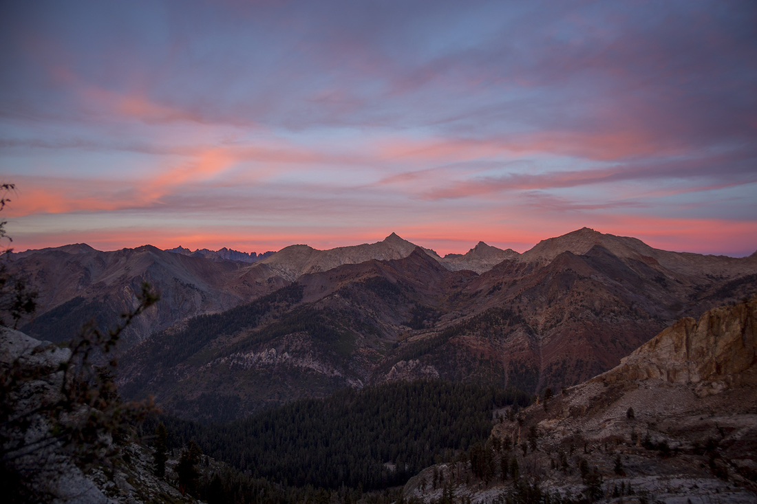
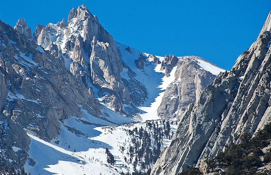
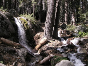
     The wonderfully diverse, readily accessible, family friendly (especially the west side) South Sierra Wilderness includes miles of trails and waterways (highlights: the Pacific Crest National Scenic Trail and the Wild and Scenic South Fork of the Kern River), along with plentiful wildlife, California’s State Fish (the gleaming Golden Trout), long meadows flanked by rolling hills, rocky ridges, and many mountains to climb (elevations run from 6100′ at Kennedy Meadows to 12,000+’ atop Olancha Peak), and forests ranging from pinyon-juniper woodlands to Jeffrey, lodgepole, and red fir higher up.  Don’t miss this inviting Wilderness.

     The South Sierra Wilderness was established by the California Wilderness Act of 1984, passed by the U.S. Congress that September, authorizing the addition of over three million acres within California to the National Wilderness Preservation System.  Archaeological evidence, including bedrock mortars and obsidian tools and points, shows that Native Americans (likely Owens Valley Paiute and Panamint Shoshone) have inhabited this area for at least 6,000 years.

March, 2026

NOTE: The Project Team will be conducting research for a full article as volunteer time allows.  Contact us if you’d like to help research, write about, and/or illustrate this Treasure!  


Maps & Directions:

NOTE: There is no quick way to get to South Sierra Wilderness from Visalia.

From Visalia, go east on Hwy 198 and exit right onto Hwy 65 south.  Go past Porterville to Ducor.  Exit east at Ducor onto J22/Ave. 56 toward Fountain Springs.  At Fountain Springs, continue east on M-56/Hot Springs Drive toward California Hot Springs.  Continue past California Hot Springs to go north (left) at the junction with FR23S03/M-504.  Take this Forest Road to Johnsondale and then continue east on M-99 to FR 22S06 (Sherman Pass Road) to its junction with Rd. J41/Kennedy Meadows Rd.  Go left (north) on J41/FR 21S08 to the Kennedy Meadows trailhead and campground, a primary gateway to the South Sierra Wilderness and access to the Pacific Crest Trail.

You can also access the Kennedy Meadows trailhead from Hwy 395 on the Sierra’s east side by exiting on J41/Nine Mile Canyon Rd., which becomes Kennedy Meadows Rd.

To access the more northerly areas of this Wilderness from the east side of the Sierra, go south from Visalia on Hwy 99 to Bakersfield, then east from Bakersfield on Hwy 58 East to Hwy 14 north to Hwy 395 north to the Haiwee Pass Trailhead* at the end of Haiwee Canyon Rd. and/or the farther north Olancha Pass Trailhead via the Sage Flat Trailhead (to access Olancha Peak).  *NOTE: As of 12/17/25 Inyo National Forest does NOT recommend entering/exiting South Sierra Wilderness via the Haiwee Pass trail as wildfires and flooding have damaged the trail.


Site Details & Activities:

Environment:  62,700 acre Wilderness spanning the Southern Sierra crest, elev. 6100′-12,132′; west of the crest is in Sequoia N.F., in Tulare County, with the balance in Inyo N.F. on the east; miles of the Wild and Scenic South Fork of the Kern River and the Pacific Crest National Scenic Trail on the relatively gentler west side with many meadows, extensive conifer forests (Jeffrey and lodgepole pine ranging up to red fir), and alpine flora in the northern section’s high peaks, all with corresponding wildlife and native plants, including some rare ones; borders Golden Trout Wilderness on the north and Domeland Wilderness on the south, affording extended Wilderness travels
Activities:  backpacking, birdwatching, botanizing, camping (campfire permit [free] required for gas lanterns, stoves, BBQs,and campfires; available online at  Prevent wildfires-Permit, dogs must be kept on 6′ leash and under owner’s control (must not harass wildlife), fishing (with valid licenses and in compliance with state and local regulations), hiking (including 7 miles of Pacific Crest National Scenic Trail, along the valley of the South Fork Kern River, with the Rockhouse Trail in Domeland Wilderness continuing 4 more miles along the river), horseback riding and packing, hunting (with valid licenses and in compliance with state and local regulations), mountaineering, peakbagging, photography, rock climbing, stargazing, wildflower and wildlife viewing
Open:  The Wilderness is always open, depending on weather, except when closed due to emergency conditions; low water levels and hot temperatures occur in summer in the lower elevations. Always carry water; treat (filter or boil) water from streams or rivers.
Wilderness permits are not required for South Sierra Wilderness; they are required for traveling north of Olancha Peak into Golden Trout Wilderness. Obtain Wilderness permits from recreation.gov, 877-444-6777.
If traveling more than 500 miles on the PCT, a long-distance permit from the PCTA is required.
Site Stewards:  Sequoia National Forest, Kern River Ranger District, 760-376-3781, email SM.FS.SequoiaNF@usda.gov (west side, in Tulare County);
Inyo National Forest (east side of Sierra crest) as of 03/23/26 had no live contact information available; see Links below for general information. 
Opportunities for Involvement: to donate visit  National Forest Foundation,  to volunteer  Visit volunteer.gov or reach out to your local National Forest or BLM office for information on opportunities near you.  See also Forest Service Volunteer Opportunities and Forest Service Volunteers
Links:  South Sierra Wilderness west side (Sequoia National Forest)
Pacific Crest Trail (Sequoia National Forest),
Kennedy Meadows Trail (Inyo National Forest) 


Atop Peak 7421
Atop Peak 7421Click on photos for more information.

Visiting Sacatar Trail Wilderness

by Laurie Schwaller

     Sacatar Trail Wilderness, truly wild, straddles the Southern Sierra crest in southeastern Tulare County. Protecting highly diverse, almost trackless, pristine landscapes virtually unaltered by human presence, Sacatar invites visitors to experience public lands in their most natural state. Elevations from 3,500′ to 8,800+’ host plant life from cactus and desert shrubs through pinyon-juniper woodland to ponderosas and red fir stands, all with related wildlife. Hikers, backpackers, and peakbaggers who value solitude, discovery, and a sense of the unknown, and are experienced, self-reliant, and well-prepared, will relish time spent in this intriguing, wide-ranging wilderness.

     The Sacatar Trail Wilderness was established on October 31, 1994, through the California Desert Protection Act (Public Law 103-433), which enlarged Death Valley and Joshua Tree National Monuments and converted them into National Parks, established the 1.6 million acre Mojave National Preserve, and set aside an unprecedented 9 million acres of Wilderness. (Motorized vehicles and equipment are now prohibited, with a very few exceptions, on all federal wilderness lands.)  Ethnographically, the STW is within the region considered to be the territory of the Tubatulabal and Kawaiisu tribes, likely shared to some extent with their neighbors, the Owens Valley Paiute, Panamint Shoshone, and, possibly, the Chemehuevi.

     Probably tracking a long-used Indian path for hunting, gathering, and trade, the Sacatar Trail was originally constructed to be a double-track wagon road, hacked out and up and over the crest of the Southern Sierra Nevada with great difficulty in the 1860s to facilitate travel of the military, cattle drovers, traders, and other commercial users between Rose Valley in the Owens Valley on the east and Kennedy Meadows and the Kern River Valley and San Joaquin Valley on the west side of the Sierra. But by the later 1800s, almost all the traffic that had been taking the Sacatar Trail had chosen to take the more southerly, and 2,000′ lower, route over Walker Pass instead. Today, the Sacatar wagon road, unmaintained for many years even as a foot trail, has dwindled to a mere “route,” as nature reclaims this ancient passageway through the wilderness.

March, 2026

NOTE: The Project Team will be conducting research for a full article as volunteer time allows.  Contact us if you’d like to help research, write about, and/or illustrate this Treasure! 


Maps & Directions:

NOTE: There is no quick way to get to Sacatar Trail Wilderness from Visalia.

From Visalia, go west on Hwy 198 and then south on Hwy 99 toward Bakersfield.  At Delano, take Hwy 155 east (left) toward Glenville and Lake Isabella.  Follow Hwy 155 as it goes south along the lake to its junction with Hwy 178.  Go left (east) on Hwy 178 for about 30 miles to the Canebrake Flat area where you’ll go left (north) on rugged, graded-dirt, high-clearance, 4-wheel-drive vehicle recommended* Canebrake Road (AKA Chimney Peak Backcountry Byway) toward Chimney Creek campground.

Approximately 9 miles up from Hwy 178 is the junction of Canebrake and Long Valley/Chimney Basin roads.  Continue on Canebrake Road past the campground and on to the junction with Road J41/Kennedy Meadows Road.  Go left (north) on this road into Big Pine Meadow, at which point the Wilderness begins a short distance from the east (right) side of the road.  (Chimney Peak Wilderness is on the west side of the road.) Farther north, a dirt road goes off to the right to a landing strip and Sacatar Meadow, at which point the Wilderness is again nearby on the right.

NOTE: There are no official trailheads for this western side of the Wilderness because there are no trails, but it can be accessed from a number of turnouts along J41 (AKA Sherman Pass Rd./Kennedy Meadows Rd.) through BLM land and also from the dirt ranch road to the north.  Be aware of the “unattended property” regulation; it’s safest to not leave your vehicle for more than 71 hours.  Also beware of trespassing; use GPS/surface management maps to ensure you’re not trespassing on or hiking over private, non-BLM lands.

Bakersfield BLM recommends driving about 1/4 mile south of the BLM Chimney Peak Work Center and Fire Station at 106490 Kennedy Meadows Rd. (AKA Sherman Pass Rd./J41) to find a couple of non-maintained dirt roads on the east side of J41 (35.866642, -118.008449).  “The hike in depends on 4×4 capability and comfortability and you’ll hit Wilderness around .5 mi. to the east and 5 mi. to the north. It was signed at one point.”

You can also access this Wilderness from the east side of the Sierra if you stay on Hwy 178 east past Walker Pass and down to its junction with Hwy 14.  Go north on Hwy 14 to its junction with Hwy 395 and go left (north) on 395 to just a few miles north of Little Lake in Rose Valley where you can find the Sacatar Trail, which goes up the edge of Little Lake Canyon to a 7,400′ pass in the Sierra and then descends on the west side via Sacatar Canyon.  NOTE: Signage is minimal, making this trailhead difficult to find; carry a topo map (Little Lake quad) or BLM map of the area.  Also, the ascent from the east side up to the pass is considerably steeper than the ascent from the west.  ALSO: Per BLM-Ridgecrest, the Sacatar Trail could better be called a “route,” rather than a trail,since it has been unmaintained for many years.  “The trailhead coordinates on Ridgecrest BLM land are 35.970704, -117.962829.  The designated route is called RC997 off Hwy 395.  This is the easiest way to access the wilderness and ‘trail'” on the east side.

*If your vehicle might have trouble with Canebrake Rd., you can continue on Hwy 178 past Canebrake to Hwy 14 north and Hwy 395 north to the junction with Rd. J41/Nine Mile Canyon Rd., which becomes Kennedy Meadows Rd., and follow it to Big Pine Meadow, as above.


Site Details & Activities:

Environment: High desert through foothills to pass (about 7,400′) over Southern Sierra crest, elevation 3,541-8,800+’, 51,900 rugged acres, very diverse ecosystems from desert to spring-fed riparian areas to bands of coniferous forest in the higher elevations, canyons, peaks, basically trail-less
Activities: backpacking, birdwatching, botanizing, camping (free campfire permit required for gas lanterns, stoves, and campfires; obtain permit at https://permit.preventwildfiresca.org/), dogs must be under owner’s control at all times and must not harass wildlife, hiking, horseback riding and packing (permitted, but not recommended; see below), hunting (seasonal, with valid licenses and in compliance with state and local regulations), peakbagging, photography, rock climbing, stargazing, wildflower and wildlife viewing.
NOTEThere are no reliable water sources in the STW, so be sure to carry sufficient water for any visits to this Wilderness.  This also means that while horseback riding and packing are allowed in the STW, they are not recommended due to the ruggedness of this trail-less country and the necessity of carrying in all feed and water that stock would need (there is no infrastructure in this Wilderness to support stock).  While fishing is allowed (with valid licenses and in compliance with state and local regulations), there is little chance of any success as almost all the water sources in the STW are only intermittent at best.  Do not drink any water found in this Wilderness without treating it (with sufficient filtering or boiling) first.
Open: The Wilderness is always open, depending on weather, except when closed due to emergency conditions.
Site Steward: Bureau of Land Management: Bakersfield Field Office, 661-391-6000; email, BLM_CA_Web_BK@blm.gov (which is 36,000 acres west of the crest);  Ridgecrest Field Office, 760-384-5400, email, BLM_CA_Web_RI@blm.gov (which is east of the crest)
Opportunities for Involvement:  donate , volunteer or reach out to your local BLM office for information about opportunities near you.  See also Volunteer Opportunities


Click on photo for more information.

Visiting St. John’s River Trail in Visalia

by Laurie Schwaller

     St. John’s River Trail is a scenic City of Visalia Treasure, inviting you to travel up to 4.4 level miles along its namesake river on a paved path suitable for people of all ages and abilities (and dogs, allowed on leash) to walk, hike, run, or wheel along while enjoying the views, reading the interpretive signs, admiring the areas where native trees and smaller plants have been restored, birdwatching, taking a break on a trailside bench, or visiting some of the adjacent parks via their short connecting trails. Early morning and sunset hours are most photogenic.

January, 2026

NOTE:  The Project Team will be conducting research for a full article page as volunteer time allows.  Contact Us if you’d like to help research, write about, and/or illustrate this Treasure


Maps & Directions:


Addresses: Visalia’s paved, multi-use St. John’s River Trail travels 4.4 miles along its namesake river from Riverway Sports Park, 3611 North Dinuba Blvd. (Hwy. 63 N), on its west end, to Cutler Park, 15520 Ivanhoe Dr., on its east end.  Both these sites have parking, potable water, picnic facilities, playground equipment, and restrooms, and are ADA accessible.

There are several other access sites along the trail (all with parking, but far fewer facilities):  Riverwalk, located where N. Ben Maddox Way meets the river, has picnic tables and informational signage; St. John’s Park, at 2457 N. Ben Maddox, has picnic tables and playground equipment; Harrell Grove Park, 2604 E. St. John’s Parkway, has outdoor fitness equipment, a tot lot/playground, and picnic tables.  There is also a small parking area with access to the trail at the north end of Lovers Lane.

Directions:

From downtown Visalia, take Hwy 198 east to exit north (left) on Ben Maddox Way and follow N. Ben Maddox to Riverwalk and/or St. John’s Park (2457 N. Ben Maddox).

Alternatively, to reach Riverway Sports Park from downtown Visalia, go north on Court Street and, at the Oval, take N. W. 3rd Ave. to go north (right) onto Hwy 63/N. Dinuba Blvd.  Follow this road to Riverway Sports Park (3611 N. Dinuba), on your left, for parking and access in its northeast section to the River Trail.

To reach Cutler Park from downtown Visalia, go north on Court Street and, at the Oval, take N. E. 3rd Ave. to then go east (right) onto Hwy 216/Houston Ave.  Follow this road past Lovers Lane, past Golden West High School, and then past 5th Ave. Cutler Park entrance will be on your left (north side of Hwy 216).   Access to the River Trail is on the west side of Cutler Park.  (Note that Cutler is a Tulare County park, not a City of Visalia park, so different regulations may apply there.)


Site Details & Activities:


Environment:  Valley, paved trail (approx. 4.4 mi.) along south side of the St. John’s River, riparian areas include native oaks and extensive irrigated plantings of oaks and other drought-resistant native flora, trail is basically flat, offers occasional benches and trash cans, some stretches have no shade, occasional side trails lead to small parks or parking areas and sometimes connect to other trails, such as the Modoc Ditch Trail and the Santa Fe Trail
Activities:  bicycling, birdwatching, dog walking (pets must be restrained on leash at all times; scoop poop and dispose of it in one of the trash cans along the trail), hiking, inline skating, interpretive signage, photography, walking (stroller and wheelchair friendly pavement with access at Riverway Sports Park and Cutler Park), wildflower and small wildlife viewing (seasonal) ; no horses (or other equines) or motorized equipment (including e-bikes, e-scooters, etc.) allowed
Open:  The trail is open 5:00 a.m. – 10:00 p.m., unless closed for emergency or maintenance conditions (the trail is not lighted)
Site Steward:  City of Visalia Parks & Trails Department, 559-713-4365
Opportunities for Involvement:  to donate, visit Visalia Community Enhancement Foundation;


Click on photo for more information.

Visiting Success Lake, and More!

by Laurie Schwaller

     Success Lake beckons in the scenic Sierra Nevada foothills just 8 miles east of Porterville.  The lake formed in 1961 after its huge earth-filled dam was completed by the U.S. Army Corps of Engineers to provide flood risk and water supply management, wildlife habitat, hydropower, and extensive recreation opportunities including biking, birdwatching, boating, camping, learning at campfire programs and Ranger talks, fishing, hiking, hunting, photography, picnicking, stargazing, swimming, and wildflower and wildlife viewing.  Open year-round, the 2,450-acre reservoir and its neighboring 1500-acre wildlife refuge promise visitors of all ages and abilities a great day out in nature.

January, 2026

NOTE:  The Project Team will be conducting research for a full article page as volunteer time allows.  Contact Us if you’d like to help research, write about, and/or illustrate this Treasure!


Maps & Directions:


From Visalia, take Hwy 198 east to exit south (right) onto Hwy 65 toward Exeter and Porterville.  At Porterville, take Hwy 190 east toward Success Lake and follow signs to the lake (on your left).  This road gives you access to the office, the campground, the marina, and the lake at the well-developed Tule Recreation Area.

To access the west side of the lake, you will turn off Hwy 190 BEFORE you get to the lake:  driving east from Porterville, you will turn left (north) onto Rd. 284 via the roundabout and at the T intersection turn right (east) onto Worth Dr. Continue past the entrance to Bartlett Park and go uphill to the lake and Rocky Hill Recreation Area.

To access the beautiful Big Sycamore Loop Trail, continue east on Hwy 190 after the roundabout and watch for the sign for the road exiting left to the Army Corps of Engineers headquarters (BEFORE you get to the dam) where the signed trailhead is near the parking lot.


To access the Kincade Cove Wildlife Management Area (wildlife refuge) bordering the lake’s northwest shoreline, come south on Hwy 65 to Strathmore (well north of Porterville) and exit east (left) onto county road J28 /Ave. 196, which will eventually curve right (south) as Rd. 276/J28 and then curve left (east) as Ave.176/J28.  You’ll soon glimpse the lake on your right (unless it’s getting too low) and see a road on your right that goes south and southwest to the wildlife refuge and the northwest arm of the lake.

NOTE: If you continue east on J28, you’ll come to a T intersection with Hwy 190. If you turn right (west), you’ll soon come to the Tule Recreation Area and you can continue on from there to Porterville and Hwy 65, making a nice loop trip.


Nearby Treasures:  Bartlett Park, Tule River Parkway, Zalud House Museum, First Congregational Church of Porterville, Porterville Main Post Office, Springville Historical Museum, Elster Building


Site Details & Activities:

Environment:  Foothills on the west side of the Sierra Nevada, about 8 miles east of Porterville, 2,450 acre reservoir surrounded by open grassland with riparian areas in various coves of the lake and scattered oak woodland on the hills; 1500 acre wildlife management area; hot and dry in the summer (unless you’re in the lake)
Activities:  bicycling, birding, boating, botanizing, camping (Tule campground), canoeing, dog walking (dogs must be on maximum 6′ leash at all times), fishing (license required, unless under age 16: Fishing License):, hiking, horseback riding, Hunting License (seasonal, license and permit required:), kayaking, marina (has rentals; see below), picnicking, playground equipment, ranger interpretive and campfire programs, stargazing, swimming, wildlife and wildflower viewing, wildlife refuge management area (exit Hwy 65 to go east at Strathmore onto Ave. 196/Rd. J28 east to Rd. 276/J28 south to Ave. 176/J28 east; Kincade Cove Wildlife Management Area will be on your right very soon.
Open:  Year-round, unless closed due to emergency conditions; office hours Monday-Friday: 7:45 a.m. -4:30 p.m.; Tule Campground gates are closed from 10 p.m. to 6 a.m. 
Site Steward:  U.S. Army Corps of Engineers, 559-783-9200 (information, e.g., campground, reservations), 559-784-0215 (project office);  success-info@usace.army.mil;  marina phone: 559-539-2341  Success Lake Marina
Opportunities for Involvement:  donate, volunteer


Click on photo for more information.

Visiting the Squatters Cabin in Sequoia National Park

by Laurie Schwaller

     The Squatters Cabin, one of Sequoia National Park’s oldest remaining buildings, is also one of only two known remaining structures of the historic Kaweah Colony (along with the Colony Mill Road, now a hiking trail). The fascinating stories of this ill-fated idealistic, socialistic colony and the founding of our nation’s second great national park are deeply intertwined, centering issues, trends, philosophies, and controversies that are still very much alive today. This homestead cabin beside peaceful Huckleberry Meadow amid the ancient giant sequoias, stands literally and figuratively at a nexus of these ongoing conflicts. Discover this history!

December, 2025

NOTE: The Project Team will be conducting research for a full article as volunteer time allows.  Contact us if you’d like to help research, write about, and/or illustrate this Treasure!  


Maps & Directions:


From Visalia, go east on Hwy 198 through Three Rivers to the Sequoia National Park entrance station (fee), where Hwy 198 becomes the Generals Highway.

Continue up the mountain on the Generals Highway to just before the Giant Forest Museum, where you will turn right onto the Moro Rock/Crescent Meadow Road.

Follow this road (bearing left where the road to Moro Rock bears to the right) to the Crescent Meadow parking lot and the trailhead on the west (left-hand) side of Crescent Meadow going to Huckleberry Meadow.

(NOTE: Crescent Meadow Road may be closed in peak season (typically mid-May to mid-September) to private vehicle traffic; if so, you can park across the highway from the museum and then catch the Gray Route 2 shuttle to Crescent Meadow).


Maps & Directions:


Take the Crescent Meadow trail on the left (west) side of the meadow and go north to the first trail junction, where you’ll go left (west) toward Huckleberry Meadow.

At the next junction, go straight (west) toward Huckleberry Meadow. Soon you’ll see the Squatters Cabin, sitting just a bit above the meadow, on your left.

Nearby Treasures:  Tharp’s Log, near the northwest edge of Log Meadow, trailhead at Crescent Meadow;  Moro Rock Stairway, just a short loop drive off the Crescent Meadow Road.


Site Details & Activities:

Environment:  giant sequoia grove, mixed conifer forest, lush meadows, creeks, rock outcrops, wildlife, many trails; carry a good map
Activities:  birding, botanizing, hiking, history, photography, wildflower and wildlife viewing (NOTE: no water is available on the trails [any water in creeks, etc. must be purified before drinking]; water and restrooms are available at Crescent Meadow, except in snow season)
Open:  daily, weather permitting (Crescent Meadow/Moro Rock road closed to vehicle traffic in snow season; road is open to hikers, snowshoers, and cross-country skiers), except in emergency conditions; park entrance fee
Site Steward:  National Park Service, Sequoia National Park, 559-565-3341
Opportunities for Involvement:  donate, volunteer, Sequoia Parks Conservancy, Support Your Park
Books:
1)  Kaweah Remembered: The Story of the Kaweah Colony and the Founding of Sequoia National Park, by William C. Tweed (Sequoia Natural History Association, 1986)
2)  Co-Operative Dreams – A History of the Kaweah Colony, by Jay O’Connell (Raven River Press, 1999)
3)  Challenge of the Big Trees -The Updated History of Sequoia and Kings Canyon National Parks, by William C. Tweed and Lary M. Dilsaver (University of Virginia Press, 2017)
4)  King Sequoia: The Tree That Inspired a Nation, Created Our National Park System, and Changed the Way We Think about Nature, by William C. Tweed (Heyday, 2016)
There are also many articles online about the Kaweah Colony and its lasting significance.


Click on photos for more information.

Visiting Sequoia-Kings Canyon Wilderness

by Laurie Schwaller

     The glorious Sequoia-Kings Canyon Wilderness is huge (over 800,000 acres) and dramatically diverse, with elevations ranging from under 2,000′ to 14,505′ atop Mt. Whitney, threaded by over 800 miles of challenging trails traveling from foothill oak woodlands through varied coniferous forest belts over high passes and along rushing creeks and rivers, through flower-bright meadows, past hundreds of lakes and tarns, into the alpine zone and up to the top of the tallest mountain in the 48 contiguous U.S. states. The scenery is spectacular, the night skies sublime, wildlife abounds, the experience is life-changing, indelible.

December, 2025

NOTE: The Project Team will be conducting research for a full article as volunteer time allows.  Contact us if you’d like to help research, write about, and/or illustrate this Treasure!  


Maps & Directions:


There are many points of access into the huge Sequoia-Kings Canyon Wilderness.  Here are most of the ones going north on, or not too far off, the Generals Highway:

From Visalia, go east on Hwy 198 through Three Rivers to the Sequoia National Park entrance station (fee), where Hwy 198 becomes the Generals Highway.  Stop at the Ash Mountain Visitors Center and Wilderness Office for maps, current conditions, and your Wilderness Permit.

Access points to the Sequoia-Kings Canyon Wilderness trailheads include: Buckeye Flat road off Hospital Rock; Crescent Meadow road’s end (in Giant Forest); Wolverton parking lots; Lodgepole parking lots; Forest Road 14S11 east to Big Meadows, Rowell Meadow, and Horse Corral to Marvin Pass trailhead for access via Jennie Lakes Wilderness; at the junction with Hwy 180 to Grant Grove, leave the Generals Highway and follow Hwy 180 down into Kings Canyon all the way to Roads End and trailheads there into the Wilderness.

You can also access this Wilderness from the Mineral King Road out of Three Rivers. There are trailheads at Atwell Mill, Cold Springs Campground, and road’s end in Mineral King.


Site Details & Activities:


Environment:  well over 800,000 acres, giant sequoia groves, extensive mixed conifer forests, lush meadows, creeks, rivers (including Wild and Scenic), waterfalls, lakes, tarns, vast areas above tree line, dozens of high peaks (including Mt. Whitney, the highest in the contiguous U.S., at 14,505′), huge canyons, wildflowers galore, wildlife at every elevation, over 800 miles of trails in all kinds of terrain (including about 100 miles of the John Muir Trail and the Pacific Crest National Scenic Trail, and all of the High Sierra Trail), and tremendous areas with no trails, for cross-country hikers seeking space, solitude, and the great gift of only natural sounds; carry good maps, plan your trip carefully and well in advance (Wilderness Permit required; quotas apply on many trails late May-late September)
Activities:  backpacking, birding, botanizing, camping, caving, hiking, history/historical sites, horseback riding and packing, kayaking, fishing (license required), mountaineering, photography, rock climbing, stargazing, wildflower and wildlife viewing (Wilderness Permit required for overnight stays; no pets allowed)
Open:  Sequoia and Kings Canyon National Parks are always open, weather permitting , except in emergency conditions; park entrance fee; Wilderness Permit required for overnighting; quotas apply on many trails, generally late May through late September, with Recreation fee required for entry during quota season; reservations may be made 6 months to 1 week before entry date; campfire permits may be required (NOTE that campfires are not permitted in some areas), maximum group sizes (including stock) apply.
Site Steward:  National Park Service, Sequoia and Kings Canyon National Parks, 559-565-3341; Wilderness Office, 559-565-3766
Opportunities for Involvement:  donate, volunteer, Sequoia Parks Conservancy, Support Your Park
Books:  1)  Challenge of the Big Trees – The Updated History of Sequoia and Kings Canyon National Parks, by William C. Tweed and Lary M. Dilsaver (University of Virginia Press, 2017)
2)  Granite Pathways: A History of the Wilderness Trail System of Sequoia and Kings Canyon National Parks, by William C. Tweed (Sequoia Parks Conservancy, 2021)


Click on photos for more information.

Backcountry Wilderness Rangers in Sequoia and Kings Canyon National Parks

by Laurie Schwaller

     Sequoia National Park’s historic backcountry ranger stations and their adjacent barns, meadows, and nearby campsites serve the parks and the public in many ways. They accommodate not only rangers, but also trail crews, cultural resources crews, snow surveyors, occasionally monitors of meadows, water, wildlife, wildfires, and weather stations, and sometimes backcountry visitors in distress.

     Their barns (also called tack sheds) store equipment and supplies used by these personnel, and their pastures provide grazing for their stock and, when conditions allow, for visitors’ animals also. Most of today’s backcountry visitors spend only a night or two in the campsites near these iconic cabins, but seasonal backcountry Wilderness rangers may be stationed in them or patrolling to them from May into October.

Redwood Meadow Ranger Station

     This strenuous backcountry work is often carried out far from many comforts, conveniences, and sometimes even company. It can be dangerous, sometimes cut off from communications, and often far from help. Many of these Park employees are seasonals, whose paychecks start and end depending on when the snow melts enough to allow access to their work sites — and when autumn weather once again closes the trails. Yet many return year after year to the wilderness.

     Like all Park employees, backcountry Wilderness rangers are charged under the National Park Service’s mission to preserve unimpaired the natural and cultural resources set aside by the American people for future generations. Rangers also strive through their visitor contacts to promote appreciation and stewardship of these resources and compliance with the regulations designed to protect them.

Captain Cornelius C. Smith, 14th Cavalry
Soldiers of the 14th Cavalry at the General Sherman Tree

     In 1906, when the national parks were still administered by the U.S. Army, prior to the creation of the National Park Service, Captain C.C. Smith, 14th Cavalry, Acting Superintendent of Sequoia and General Grant National Parks, defined the ranger’s qualifications to be “somewhat as follows: He must be an experienced mountaineer and woodsman, familiar with camp life, a good horseman and packer, capable of dealing with all classes of people; should know the history of the parks and their topography, something of forestry, zoology, and ornithology, and be capable of handling laboring parties on road, trail, telephone, bridge, and building construction. These men, in the performance of their duties, travel on horseback from 3,000 to 6,000 miles a year, must face dangers, exposure, and the risk of being sworn into the penitentiary through the evil designs of others.” In addition to the troops, four civilians were working as rangers in Sequoia and General Grant National Parks at that time.

     Stephen T. Mather, first Director of the National Park Service (established in 1916), described the early NPS rangers this way: “They are a fine, earnest, intelligent, and public-spirited body of men . . . . Though small in number, their influence is large. Many and long are the duties heaped upon their shoulders. If a trail is to be blazed, it is ‘send a ranger.’ If an animal is floundering in the snow, a ranger is sent to pull him out; if a bear is in the hotel, if a fire threatens a forest, if someone is to be saved, it is ‘send a ranger.’ If a Dude wants to know the why, . . . it is ‘ask the ranger.’ Everything the ranger knows, he will tell you, except about himself.”

First NPS Director Stephen T. Mather, 1927

     Author Eric Blehm describes the diversity of Sequoia’s modern seasonal backcountry Wilderness rangers and their commitment and dedication to their work: “[They] held master’s degrees in forestry, geology, computer science, philosophy, or art history. They were teachers, photographers, writers, ski instructors, winter guides, documentary filmmakers, academics, pacifists, military veterans, and adventure seekers who . . .were drawn to wilderness. In the backcountry, they were on call 24 hours a day as medics, law-enforcement officers, search-and-rescue specialists, and wilderness hosts. They were interpreters who wore the hats of geologists, naturalists, botanists, wildlife observers, and historians. On good days they were ‘heroes’ called upon to find a lost backpacker, warm a hypothermic hiker, or chase away a bear. On bad days they picked up trash, extinguished illegal campfires, wrote citations, and were occasionally called [bad names] simply for doing their jobs. On the worst days, they recovered bodies.

     “Park Service administrators often referred to these rangers as ‘the backbone of the NPS.’ Still, they were hired and fired [laid off] every season. Their families had no medical benefits. No pension plans. They paid for their own law-enforcement training and emergency medical technician schooling. And . . . each one of them knew the deal when he or she took the job.”

     In their end-of-season reports, the Wilderness rangers describe their patrols (miles on horseback, miles on foot, areas and sites patrolled), visitor services (contacts: backpackers, day hikers, park staff, private and Park stock users, and commercial stock users, both spot and full-service trips), law enforcement (contacts, warnings, education, citations). They report on search and rescue and medical incidents, opening and closing times and condition of the ranger station and grazing areas, signage issues, meadow health, and fencing. They discuss natural resources (wildlife, vegetation, water), cultural resources (historic and prehistoric sites, historic structures), and backcountry facilities (ranger stations, barns, outhouses, water and electrical and solar systems), sanitation (campsites, fire rings, pit toilets, “TP roses”), and food storage cables and bear boxes. Other areas covered include supply and equipment inventories and needs lists, aircraft observations, interface with area trail crews, and special projects and recommendations.

     Backcountry Wilderness rangers also do their own cooking, clean and maintain their cabins and barns, trap hordes of invading mice, cut firewood for their cabin stoves, build and repair fences, doctor and shoe horses and mules, help to clear and maintain trails, and assist park scientists with projects such as residual biomass monitoring on meadows. Rangers remove hundreds of pounds of trash from trails and campsites, break up illegal fire rings and restore abused camp areas, look for lost stock and missing hikers, conduct hunter patrols in the fall, and rarely work an eight-hour day, as they are on call as long as they are in the backcountry.

     Their work can be exhausting, and it goes on no matter what the weather. Bad weather or trail conditions are often when rangers’ aid is needed most, leading to some longer work days. And yet many of the parks’ Wilderness rangers return for duty repeatedly, as long as they can afford to. They love their jobs and the country they work in. There are hundreds of applicants for each opening every season.

     Many cite the beauty of their surroundings, their wholehearted support of the Park Service mission, the pleasure of working with their dedicated colleagues. They care deeply about the health of the backcountry, its lakes and streams, grasses and trees, wildflowers, birds, insects, fish, and animals from little haystack-making pikas to big black bears. They appreciate the opportunity to meet and interact with park visitors, sharing their knowledge of and joy in the backcountry, and keeping the parks safe from the people and the people safe from the parks. And, as Ranger Randy Morgenson said, backcountry rangers get paid in sunsets.

 “. . . July and August saw several days each of excellent afternoon thunderstorms complete with hail and strong winds. A family of six . . . were caught in one of the storms as they hiked back from Evelyn Lake to their camp at Hockett. At 6:30 pm the group had still not returned and I went out looking for them. I found the 8 year old and her 13 year old brother running down the trail about a half-mile from the station. . . . I sent these two who were soaked and shivering to the station where I had a fire going. . . . I continued up the trail and located the 10 year old and 16 year old . . . and a few minutes later I located [their parents].

 “On the way back to the station I came upon two other backpackers, both soaked and cold. The cabin was crowded that evening with everyone crowded around the stove, drying wet clothing and attempting to keep warm. The trail crew served up some pasta and sauce for everyone and by 9 pm the rain had stopped. The family went to their respective tents and the two backpackers spent the night in the tack shed.” — Joe Ventura, Hockett Meadow Ranger, 2008

May, 2020


Quotes & More Photos:

In Their Own Words — Excerpts from Sequoia and Kings Canyon National Parks
Backcountry Wilderness Rangers’ reports and articles:


” The backcountry ranger job is a very coveted park position and the one in Sequoia has got to be one of the best in the nation. . . . To get the gig, you have to . . . [g]o to USAJobs.com, fill out the resume . . . . score very well on the questionnaire . . . . [Y]ou have to have past experience . . . living in the wilderness . . . not to mention a lot of past time in the High Sierra or a comparable environment. You have to be an EMT, you have to qualify for the GS-5 using education or past government employment . . . . It’s actually a very difficult job to get.” — Chris Kalman, 2015

“[W]e are all visitors here in the parks . . . because we love their astounding beauty. Every time I met someone on the trail, I tried to engage them in conversation that would help them reach, recall, or revel in that conclusion on their own. . . . ” — Chris Kalman, 2015

“I felt connected to people from around the world. I eased visitors into the spirit of the place, offered route suggestions, passed on weather forecasts, repaired boots, supplied a little extra food, or just lent a compassionate ear. Under the open sky, people’s hearts come out to play.” — Rick Sanger, 2019

“Most visitors either want a weather forecast or just to visit the ranger and see the ranger station, and of course take a picture of the station and/or ranger.” — Dario Malengo, McClure Meadow Ranger, 2014

“We met with the Little Five ranger and collected nearly 800 pounds of his food and gear, and the next day Don and I saddled up 6 mules and our horses, and headed for Little Five via Pinto Lake.

“Chris did not tell us that there were 6 dozen fresh eggs in the loads. We packed it all up at Mineral King, rode to Pinto, unpacked for the night, repacked in the morning, rode over Blackrock Pass arriving at Little Five, without breaking a single egg.” — Joe Ventura, Hockett Meadow Ranger, 2015

“Training Curriculum for Level III certification requires the rider to overnight in the wilderness, and catch, pack, and lead a string of up to 4 pack animals . . . . Mineral King Trailhead Ranger Cody Cavill traveled to [Hockett] with me and led a string of pack animals. . . .

“Cody assisted in the search and capture of overdue stock, led three head cross-country from Wet Meadow to Quinn Patrol Cabin. He set up an electric fence there, took the stock to water and put three head in the fenced area and turned out the others.

“He caught the stock the next morning, saddled and packed and led the string back to Hockett. His training covered approximately 63 miles of riding and he is certified as a Level III rider.” — Joe Ventura, Hockett Meadow Ranger, 2015

“Due to heavy spring snow, I was flown into the Hockett Ranger Station on June 19th. . . . There was three to four feet of snow on the meadow and six to eight feet of snow covering the trails on the plateau with drifts to twelve feet.” — Cindy J. Wood, Hockett Meadow Ranger, 1995

“I brought my three head of stock into the backcountry on August 4th when the Atwell-Hockett trail was opened to stock. During the season, I patrolled 913 miles of trail. (527 miles patrolled on stock and 386 miles on foot.)  I contacted 892 visitors this season. (5 day hikers, 517 backpackers, 6 hunters and 364 stock users with 550 head of stock.)” — Cindy J. Wood, Hockett Meadow Ranger, 1995

” On July 23 two pack mules and an 80 year old male on horseback went off the trail at Cabin Creek, about 1 mile from Atwell Mill. . . . The injured party was carried out by litter to Atwell Mill . . . and flown by Life Flight to UMC. By 10:30 pm I had the equipment, mules, and fellow companion of the injured party out to Atwell.” — Joe Ventura, Hockett Meadow Ranger, 2006

“It was a life steeped in beauty. . . . I woke with the chickaree’s chatter and eased into each morning with anticipation for the day’s adventure, whether a mellow exploration or a grand challenge. The summer’s passing was ticked off by the early season song of the hermit thrush, the bloom and fade of Jeffrey shooting stars, the height of the corn lilies, the late season calming of the stream’s frenzy.” — Rick Sanger, 2019

“The National Park Service preserves unimpaired the natural and cultural resources and values of the national park system for the enjoyment, education, and inspiration of this and future generations.’ I stand by that, and I believe it is one of the most important things the United States of America does as a nation.” — Chris Kalman, 2015

“There was never a U.S Flag in the cabin. I always brought in a new one each season . . . . The cabin just looked more handsome with the flag flying.” — Joe Ventura, Hockett Meadow Ranger, 2008

“I have told many of you of the times when sitting on the porch of the Hockett in the evening, . . . someone hikes in from the trees, views the meadow and the cabin, looks at me and says, ‘Wow, how does a person get a job like this?’

“So thanks to all of you for allowing me to enjoy the experience ‘of a job like this.’ It has been a genuine pleasure working for and with all of you.” — Joe Ventura, Hockett Meadow Ranger                                                                        


[

Click on photos for more information.

Sequoia and Kings Canyon National Parks Trail Crews  –  the People Whose Work We Walk on

by Laurie Schwaller

     Over a million people a year walk, hike, or ride horseback on the amazingly diverse trails of Sequoia and Kings Canyon National Parks. From a short, easy stroll into a magnificent giant sequoia grove to a strenuous backpacking trip to the summit of rugged Mt. Whitney, the highest peak in the 48 contiguous states, these paths offer people of all ages, inclinations, and abilities a multitude of opportunities to experience the parks’ wonders in the very best way: at a walking pace, free to pause whenever they please, immersed in the sights, scents, sounds, and thrills of the wild world.

     Ranging in elevation from less than 2,000 feet up to 14,500 feet, the trails traverse over a thousand miles to connect the major features and extraordinary environments of these spectacular parks. Who builds these beckoning byways, and who maintains them in the face of floods, fires, avalanches, rock slides, falling trees, deep snows, and thoughtless trail-cutters?

     Since the National Park Service was established in 1916, this essential work has been carried out primarily by NPS Trail Crews (while Civilian Conservation Corps workers contributed a tremendous amount of trail maintenance from 1933 to 1942). Beginning in the 1970s, the parks have also been partnering with volunteer service organizations such as the Youth Conservation Corps to help maintain the miles of trails being “loved to death” by the increasing national interest in outdoor recreation.

     It’s not easy to get hired on to a Sequoia and Kings Canyon National Parks trail crew. First, applicants must realize that their work locations may be in any area of these two parks, which are 93% wilderness and span “an extraordinary continuum of ecosystems, arrayed along the greatest vertical relief (1,370 to 14,495 feet elevation) of any protected area in the lower 48 states.”

     Trail crew positions require wilderness travel and camping skills; the ability to hike at high altitude for extended periods of time and up to 20 miles a day while carrying backpacks, tools, and supplies weighing at least 50 pounds; and the ability to perform masonry and carpentry work in addition to a full spectrum of basic trail work, including clearing fallen logs, removing encroaching vegetation, digging to maintain drainage structures or trail tread, and moving materials of all shapes and sizes in rugged terrain.

     Are you still interested?

     Trail crews in these parks work outdoors in temperatures varying from over a hundred degrees down to near ten degrees, and may experience heavy rain, hail, and falling snow. Typically, the work environment is hot, dusty, dirty, and sometimes noisy. Working long hours, hiking or riding horseback in rough country, crews may encounter hazards such as poisonous plants and animals and high, cold, swift water at stream crossings.

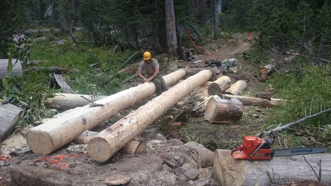
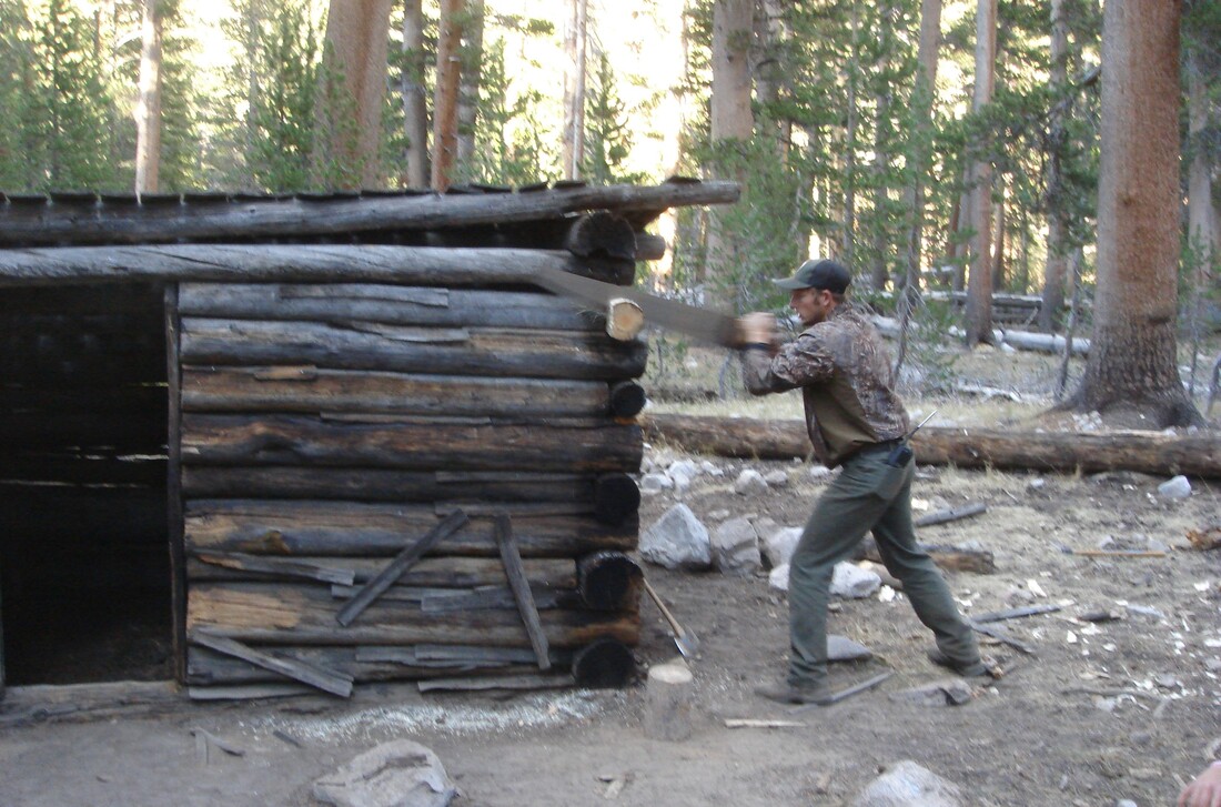
     They construct, repair, and maintain bridges, abutments, aesthetically pleasing rock walls, walkways, causeways, trail tread, water bars and retainer steps. Their tools include rock bars and drills, jacks, chisels, a variety of saws, timber tongs, draw knives, planes, and other masonry and carpentry tools, which they also clean and repair.

     Heavy physical effort is required in using both hand and power tools; frequently lifting , carrying, or rolling objects such as rocks and logs weighing over 100 pounds; moving slabs and boulders weighing several tons with rock bars; using hammers to crush or shape rock; and shoveling extensively.

     To provide for visitor access and safety, the crews build all kinds of trails, from accessible trails meeting Americans with Disabilities Act guidelines in some frontcountry sites to trails that climb to high mountain peaks in the backcountry. Laws including the National Historic Preservation Act, the National Trail System Act, the Wilderness Act, the National Environmental Policy Act, the Endangered Species Act, and the Clean Water Act all apply in Sequoia and Kings Canyon.

     These laws require trails to avoid damaging habitats or disrupting important lands, waters, or historic or prehistoric sites. To protect cultural and natural resources, crews may route trails around sensitive areas, construct boardwalks over wetlands, or seasonally close trails during nesting or migration times.

     Crew members must also have the ability to live and work effectively in remote, primitive backcountry areas in close contact with small numbers of people for two to twelve weeks at a time. Crews typically consist of three to ten NPS workers, and a Cook for work in the backcountry. Crews may be supplemented by work groups from the California Conservation Corps, the Student Conservation Corps, Volunteers-in-Parks, and other programs. To support backcountry projects, pack trains periodically bring in food, mail, supplies, and equipment.

     Would you like to gain the extra skills and responsibilities of a crew leader?

     Trail crew leaders not only perform the full spectrum of trail work themselves. They also have to perform inspections, surveys, and inventories of facilities for maintenance needs to provide for accurate planning and scheduling of work, and make informed recommendations for operational improvements. They plan, lead, and supervise the crew’s work, provide training, emphasize and monitor safety, and, of course, write reports.

     Additionally, crew leaders must possess and maintain an NPS Blasters License because they serve as Blaster in Charge to remove obstacles such as logs and rocks from trail tread, to quarry stone for masonry work, and to establish trail bench in bedrock areas. They also assist in mule and horse packing operations by riding on mountainous trails, preparing supplies and materials for mule transport, tying on loads, and leading pack animals. To move big boulders and logs in the wilderness, they set up and use human-powered winches and rigging such as high-lines.

     The crews often coordinate with backcountry rangers to determine and prioritize projects in their work areas, and frequently assist park visitors by providing information about trails and weather, helping with communications and directions, and even participating in searches for persons reported missing or overdue.

     Have you had the opportunity to thank a trail crew yet? Next time you’re traveling on some part of the tremendous trail network in Sequoia and Kings Canyon National Parks, pause to reflect on what you’re walking on and appreciate the work of the dedicated, skillful men and women who have labored for such long hours in such difficult conditions to make your journey as smooth and safe as they can.

     As a young worker from the Eastern Sierra Conservation Corps serving in our parks put it, ” It takes tremendous grit and passion for a member of a national park trail crew to thrive. Though the days may be long, the physical demands arduous, and the unexpected challenges difficult to navigate, one thing is for sure: serving on a trail crew guarantees an unforgettable experience.”

     (If you’d like to try to join a national park trail crew, check usajobs.gov and search for “maintenance worker trails”.)

May, 2020


NOTE:  To find the “History of the Wilderness Trail System of Sequoia and Kings Canyon National Parks, see Granite Pathways, by William C. Tweed (Three Rivers, CA; Sequoia Parks Conservancy, 2021).

[


Quotes & More Photos:

“Nothing will give you as much appreciation for the trails you tread on than serving on a trail crew. The stunning vistas, backpacker-friendly schedule (many crews work 8-10 days on, 4-6 days off) and group camaraderie are just icing on the cake.” — Paul Chisholm, 2017

“Working at a National Park teaches you confidence and perseverance. I spent six months with the Backcountry Trails Program in Kings Canyon National Park . . . . [T]the commute was the worst part. . . . I had to move as fast as I could with a pack and tools — shovels, McLeod’s, loppers, Pulaskis, sledgehammers, 20-pound rock bars, grip hoists — uphill, nonstop, for miles . . . at elevations exceeding 13,000 feet. We were the highest-elevation trail crew in the country that year . . . .” — Anna Mattinger, 2018

“We used hand tools for everything. To the tune of snow, heat, river crossings, and mosquitoes, we turned big rocks into little rocks into littler rocks . . . to make a foundation of several feet of ‘crush’ hidden underneath dirt trails to prevent overgrowth . . . .” — Anna Mattinger, 2018

“Trail crews frequently work in isolated areas where medical facilities are not readily available, and transportation of an injured person is often difficult and dangerous. Good safety practices demand that each crew member keep in good physical condition and maintain a high level of safety consciousness at all times, in camp as well as on the job. . . . [E]very employee must be his or her own safety inspector on the job, work in a safe manner, and point out unsafe practices to other crew members.” — NPS Trails Management Handbook

“You’ll learn to fear lightning when you’re working above the timberline. You’ll learn drystone masonry and how to build rock walls and stairs without cement. The standards are high: If your work can’t be expected to withstand a century of continuous foot traffic and weather, it isn’t good enough. . . . . Doing this stuff, you’ll learn that granite weighs around 170 pounds per cubic foot.” — Anna Mattinger, 07/18/18

“The trail crew cleared and blasted granite footing and widened the area around the bluffs. Great work, mules will no longer bang their boxes on the upslope side, the impact pushing the animal toward the trail edge.” — Joe Ventura, Hockett Meadow Ranger, 2009

“It has to be sturdy enough to take the steady thudding of boots and hooves without disintegrating. It has to be angled so that the water pouring down a slope doesn’t course through it and turn it into a stream. It has to be high and dry enough that boots and hooves don’t sink knee-deep in mud. Oh, and it can’t have fallen trees blocking it. When about 700 trees . . . were left sprawled across the 10 -mile trail . . . by winter’s high snows and spring’s high winds, someone had to clear them away.” — Felicity Barringer, 2011

“The trail was still going down as I passed some huge logs, freshly cut into pieces. The smell of fresh sawdust still hung in the air. I am always amazed about the people who do all this work: maintaining the trails, fighting fires, building bridges and cutting up big trees that obstruct the trail. I realized that they must bring all their tools, probably by mules or horses, but still they must hike days on the same trail as I was doing.” — Overseas Hiker, 2018

“[T]he regular National Park Service trail crews were supplemented for six weeks by a 14-member crew organized by the California Conservation Corps. The crew included seven veterans (some recruited through the three-year-old Veterans Green Jobs nonprofit) and was part of a pilot program to give former service members training in land conservation.” — Felicity Barringer 2011

“The first few weeks on the job, I contemplated quitting . . . . I am glad I did[n’t], because I learned so much. I was able to participate in creating a bridge over a stream–from felling the tree to using a grip hoist to set the bridge into place. I also was able to help in transforming a rocky slope into a usable trail. I got to rework trails so that water would run off them and erosion would be minimized. I believe these skills will be useful in a future career in landscape architecture.” — joinhandshake.com, 2018

“Performs carpentry work, primarily using heavy log and rough-sawn lumber, on trail structures such as log checks, foot-bridges, multi-use bridges, corrals, hitch rails, and boardwalks.” Use a chain saw to “fell, buck, notch, and/or shape both native and pressure treated logs in the maintenance and construction of bridges, water bars and retainer steps, crib walls and steps, . . . and in clearing trails of down trees and brush. — from NPS job description

“In the summer of 1973, my backcountry crew and I were working at . . . Redwood Meadow . . . . An old fence, first built by the CCC . . . had long ago fallen into disrepair, so we started . . . replacing the rotten posts and stringing new wire. One afternoon . . . we uncovered an old metal bin [and] . . . found the carpentry tools the CCC had used to build the cabin at Redwood Meadow: double-bit axes, log carriers, drawknives, and a brace and bits. Their wooden handles were still dark from the oil and sweat of men working there thirty-five years earlier.” — Steve Sorensen, 2018

“[T]he [trail] crossing below [Redwood Meadow] . . . [needed] a series of wooden footbridges. . . . [A] lot of the satisfaction [in building the bridges] came from using those old tools . . . in the same way the CCC workers had used them long ago. . . . Before supper we’d hike down to Cliff Creek and jump . . . into a deep pool of clear water — the same place where the CCC boys had washed and played three decades earlier.” — Steve Sorensen, 2018

“During the trail crew visits . . . [w]ood was bucked up, split, hauled, etc. for the trail crew, Hockett ranger, wilderness seminar, and snow survey. Two new hitching rails were constructed . . . . One of the public outhouses was moved here at Hockett Meadow. Several days were spent . . . doing trail work (raking rocks) and on the new bridge near Horse Creek. ” — Lorenzo Stowell, Hockett Mdw. Ranger, 1992

“Once again, I received numerous glowing accolades from visitors regarding the quality of the trails in Sequoia and the friendliness and helpfulness of the crew members they encounter. Thanks, Sequoia Trails!” — Christina Gooch, Tyndall Creek Ranger, 2014

Click on photos for more information.

Farmland Forever: the Story of Sweet Home Ranch

by Shirley Kirkpatrick

     Paul and Ruth Buxman’s Sweet Home Ranch will remain forever in farming. And that’s just the way they want it. In fact, that’s what they stipulated when they traded the development rights on their 40 acre farm east of Kingsburg for one of the first two farmland conservation easements in Tulare County. The other is held by close neighbor and friend Jim Moore.

     The easements were facilitated by Sequoia Riverlands Trust in 2009 with funding to buy the farmers’ development rights coming from Tulare County’s Measure R road improvement tax fund. As part of the county’s project to widen the Visalia/Dinuba highway (Road 80), Cal Trans stipulated that the farmland being eaten up by the widening must be mitigated by placing farmland conservation easements on comparable prime agricultural land.

     In addition to being a farmer, Paul Buxman is also an artist, musician, teacher, mentor, rural philosopher, and visionary. He was eager to save his farm from the threat of urbanization as new subdivisions leap-frogged across the fertile Kings River plain toward his property.

     His son, Wyeth, the fourth generation of Buxmans at Sweet Home Ranch, is also greatly relieved. He didn’t think he could continue the family’s farming tradition if faced with the traffic, dust, and noise generated by a population explosion nearby.

     Paul points to an amazing fact when he considers why he wants to preserve farmland. “A little more than one percent of the earth’s surface is actually farmable. That’s it. Only that one percent enables us to survive. I don’t think people realize that. When you remove arable land and put it into something non-productive – at least in the way of producing food and fiber – to bring it back into some kind of agrarian use is a massive undertaking,” he said.

     He and his neighbors live and work in an area they call the Golden Triangle of farmland. “Great water, great fertility, great location, great weather – and we’re trying to draw lines of farmland forever.”

     Paul understands completely the current trends in agriculture nationwide: (1) the average age of farmers is increasing as fewer young people choose to return to the family’s farm, and (2) farms are getting larger to take advantage of the economies of scale.

     Paul and like-minded small farmers are not only vested in farming as a livelihood, but they see it as a way of life – a place to raise their children and teach them about working and living with nature – “cultured nature, agriculture,” in Paul’s words. They believe land would be taken care of better for a longer period of time if children were introduced to it early, so farming is perpetuated.

     To express those concepts Paul started something called Celebration of the Small Family Farm. He formed a group of farmers called California Clean Growers (CCG). Their goal is to farm responsibly and win the hearts of urban people. California Clean Growers became known for making their farms and homes accessible to visitors, for conserving fertility of the soil and water through the practice of Integrated Pest Management (IPM) and for marketing their products with the CCG backing.

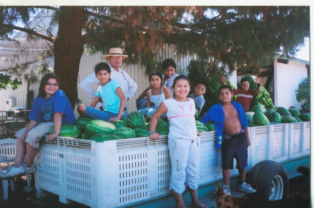
     Paul and Ruth practice what they preach. Every year they set aside a portion of Sweet Home Ranch to give young people the experience of growing a crop. Through their church, the Buxmans are introduced to at-risk youth, who are invited to participate. Given tools and seeds for planting, the teens began with growing food items they could easily sell: watermelons, corn, and other favorites. “The kids had to grow it, tend it, weed it, harvest it, and sell it,” said Paul. They also learned to cook it and eat it. And they profited from it.

     With the earnings, Paul and Ruth began taking the youth on overnight trips to the nearby national parks – places the youngsters had never seen. “So, in this case,” said Paul, “farmland is being used as a way of gang prevention, a way of intervening in young people’s lives … and changing their lives for the better, we hope.”

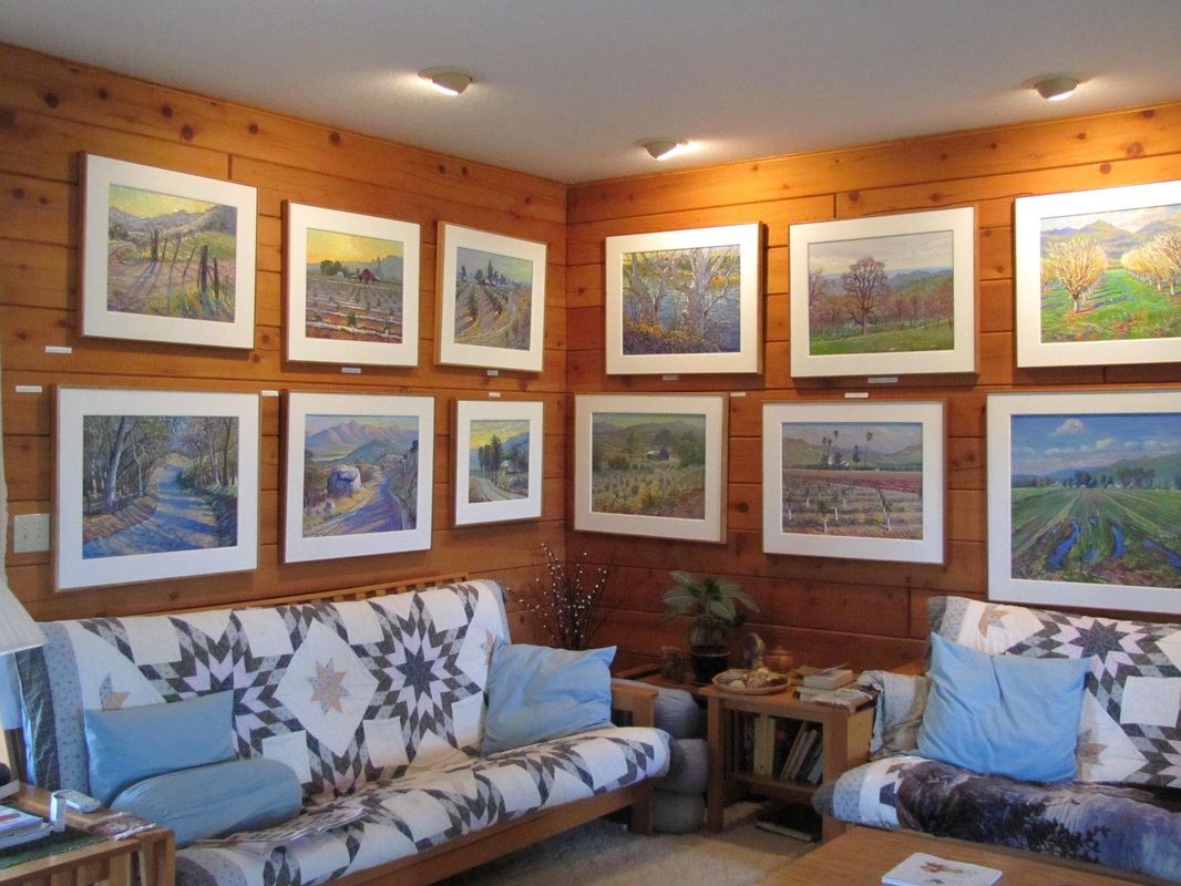
     When not cultivating, irrigating, pruning, and taking care of his farm, Paul finds time for his other passion – art. A trained and noted painter of the Plein Air impressionistic style made famous during the Arts and Crafts era, Paul doesn’t have to travel far for his inspiration. He finds it in nature at his and nearby ranches and farms. He paints what he sees and what he understands – even the flow of water through the weir of an irrigation ditch is made beautiful with his choice of vibrant colors, shadows, and depth. Many online articles and interviews detail his art story.

     To share the beauty and the bounty of Sweet Home Ranch and nearby farms, Paul and Ruth host a harvest festival every year on the two days following Thanksgiving, inviting their neighbors and other small farmers to participate. The public is invited to enjoy the art show and tasting of locally handcrafted foods from 9-5:00 on Friday and 9-4:00 on Saturday at the ranch.

     Offered for entertainment, amusement and sale are: art, art cards, fresh fall fruit, trailer rides on the farm, locally made wines, 12 kinds of bread, handcrafted cheeses, dried fruit from small family farms, jams, jellies, soaps, infused honey, nuts, and more. Paul says, “Come out and see what we’re growing here for you.” On land that will be farmland forever.

November, 2012


UPDATE: In 2017, Paul and Ruth Buxman sold their beloved Sweet Home Ranch, as the intensive full-time manual labor became too much for them. But, good news: they still live there, they’re still making their famous jam, their Sweet Home traditions will continue, and now the entire ranch is protected by an agricultural easement.

  Happily, the Buxmans were able to sell the ranch to a wonderful, young and energetic couple, Jordan and Bailey Carlson, who are committed to family farming and live just a half mile west of Sweet Home Ranch. They will retain the ranch name and carry on the traditions of the farm, which are guided by love of environment and neighbor. These traditions are the secret to the award-winning fruit and faithful workers.

   Meanwhile, the Buxmans have retained a life estate on their house and studio and about a quarter of an acre of trees so that they can keep harvesting fruit and making their jam. Their traditional harvest festival will still be held at the ranch on the two days following Thanksgiving. And, working with Sequoia Riverlands Trust, they executed a lot line adjustment that made their two parcels one, thus securing a conservation easement on the entire 57 acres. Farmland Forever, indeed!


Slideshow:


Quotes & More Photos:

“I’d put everything I have under easement if there were money for it.” — Jim Moore

“All the natural ingredients were in place for intensive agriculture. The snow accumulated in the Sierra Nevada; the narrow river canyons that drained the mountains were located in the foothills where dams and reservoirs could be easily constructed; the valley floor was relatively flat and had the proper gradient for canals; and there was plenty of sun. The landscape would be altered – transformed to a greater extent than any similar place on earth – but the elemental factors remained in place and determined what occurred there.” — Philip L. Fradkin

“People in cities may forget the soil for as long as a hundred years, but Mother Nature’s memory is long and she will not let them forget indefinitely.” – Henry Cantwell Wallace

“Before we approve another kind of industry on top of farmland, let’s think – What will be our legacy? It will be that we are the fruit basket, the bread basket, we are the milk carton, we are the raisin capital. Let’s be what we were intended to be. This San Joaquin Valley is like no other place on earth.” — Paul Buxman

“Farmland is going to be the most important and most beautiful thing that we preserve in this country. We have National Parks, National Forests. Why not National Farms?” — Paul Buxman

“I just think all farms could be like this, right here in Tulare County. ‘Tulare County: known for its small family farms and community involvement.’ You know, why not?” — Paul Buxman


Maps & Directions:

Directions:

Address: 4399 Avenue 400, Dinuba, CA 93618; east of Kingsburg

Latitude/Longitude:

36° 31.054’/W119° 28.5308′

36.517567/119.475514N

From Visalia, go west on Hwy 198 to Hwy 99 North. Take exit 111 from Hwy 99 onto Mendocino Street going north, then go right onto Sierra Street (Ave. 400) in Kingsburg.  Go east on Ave. 400/Hwy 201 approximately five miles to 4399 Ave. 400 (between Roads 40 and 48), and turn right (south) into the long unpaved driveway to the house (which will be on your right).


Site Details & Activities:

Environment: Valley, farm
Activities: annual Harvest Festival: arts and crafts, hayrides, photography, produce tasting, visiting farm
Site Stewards: Paul and Ruth Buxman, 559-260-1958, irbuxman@gmail.com; Sequoia Riverlands Trust (SRT), 559-738-0211
Links:
Open: annually, on the two days following Thanksgiving (9-5:00 on Friday, 9-4:00 on Saturday)


Click on photos for more information.

The Springville Historical Museum: A Dream That Wouldn’t Die

by Louise Jackson

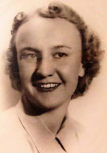
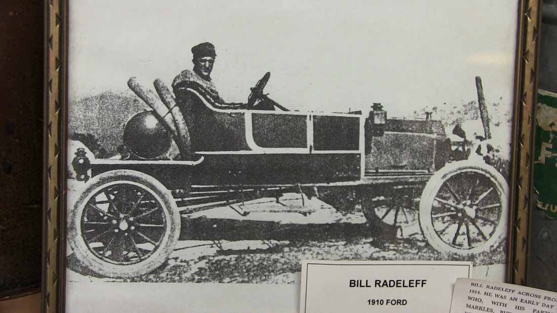
     It can be hard to know when an important idea is conceived. To ninety-eight-year-old Virginia Radeleff the concept of a community museum is simply part of a small town’s unique history. Raised from birth in the foothill community of Springville, California, Miss Virginia grew up and spent most of her adult life living her community’s history.

     “I think I realized from the time I was a little kid, that the town was a little bit different, that it needed to be preserved.” she reflects. “It wasn’t quite like other towns.” Born in 1919, Virginia left Springville to attend two universities, obtain two teaching credentials, and to work in an aircraft factory during World War II. But she always returned home.

     “People knew from the time I started teaching when I was about 21 years old, that I was working for a museum. We talked about it. They knew it. The way youngsters grow up in a town like this needs to be preserved.”

     The way they grew up in Springville was indeed special. Small by any community standards, it was a foothill town without borders, with few fences or restrictions. Its children of the early 1900s played, ate, and grew up together under the direction of all their neighbors. According to Virginia, “Everybody had a garden and a milk cow and lived within their means.”

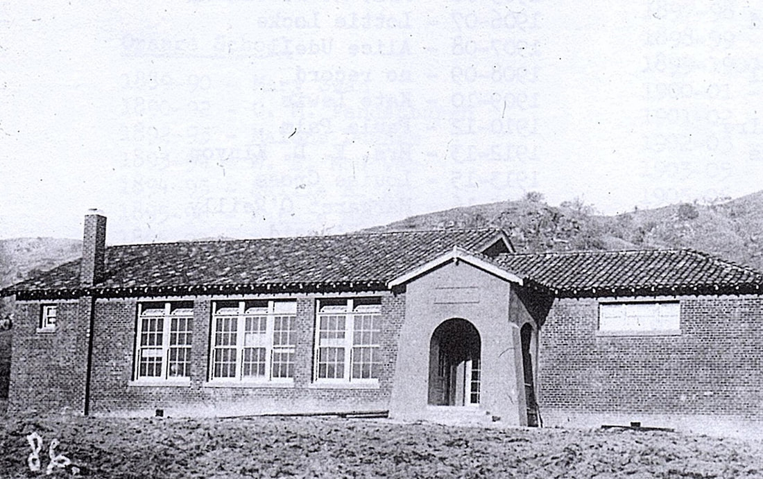
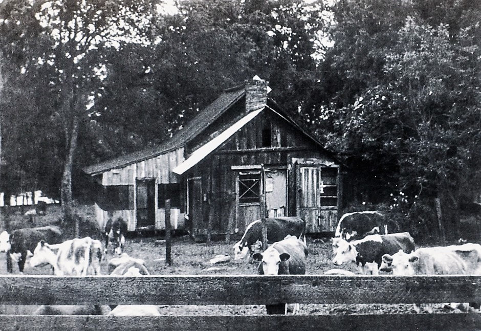
     The original town was formed when John Crabtree, one of the first settlers on the Tule River, sold a piece of his 1856 land patent to William G. Daunt. In the 1860s, Daunt built the area’s first combination store and post office, which served the growing area for many years. That piece of property, sitting beside today’s rodeo grounds, and still supporting the original post office/store chimney, became the eventual home of Springville’s Tule River Historical Museum.

     The story of Springville’s museum is a tale of vision, determination, cooperation, perseverance, and hard work. Its very existence stands as a testimonial to the kind of community Springville is, and to the woman who made it happen.

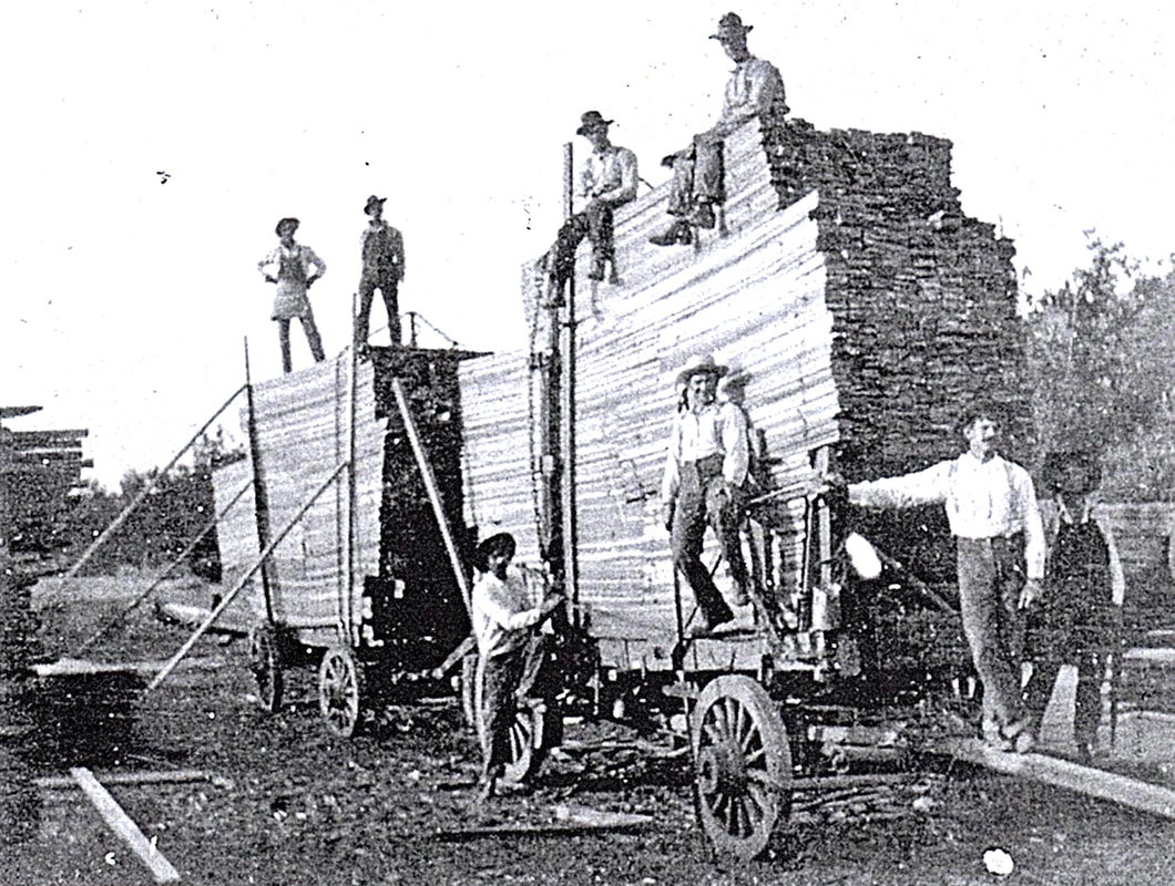
     Virginia Radeleff constantly gathered its history. The heritage of its prehistoric Yokuts people who thrived in the lush landscape of its clear springs. Its early years as an important way station for southern Sierra Nevada hunters, trappers, miners, stockmen, and sheep herders. Its years as a major lumber mill town, with a railroad line to serve it. Its evolving role in ranching and farming. Home to a major regional hospital facility during a pandemic of tuberculosis that ravaged the nation for over 50 years. Its importance as a gateway to the Sierra Nevada’s recreational opportunities on both federal and private lands.

     Every time someone had something they thought should be in the museum, they gave it to Virginia to store. Finally, in the 1970s, she had to tell the town, “It’s time for us to hunt for a museum because we can’t just keep putting it in Miss Virginia’s garage!”

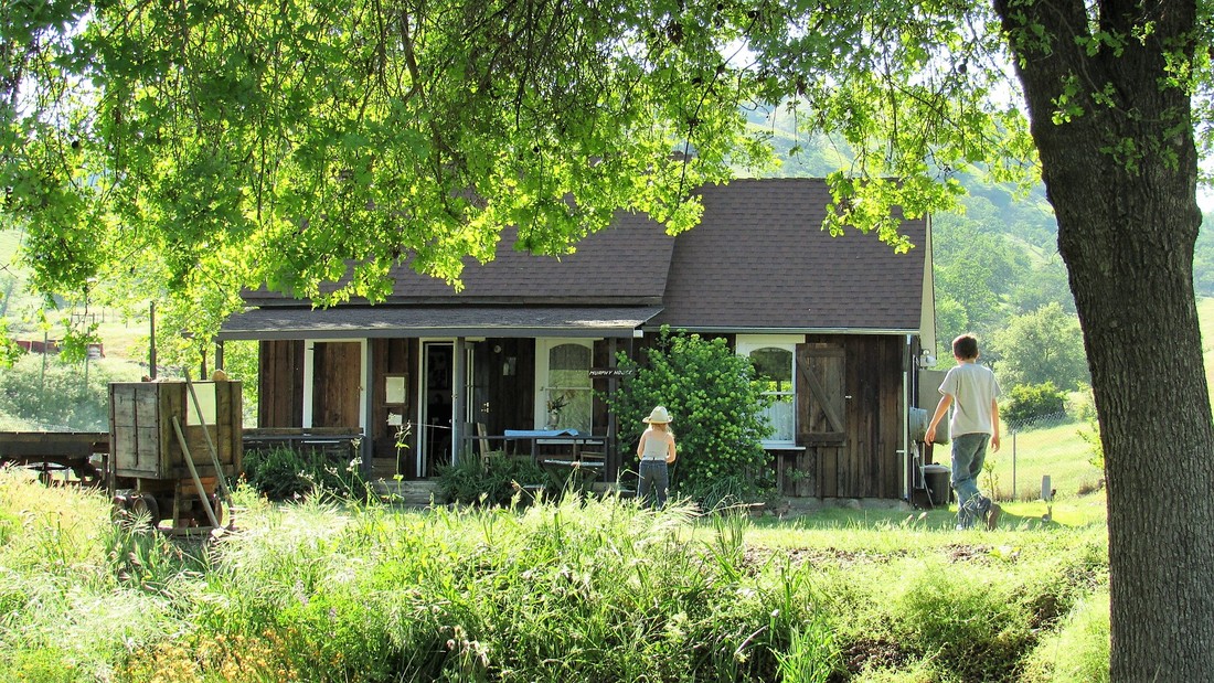
     The first places the community approached—the closed hospital, an old railroad right-of-way site, and the property of the Springville Hotel that had burned down—all proved unworkable. Then an interesting offer came. Lindsay dentist Dr. Franklin Baughman and his wife were going to build a new house on the property of one of the area’s early homesteads. The historic Murphy House was in the way, so they offered it for use as a museum. But there was one caveat; the old building had to be hauled away.

     On September 13, 1981, the Tule River Historical Society became a legal non-profit entity with two stated goals: to research and preserve the history of the area—and to move and preserve the Murphy House.

     Four years later, with the Baughmans ready to build but still without a home for the building or the capability to move it, a crew of volunteers started taking the structure apart. Piece by piece, they numbered each one and stored them all in nearby turkey sheds, a sea cargo container, and a barn. It took almost ten years before the Society found a place to re-assemble them into a house. That place turned out to be the property of the old Daunt store and post office.

     Daunt’s one acre site, its location by the rodeo grounds, and its history made it a perfect location for the museum. The Historical Society approached Mariann Sanders, who owned the property, but, once again, there were problems. Funds to buy the property, access to it, water and electrical connections were all missing.

     A committee of the Historical Society went to work on the funding first. It offered to handle the sales of local historian Jeff Edwards’ book, 100 Year History of the Tule River Mountain Country, in return for a donation to buy the property. When the donation reached over $4,000, negotiations with Mariann Sanders began in earnest, and in 1988 an agreement was reached in which she donated the land in exchange for payment of back taxes.

     The next few years were busy. The Rodeo Association granted access to the site, the Lions Club donated over $5,000, and in 1990, after the Tulare County Planning Department issued a building permit and approval of the site plans, the Southern California Edison Company brought in an underground electrical conduit. The Historical Society repaired the Daunt chimney, fenced the site, and poured the slab for its first building. Finally, in 1994, the Murphy House was reassembled in its new home and its restoration began.

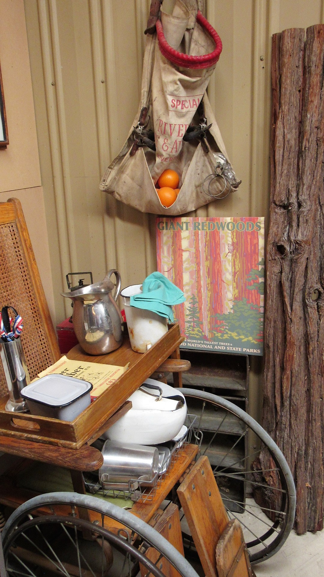
     Today, Springville’s Historical Museum stands as a wonderful repository for all the artifacts and historic records of the upper Tule River region that Virginia Radeleff and the Tule River Historical Society have gathered through the years. The fully restored Murphy House is a museum in itself, filled with pioneer furnishings, fascinating artifacts of early America, interpretive photos, stories, documents, and genealogies.

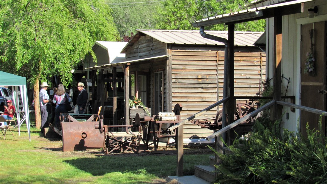
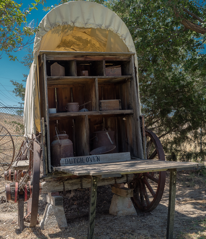
     The museum grounds display restored and refurbished artifacts seldom seen in a rural museum. A full blacksmith shop, freight wagons, a covered wagon, historic trucks and cars; early lumbering and water power equipment, farm and ranch equipment, a replica post office and stores; and the original Daunt chimney standing tall, as a witness to the passing times.

     One of Miss Virginia Radeleff’s goals for the future is for the Tule River Historical Society to collect the modern industrial and personal technologies that are changing rural America’s way of life today. To maintain and grow the Springville Museum as continuing testimony to an ever-evolving community and its special can-do people.

October, 2017

UPDATE: On Sunday, January 26, 2025, Miss Virginia Radeleff died peacefully in her sleep at the age of 105.  Her dedication to the education of generations of Springville’s students and to the collection, preservation, and dissemination of the community’s (and its region’s) history has left a lasting legacy that is truly a Tulare County Treasure.


Slideshow:


Quotes & More Photos:

“[A museum] is an opportunity for a community to do things together . . . a museum can be a focus, not only of children but their parents and even grandparents . . . they not only take a part in life now, but they want to show their descendants what it was like.” — Miss Virginia

“My mother had the . . . telephone company switchboard in our living room, and the county library. That was her job. And my dad had a service station down the street. And no one was making any money. . . . But the one thing that both my parents always insisted was that every one of us was going to go to college. . . .  So we grew up with education being at the heart of everything.” — Miss Virginia

“. . . I found that working with youngsters was what I wanted most, and I thought I could help the town the most that way. There are at least six families here now that I taught four generations in their family.” — Miss Virginia

“The janitor over at school, when I first started to teach, every day when he came to school, he brought his milk cow with him, and tied her out along the fence, and she ate the grass along the road, and when he went home for lunch, he took her home, and then back.” — Miss Virginia

“The name of Springville was never official until 1911. At this time the name was changed from Daunt to Springville.” — Jeff Edwards

“To the Indians this was a spot for good living, and many significant signs show that they used it. The depth and size of the many potholes indicate the Indians ground a lot of acorns here. Game was plentiful, as were fish, fowl and vegetables.” — Jeff Edwards

“Murphy House is local, and it was actually built here . . . . about Civil War time, 1850s . . . . and it was pretty well put together.” — Miss Virginia

“The stove in the kitchen  . . . is out of the family that just recently gave us the Model [A] Ford. Somebody gave us the bathtub, made out of wood. The little organ that you can carry was given to us by a family from up there. The minister used to carry it in a little suitcase up to the mountain on Easter morning and we had sunrise services.” — Miss Virginia

“Also what happens in a small town that you can take advantage of when you want to start a museum is that people are used to doing their share. They don’t sit back and wait for someone else to do it.” — Miss Virginia

“That first year, everybody in Springville, or relatives, when Jeff put his book out got a copy; that was their Christmas present.” — Miss Virginia

“We’ve had some pretty nice big pieces of machinery from the mills and from the ranches. PG&E and Edison have both donated really hard-to-find heavy equipment, so some really good things from the power houses are in there.” — Miss Virginia

“You’re not only saving a thing, you are saving an idea and an effort and showing younger people what you can do for the town. . . . You’re generations of people, but there’s also generations of artifacts and of things and of attitudes . . . . Everything to do with a town and families and history is a living thing, and you just are preserving what’s available . . . .” — Miss Virginia


Maps & Directions:

Address:  34902 Hwy 190, Springville, CA 93265

From Visalia, take Hwy 198 east. Turn right (south) onto Road 204/Spruce Rd.  At the stoplight at the “T” intersection, turn left (east) onto Hwy 65 south toward Porterville.  Turn left (east) onto County Route J28 through Strathmore to the junction with Hwy 190.  Go left (east) on Hwy 190 toward Springville.   Nearing the west end of Springville, watch for the Springville Rodeo grounds entrance on your left.  Turn in  through the gate and immediately turn right and go downhill to the gateway to the museum.


Site Details & Activities:

Environment: Foothills, just southwest of Springville
Activities: tour museum, attend special events; Open House first Sunday in December
Open: Tuesdays, 10:00 a.m. – 4:00 p.m.; and Sundays, 1:00 p.m.- 4:00 p.m.
Site Steward: Tule River Historical Society; 559-539-6314; 559-539-5600
Opportunities for Involvement: volunteer, donate
Links:
Books: 1) 100 Year History of the Tule River Mountain Country, by Jeff Edwards (Panorama West Books, 1986)
2) The Men of Mammoth Forest: A Hundred-year History of a Sequoia Forest and Its People in Tulare County, California by Floyd L. Otter (self-published, 1964)


Click on photos for more information.

Science and Shelter at the Summit

by Laurie Schwaller

     Mt. Whitney’s distinction as the highest peak in our 48 contiguous states has made it a hiker magnet for almost 150 years. It also made it an astrophysicist magnet that drew a number of world-renowned scientists to its summit in the late 1800s and early 1900s.

     It was the scientists who, in 1908-1909, were responsible for the design and construction of the Smithsonian stone hut that continues to offer shelter and photo opportunities to the tens of thousands of trekkers striving to reach the top each year.

     In September, 1881, Samuel Pierpont Langley, then director of Allegheny Observatory and subsequently Secretary of the Smithsonian Institution in Washington, D.C., and director of its Astrophysical Observatory, led an expedition up a narrow foot trail from Lone Pine to the barren 4-acre plateau at the mountain’s top to study solar radiation.

     Excited by the quality of his results, Langley recommended that Mount Whitney and its environs be reserved by the government as a prime location for a high-altitude observatory. His expedition report noted that a permanent shelter was required to enable scientists and support teams to remain at the summit, and added that “Stone for the erection of permanent buildings is here in unlimited quantity.”

     In July, 1903, Professor Alexander G. McAdie, Chief of the U.S. Weather Bureau in San Francisco, and Professor Joseph N. LeConte reached the summit with their instruments, in company with a 137-member Sierra Club High Trip group. McAdie’s report that Mount Whitney was “most suited for a meteorological observatory” contributed ultimately to a series of expeditions under the auspices of the Smithsonian Institution.

     Spurred by the tourists’, scientists’, and National Park’s interest in “their” mountain, the citizens of Lone Pine raised money to complete the trail work started in 1903 by U.S. Army troops under Captain Charles Young, Acting Superintendent of Sequoia National Park that year.

     Gustave F. Marsh, who operated a stage line and express business in Lone Pine, was contracted to engineer and finish building the Army’s good path for pack and riding stock all the way to the summit. He finished his work on July 22, 1904.

     Plans for a summit shelter finally got made in 1908, as a result of a summit expedition that August. Dr. William Wallace Campbell of the University of California’s Lick Observatory and Dr. Charles Greeley Abbot, the new director of the Smithsonian’s Astrophysical Observatory after Langley’s death, ascended the peak on a reconnaissance mission.

     Campbell had decided 14 years earlier that he had to be atop Mount Whitney in late August of 1909, when Mars would next be most favorably positioned for his studies, at its brightest and closest to Earth, opposite the Sun in Earth’s sky. He was determined to debunk the “evidence” of intelligent life on Mars that was currently being popularized. Abbot was accompanying him to continue Professor Langley’s studies of solar radiation.

     With only a two-week opportunity for the best viewing in 1909, the scientists had climbed Whitney a year in advance so they could meticulously plan and prepare for that expedition. Gustave Marsh, head of the crew that opened the east side pack trail to the summit in 1903-04, had been hired to guide both the 1908 and 1909 expeditions.

     After the scientists spent a frigid night on the summit in 1908, Campbell decided that observations in 1909 “should not be undertaken unless a building of some kind could be erected as a shelter in case of storm.” He drew plans for a three-room hut with stone walls and a steel roof and doors, “to be used as a shelter and living quarters for observers in any branch of science.”

     Abbot presented Campbell’s plans to Secretary Charles D. Walcott of the Smithsonian, and on October 30, the Smithsonian approved a grant for the shelter. Abbot hired the firm Speiden and Speiden to create the construction plans. Then, through the Smithsonian, he got government permission to construct the shelter on the summit, and funds to pay for it.

     Campbell tackled logistics. He got estimates for cement and workers’ tents and for the steel and glass parts from the United Sheet Metal Works in San Francisco. (No wood was to be used, as lightning could set it on fire.) Through Marsh, he got costs for packers to carry everything up the mountain and for a mason and helpers on the peak to assemble the hut. He sent Abbot an estimate of $2,315. The enthusiastic Secretary Walcott approved a generous $2,500 instead.

     In 1909, the badly deteriorated east side trail had to be remade to enable pack stock to transport the building materials, supplies, and scientific instruments to the summit. On July 28, the first mule train reached the top, barely a month before the expedition’s arrival, and work began on the shelter, with stone for the walls being broken, shaped, riveted, and cemented with hand tools.

     By mid-June Campbell had inspected all the steel parts assembled for the hut in San Francisco, and supervised their actual trial erection. He shipped them, the cement, and the tents for the construction crew to Lone Pine while Marsh worked tirelessly at all the tasks on the summit.

     Campbell had also invited McAdie of the Weather Bureau to join the party as its meteorological observer. The main expedition party left Lone Pine on August 23. Abbot set up his 16-inch heliostat and spectrograph to compare the spectra of the Moon and Mars, and began his observations before the shelter was completed.

     Twenty-eight years after Langley made his observations on the summit, McAdie obtained continuous records of pressure, humidity, and temperature for the entire period on the peak.

     On August 28, Campbell and the Lick group, including Messrs. Albrecht, McAdie, the physician Dr. Miller, Hoover, and Skinner, arrived at noon, and the entire party got soaked in a thunderstorm. The storms continued until September 1, but on that night and the next, Campbell obtained a good series of exposures on Mars and the Moon.

     The spectrograms were developed at the summit as they were taken. Then the unusual, extremely adverse weather returned, precluding further observations, and sending the expedition back down the mountain. Campbell’s findings substantiated that there was insufficient water vapor on Mars to support life as we know it on Earth.

     In August of 1910, the Smithsonian shelter was used again when Dr. Abbot and Mr. Marsh were back on the summit in an expedition organized to complete the scientists’ work and confirm the 1909 results. The Smithsonian’s final Whitney excursion was in 1913.

     The National Park Service acquired title to the shelter in 1926, when Sequoia National Park was expanded to include its site. Those hiking the high trail at night can still experience the stunningly clear starry skies that drew the scientists to the great peak over a century ago. William Wallace Campbell designed the simple stone building well. In 1909, he told The New York Times that it “should last 500 years.”

December, 2020

 Mt Whitney lies on the boundary of Sequoia National Park and Inyo National Forest. About 30,000 people per year want to hike Mt. Whitney, so hikers must secure a permit from the Forest Service* in order to enter the Mt. Whitney Zone. Permits are required year-round, for both day and overnight use, and a quota system is in effect between May 1 and November 1.

 Applications to reserve a backpacking trip on the Mt. Whitney trail or a day hike in the Mt. Whitney Zone are accepted in the Mt. Whitney Lottery from February 1 through March 15. Any space left over after those dates will go on sale April 1 at 10:00 a.m. Go to https://www.fs.usda.gov/detail/inyo/passes-permits/recreation/?cid=stelprdb5150055 for Inyo National Forest permit and trail information. Wilderness Office Information Line: 760-873-2483. Reservations can be made through www.recreation.gov.

Hikers are advised to carry crampons and ice axes when snow and ice may be on the trails. Those on the summit are warned against seeking shelter in the Smithsonian hut during lightning storms.

The Smithsonian Shelter was added to the National Register of Historic Places on March 8, 1977, because it is “a monument to the difficulty of high altitude research in the period before prolonged human flight was possible.”

*If your trip begins in Sequoia or Kings Canyon national parks, then the Inyo National Forest will accept the permit issued by that agency as long as you meet the requirements for continuous wilderness travel.


Slideshow:


Quotes & More Photos:

Mount Whitney, elevation 14,505 feet, was “discovered” by scientific Americans in July, 1864, when the California Geological Survey’s Brewer party decided that it was “so far as known” the state’s highest point and named it in honor of Josiah D. Whitney, the Survey’s Chief Geologist. (The Owens Valley Paiute Tribes called it Tumanguwa.)

On August 18, 1873, three Owens Valley fishermen made the first recorded successful summit climb. On September 6, Carl Rabe, an assistant in the State Geological Survey, arrived on the peak with a mountain mercurial barometer and made the first determination of the mountain’s height.

Langley wanted to find out whether Mt. Whitney’s very high altitude, very dry atmosphere, and very clear air would reduce the interference of earth’s moist atmosphere with astrophysical observations. “In no country is there a finer site for meteorological and atmospheric observations than . . . Mount Whitney and its neighboring peaks. . . . The sky is of the most deep violet blue, . . . an incomparably beautiful sky for the observer’s purposes.” — Samuel P. Langley, 1881

In 1896, Swedish scientist Svante Arrhenius, winner of the Nobel Prize for chemistry in 1903, used Langley’s measurement of interference of the infrared radiation by carbon dioxide in Earth’s atmosphere to make the first calculation of how earth’s climate and temperature would change from a future doubling of carbon dioxide levels.

In 1903, Langley’s sketchy 20-year-old path had almost disappeared. Captain Charles Young deployed troops from Sequoia National Park to make a new trail suitable for stock travel over Army Pass, cutting 20 miles off the old multi-day route to the mountain’s west base. They started work on the east side trail as well.

On July 22, 1904, Gustave Marsh wrote to Dr. McAdie that “{W]e completed the pack trail to the summit of Mount Whitney . . . and parties are going over it every day.” Four days later, Dr. Barton Evermann, chief of the Division of Scientific Inquiry, U.S. Bureau of Fisheries, and three employees took the new trail to the top. They were eating lunch when lightning struck them, killing Byrd Surby.

Astronomer Percival Lowell proclaimed that there was intelligent life on the Red Planet, evidenced by the “canals” crisscrossing its surface that he had seen from his observatory on “Mars Hill” near Flagstaff, Arizona.

“[I] arrived on the summit August 22. The walls of the building were done except gables and partitions, and the frame of the roof was up. The masons were laying the walls of the little stone hut for my work, and they finished it, including the roof, that day. Several 6 x 6 tents had been loaned by Professor Campbell, and in these we cooked, ate, and slept.” “Marsh worked at all kinds of jobs himself — cooking, breaking stone, carrying stone, carrying snow for water, riveting and cementing, as well as general bossing. He will never get paid in this world for the work he did on that house.” — C.G. Abbot, 1909

The approximately 11 x 30 foot structure is built of concrete-mortared granite from the site, with a roof of corrugated steel riveted to a steel truss frame. The three rooms are in a line, with windows in each and an east-facing door in both the north and south rooms. Iron shutters can cover the windows and doors. Built to withstand extreme weather conditions, the Smithsonian shelter has undergone only minor alterations since its construction in 1909. — NRHP Nomination Form

“Two of the rooms communicate, and are kept locked by the Institution except when in use by authorized observing parties. The third room is accessible to the general public, and will doubtless be very welcome to persons who may be caught by storms or cold blasts on the top of Mount Whitney.” — C.G. Abbot, 1909

Distant lightning bristled the hair on the necks of the 14 animals in the pack train ascending Mount Whitney. “Two of the mules, Jack and Lucky, were specially honored,” McAdie wrote, “because they carried the mirrors safely to the top.” The size of the mirrors had been set by the heaviest load that a mule could carry.

“To an Easterner it is hardly a trail even now, and even Mr. Marsh said . . . that he hardly saw how the mules could go over it, unless they had hooks on their hind feet to hang on by till they found a place for their fore feet. There are places where . . . the mules must step down as far as from a high desk to the floor, landing on jagged rocks, not on dirt or sand.” — C.G. Abbot, 1909

“[A]t an elevation of about 13,000 feet, . . . four mules and a saddle horse, loaded with mirrors, photographic material, hygrograph and thermograph, lost their footing and glissaded the snow fields … fortunately … the injuries were mostly flesh wounds.” — Alexander McAdie, re 1909 expedition

“May we not hope that this is the nucleus of a great aero-physical observatory where work shall be done that will both add luster to American science and justify in fullest measure the aim of the Smithsonian Institution in its purpose to diffuse knowledge throughout the world for the welfare of men.” — Alexander G. McAdie, 1910

“I found the [Smithsonian shelter] in good shape and everything as I had left it. . . . [The Comet] was a good deal larger than I expected . . . and the tail streamed out for a long distance and was very beautiful . . . I forgot all about the time, but was wishing . . . I had someone with me who understood more about it.” — Gustave F. Marsh, atop Mt. Whitney to see Haley’s Comet, May 23, 1910

In 1913, a final Smithsonian Whitney expedition used the shelter. A colleague of Dr. Abbot, Anders Angstrom, then aged 25, of Uppsala, Sweden, came to study the radiation of the atmosphere. W.R. Gregg, of the U.S. Weather Bureau, launched captive balloons from the summit to explore the upper air. Gustave Marsh rebuilt the trail and organized the logistics from Lone Pine.

Abbot’s small flat-roofed stone shelter was again used for setting up the instruments inside and on its roof, while the 11 x 30 foot shelter provided living quarters and storage. “A thrilling electric storm raged for some time. Every point of rock and the tips of the nails and hair emitted electric discharges. But the little stone-and-iron building of the Smithsonian Institution furnished shelter.” — Anders Angstrom, 1915

“The Mount Whitney shelter . . . received some much needed repairs by Thor [Riksheim] in mid-September. He re-hung the doors and patched some of the holes in the structure too in an attempt to keep blowing snow out of the building. . . . The lightning diffusion system is intact and in good repair.” — SEKI Crabtree Ranger End of Season Report, 2006

“During its centennial summer of 2009, recognition is extended to all who have hiked to the summit and seen the shelter. Special appreciation is being noted for the services of construction foreman Gustave F. Marsh, his crew, and the citizens of Inyo County whose support was key to seeing that the shelter was built in time for the 1909 observations of Mars.” — U.S. Forest Service, Inyo National Forest


Maps & Directions:

    Trail from Whitney Portal to Mt. Whitney Summit

Directions:

The shortest and most popular route to the summit is a 10.7 mile trail from Whitney Portal, 13 miles west of the town of Lone Pine on the east side of the Sierra, via Hwy 395.  Permit required.  See information above, just below article.

From Visalia, take Hwy 99 south to Bakersfield and go east on Hwy 58 over Tehachapi and down to the junction with Hwy 14. Go north on Hwy 14 to Hwy 395 north to Lone Pine and then up Whitney Portal Road to the trailhead.


   High Sierra Trail from Giant Forest to Mount Whitney Summit


Directions:

Other routes to Mt. Whitney are less heavily used, but require a much longer hike to reach the summit. To start from the west side, the High Sierra Trail leaves from Giant Forest in Sequoia National Park and is about 60 miles (taking a minimum of 6 hiking days) one-way. A Sequoia National Park wilderness permit for the High Sierra Trail is required (see Site Details below).

From Visalia, take Hwy 198 east through Three Rivers to the Sequoia National Park entrance station (fee), where the road’s name changes to the Generals Highway. About a mile up the road, stop at the Wilderness Office near the Foothills Visitor Center to pick up your required Wilderness Permit for the High Sierra Trail (see Links in the Site Details section below).

Proceed on the Generals Highway to just before the Giant Forest Museum area and turn right onto the Moro Rock/Crescent Meadow Road. From the parking area at the end of the road at Crescent Meadow, follow the signs to the High Sierra Trail trailhead.


Site Details & Activities:

Environment: Mountains, summit of Mt. Whitney, Sequoia National Park (NOTE: the Smithsonian shelter can be visited only by foot trail; summit elevation is approx. 14,505′.)
Activities: architecture study, backpacking, birding, botanizing, camping (below the summit), hiking, history, photography, wildflower and wildlife viewing
Open: Sequoia and Kings Canyon National Parks are always open, weather permitting, unless closed due to emergency conditions; park entrance fee; High Sierra Trail Wilderness Permit required for trail to Mt. Whitney from the west; permit required from Inyo National Forest if coming from the east.
Site Steward: National Park Service-Sequoia and Kings Canyon National Parks; 559-565-3341; www.nps.gov/seki
Opportunities for Involvement: Sequoia Parks Conservancy (SPC) membership; donate, volunteer
Links:

Click on photos for more information.

The Story of the Origins of Sequoia National Forest: The Sierra Forest Reserve

by William Tweed

     In terms of the acreage involved, no other conservation effort in the history of Tulare County comes close to the establishment of the Sequoia National Forest, and that story, like so many others, has its origins among the citizens of this county.

     When the effort began, the campaigns that would ultimately result in the creation of both Sequoia National Park and the Sequoia National Forest were one and the same. The goal, quite simply, was to protect all the Sierra Nevada watersheds that provided mountain water to the expanding farms of the San Joaquin Valley.

     The initiative got under way in Visalia in October 1889, when four local residents – Tipton Lindsey, Frank. J. Walker, John Tuohy, and George Stewart – launched a campaign to protect the mountain lands adjacent to the southern half of the San Joaquin Valley. Each of the four brought special skills to the movement. Lindsey, because he worked in the United States Land Office in Visalia, provided his knowledge of federal lands. Walker and Stewart were associated with the Visalia Delta newspaper. Tuohy, a rancher, knew the mountains first hand.

     Collecting information from the group, Stewart drafted a map of the area they wanted to see protected from overgrazing and logging, a huge tract of over two hundred thirty-six-square-mile townships, and circulated a petition calling for its protection as a federally-controlled reserve.

     The threat to the giant sequoia trees soon became so intense, however, that Stewart and his friends temporarily set aside this broader target and shifted their focus to a more limited and immediate goal – the establishment of a national park to protect the best of the giant sequoia trees. This effort gained energy over the summer of 1890, and Congress passed a bill establishing such a park in September 1890. A mere week later, the new park was enlarged, but it still contained only seven of the two hundred townships the group wanted to protect.

     The Visalia group remained in close contact with Interior Department Secretary John Noble, who was highly sympathetic to what they were trying to accomplish. Noble had the ear of President Benjamin Harrison, who had appointed him. This was an important connection because Harrison supported what came next when Noble succeeded in adding a forest reserve clause to an obscure piece of legislation focused on repealing obsolete timber culture laws.

     The March 1891 Forest Reserve Act, as it came to be known, gave the president the right to set aside lands from the public domain as “forest reserves,” thus withdrawing them from sale to private interests.

     This provided the Visalians with just the authority they needed to renew their campaign for protecting the entirety of the southern Sierra. The Visalia group resumed their political efforts.

     Responding to the resulting local interest in forest protection, Secretary Noble put special land agent B. F. Allen on the ground in the Sierra studying what lands might logically be placed within a “Tulare Forest Reserve.”

     Allen, working largely alone, resumed his efforts once the snows melted from the Sierra in the spring of 1892, and he finished his report in January 1893. He had spent most of a year riding the trails of the Sierra, checking on conditions, and listening to local concerns.

     Time was running short now, for President’s Harrison’s term was ending, and thus Noble would soon also be leaving the Interior Department. Noble pushed Allen’s report onto the president’s desk, and on February 14, 1893, just two weeks before the end of his term, President Harrison created the “Sierra Forest Reserve” under the authority granted to him by the Forest Reserve Act. The new reservation set aside for permanent public ownership over four million acres of forest land.

     It took another dozen years and a government reorganization before effective management came to the reserve, but the changes did come. In 1905, management of the reserve was transferred to a new agency in the Agriculture Department, the United States Forest Service. In 1908, the new managers renamed the Tulare County portion of the forest reserve the Sequoia National Forest, the name under which the huge area is still managed today (with 353,000 acres of it designated as Giant Sequoia National Monument in April, 2000).

     Tipton Lindsey, Frank. J. Walker, John Tuohy, and George Stewart had succeeded beyond their wildest dreams. The Sequoia National Forest is the direct result of the efforts of these forward-thinking early Tulare County citizens.

                                                                                                                                                                                                                     October, 2012

     The Sequoia National Forest includes elevations ranging from 1,000 to over 12,000 feet, more than 30 giant sequoia groves (and Giant Sequoia National Monument), over 1500 miles of maintained roads, 1000 miles of abandoned roads, and 850 miles of trails (including 78 miles of the Pacific Crest National Scenic Trail and three National Recreation Trails: Summit, Cannell Meadow, and Jackass Creek), over 200 miles of Wild and Scenic Rivers, over 300,000 acres of wilderness, 158 ponds and lakes, 52 developed campgrounds, and frontcountry and backcountry winter activity areas. Portions of four of its six designated wilderness areas are within Tulare County: South Sierra, Domeland, Jennie Lakes, and Golden Trout. Three USDA Forest Service ranger districts — Hume Lake, Western Divide, and Kern River — administer the 1.1 million-acre Sequoia National Forest.


Slideshow:


Quotes & More Photos:

“The conservation of natural resources is the fundamental problem. Unless we solve that problem it will avail us little to solve all others.” — Theodore Roosevelt

“The creek is very clear and beautiful, gliding through tangles of shrubs and flower-beds, gay bee and butterfly pastures, . . . pure Sequoia water, flowing all the year, every drop filtered through moss and leaves and . . . myriad spongy rootlets . . . .” – John Muir

“Man did not weave the web of life; he is merely a strand in it. Whatever he does to the web he does to himself.” – Sealth, Suquamish Chief (Chief Seattle)

“The interior landscape responds to the character and subtlety of an exterior landscape; the shape of the individual mind is affected by land as it is by genes.” – Barry Lopez

“The nation behaves well if it treats the natural resources as assets which it must turn over to the next generation increased; and not impaired in value.” – Theodore Roosevelt

“What we are doing to the forests of the world is but a mirror reflection of what we are doing to ourselves and to one another.” — Chris Maser


Maps & Directions:


Three main roads from the west side will take you to the Sequoia National Forest:

1. From Visalia, take Hwy 198 east to Hwy 65 south to Hwy 190 east through Springville to the Forest (or stay on Hwy 65 south to Ducor and take J22/Avenue 56 east to Fountain Springs, where either M56/Hot Springs Drive or M190/Old Stage Road lead into the Forest/Giant Sequoia National Monument (Western Divide Ranger District and, if you keep going east, Kern River Ranger District).

2. From Visalia, take Hwy 198 east through Three Rivers and the Ash Mountain Entrance Station of Sequoia National Park (fee) and continue on the Generals Highway through the Park, passing Dorst campground, to enter the National Forest/Giant Sequoia National Monument, and trails to Jennie Lakes Wilderness (Hume Lake Ranger District).

3. From Visalia, take Hwy 63 north to Hwy 180 east through the Big Stump entrance station to Kings Canyon National Park (fee), and then go either left or right at the “Y” junction to access the Forest/Giant Sequoia National Monument (Hume Lake Ranger District).


Site Details & Activities:

Environment:  Foothills, Mountains, oak woodlands, conifer forests, giant sequoias
Activities:  backpacking, bird watching, boating, botanizing, camping, dog walking (on a 6′ leash; scoop poop), fire lookouts, fishing, hiking, horseback riding and packing, hunting, kayaking, OHV routes, pack trains, photography, picnicking, mountain biking, scenic drives, skiing, snowboarding, snowshoeing, snowmobiling, swimming, whitewater rafting, and wildlife and wildflower viewing
Open:  daily, year-round, weather permitting, free admission
Site Steward:  USDA-National Forest Service, Sequoia National Forest, 559-784-1500; and see Links below:
Books:  The Magic of My Mountains–Memories from California’s Sequoia National Forest 1919-1926, by Norman L. Norris, 1998


Click on photos for more information.

Recognizing Tulare County’s
Last True Mountain Man

by Laurie Schwaller

     Joseph Walter “Shorty” Lovelace may not have looked like the classic image of a mountain man, but the National Historic District bearing his name in the rugged high Sierra Nevada of Kings Canyon National Park is a testament to the lifeway, ingenuity, and endurance Shorty embodied for forty years as a totally self-sufficient fur-trapping mountain man.

     Born in 1886 in Sacramento, he moved with his family two years later to a homestead several miles above the village of Three Rivers in the foothills of what became Sequoia National Park in 1890. Shorty spent his early years exploring, hunting, and trapping with his four brothers and his pioneer father.

     The family moved to Visalia in time for Shorty to attend high school there, and he turned out to be a fine mechanic. He operated a garage in Tulare County and then in Reno, Nevada, before opening a pump shop in Visalia in partnership with his boyhood friend Charles Hammer, whose sister he married a few years later.

     But by 1920, Shorty had lost his partnership, his marriage, and all his prospects to alcoholism. His father and his brother Bryan helped Shorty find a way out. Together, they completed a cabin compound begun in 1911, including corrals and pelt-drying racks, in Crowley Canyon near Comanche Meadow, a few miles beyond Sequoia National Park’s northern boundary. Shorty would live there all winter, where the solitude, peace, beauty, labors of trapping, and absence of liquor stores would keep him sober and productive for half the year.

     From that base camp, Shorty steadily extended his range, building as many as 36 smaller shelters throughout the South Fork of the Kings River drainage. All but one were smaller than six by ten feet, with none taller inside than five and a half feet, which was fine for Shorty, who stood only about 5’3″.

     They were tiny because he built most of them single-handedly, so the materials couldn’t be too large or heavy. Also, he didn’t want them to be noticed, by people or animals. A small space was easier to heat, important when temperatures often fell below zero, and snugly accommodated his furnishings, consisting of only a little plank bed at one end, a mortarless stone fireplace at the other, and numerous shelves to hold his utensils and supplies.

     Shorty constructed these winter homes usually in the summer or early fall, from the natural materials available at each site. Whenever possible, he used small fallen trees, which he cut into logs 6-12″ in diameter for the walls. He notched them lightly to fit together and spiked wooden wedges or poles into place to fill the gaps. Sometimes he used stones for foundations, but his floors were all just dirt.

     He cut poles to serve as rafters. Shakes made the roof and also the door, which hung on leather straps. He tied a piece of rope to an overhanging branch so that he could dig below it to locate each den in the snow.

     By October, Shorty was loading pack animals, his own or ones he rented, with canned goods, traps, toilet paper, blankets, candles, matches, reading material, and everything else he would need alone in the mountains for the next five or six months. As he stocked each cabin and lean-to, he also laid in a big supply of firewood, his only source of heat for the long winter. When all his shelters were ship-shape, he took the pack animals out of the mountains and watched the peaks for snowfall.

     Shorty was a strong, skilled, resourceful mountain man, who worked hard as a fur trapper. He travelled only on foot or his home-made skis (equipped with pine marten climbing skins for trekking uphill) until he brought the pack animals back in the spring to haul out his winter accumulation of furs.

     His huge territory covered most of the watershed of the South Fork of the Kings River, spanning 50 miles from his Crowley Canyon compound to his cabins in Upper Basin, and ranging in elevation from 4,600 feet to over 12,000. Unless the weather was too extreme, he was out every day, traveling over steep, trackless, rugged terrain, setting his traps, checking them regularly, killing and skinning the animals he caught, processing their pelts, watching for treacherous ice or snow, wary of avalanches, falling rocks and trees, and sudden storms.

     Only once did the mountains almost beat him. One winter in the 1930s, a falling tree crashed into his Granite Pass cabin, caught fire, and burned him out. Despite painful internal injuries, Shorty had to reach shelter before nightfall. Gradually he moved from cabin to cabin, covering almost 50 miles back to his Crowley Canyon headquarters. A snow survey crew, finding him there in March, still in bad shape, offered to take him out of the mountains, but Shorty refused. When the snow melted, he walked out alone.

     Shorty continued his annual schedule by selling his pelts in the spring, in Visalia or San Francisco. He earned up to $2,000 a year for his furs (fisher furs averaged about $45 each, wolverines $25 to $30, and martens about $15), when most California trappers reported making about $160.

     After giving his brother enough money to cover his re-stocking costs in the fall, Shorty spent his summers blowing most of his earnings on binge drinking, but also, when sober, working on his shelters in the mountains and on odd jobs in the valley, and visiting his extended family at various gatherings, where he was especially a much-loved uncle of the children.

     A letter was waiting for Shorty when he came out of the mountains in the spring of 1940. It said that Kings Canyon National Park had been established on March 4. Encompassing virtually all of Shorty’s trapping range, the park did not allow hunting or trapping.

     Shorty, age 54, knew what he had to do. Within just a few years, he completed a new layout of traplines and shelters north of the new national park, on the watershed of the North Fork of the Kings in the Sierra National Forest. He worked his new territory for another 20 years, until, at age 75, he brought his winter harvest down from the mountains for the last time.

     Shorty died two years later, in 1963, but at least two of his structures survive. In the 1970s, and again in 2012, Sequoia and Kings Canyon National Parks restored his Cloud Canyon and Vidette Meadow cabins (the latter just north of the Tulare County line). Visitors can duck under their low doorways and imagine spending 15-hour nights there under 10 feet of snow with only a candle and an old magazine for company and a little fire for warmth after working traplines alone in the wilderness all day.

     As one visitor remarked, “Shorty must have been one tough, savvy woodsman.” While our time spent in the high Sierra is different in many ways from Shorty’s, these magnificent mountains are still a haven of solitude, respite, peace, beauty, and adventure for us all.

November, 2020


Slideshow:


Quotes & More Photos:

“One of the most unforgettable characters that I ever knew as a boy in Tulare County was a fifty-plus year old man named ‘Shorty’ Lovelace. I don’t believe I ever knew his real first name. To everyone he was just ‘Shorty.’ He stood about five feet three or so, and had a very deceiving stature. At first glance you’d say he was fat, or chunky, or obese. The truth was he was hard as nails . . . he had to be to endure the rigors of his unusual lifestyle.” — Jack Harold Moffet, 1990

Jack Moffet was sleeping outdoors when Shorty placed a piece of Limberger cheese near his face. The strong smell woke Jack up. “My shout was answered by a loud, high-pitched belly laughing . . . . Then out popped this diminutive, Santa Claus of a creature . . . holding his belly in absolute delight. . . . He loved a joke or prank, whether executed by or perpetrated on himself.” — Jack Harold Moffet, 1990

During the 1920s and 1930s Shorty trapped all over the southern two-thirds of what is now Kings Canyon National Park. His preferred prey was the pine marten, a house-cat-sized member of the weasel family. He trapped in the winter because that was when the pelts of the animals he caught were at their best. — Central Sierra Historical Society

“First, traveling on homemade skis, he set up trap lines using the time-honored snow trapping methods of placing traps in trees, hollow logs, or beneath small conifers. Then he followed a regime of checking established traps, placing new ones, and hauling in the pelts as they were caught.” — William C. Tweed, 2007

“By 1922, if not earlier, he was building additional line cabins. Ideally, these small shelters were not more than a day’s travel apart. They were arranged in loops so that travel between them would be as infrequent as possible,” since frequent travel made the game more wary. — William C. Tweed, 2007

Shorty built shelters throughout his trapping territory, at sites including Williams (Quartz) Meadow, Rowell Meadow, Kettle Peak, Ellis Meadow, Moraine Meadow, Cloud Canyon, and probably in upper Deadman and Ferguson canyons. Over the years, he gradually expanded, over Avalanche Pass onto Sphinx Creek, down into Kings Canyon, up Bubbs Creek, over Granite Pass, and into Rae Lakes, Sixty Lakes, and Gardiner basins. — William C. Tweed, 2007

“[M]oving uphill, Shorty had to use climbing skins strapped to the bottoms of his skis, and there can be no better skin for that purpose than the hide of a marten; it’s [sic] finely textured fur grows at a backward angle, allowing the skis to glide smoothly forward while sticking to the snow when slipping backward.” — Steve Sorensen, 2018

“I once asked an experienced wildlife biologist why we don’t see more pine martens in Sequoia and Kings Canyon. His answer was, ‘I don’t know. Maybe Shorty trapped them all.'” — Steve Sorensen, 2018

Unless he encountered a snow survey crew, he spent his days and months in total isolation. Only once did he try having a partner. Long before spring released them, they were sick of each other, crammed together in tiny spaces, both armed — and Shorty said he had to spend more time keeping track of his friend in the wilderness than minding his traps. — from Jack Harold Moffet, 1990

“Once his initial binge was over, Shorty whiled away the remainder of the summer, dividing his time between the mountains and the valley. Sometimes, Shorty hunted coyotes in Kern County for the bounty. Occasionally he took an odd job, building a fireplace or replacing an engine.” — William C. Tweed, 2007

“In at least two different years ‘Shorty’ never made it back to his traps. Instead he was an honored guest [working inmate] of the Tulare County Sheriff’s Department Road Camp at Cain Flat. Evidently ‘Shorty’ was a hellatiously [sic] good cook and was a welcomed trustee. The officers and inmates never ate so well as when ‘Shorty ‘ donned the white hat and apron.” — Jack Harold Moffet, 1990

“At seventy-five, [Shorty] was too old to winter in the Sierra any longer. That same summer, he was seen camping in the Roaring River area, where he had set up his first high mountain trap lines nearly half a century earlier. Two years later, he was dead.” — William C. Tweed, 2007

“. . . Shorty Lovelace was the first and only Caucasian ever to reside in the upper Kings Canyon region on a long-term year-round basis. Since Shorty’s departure, this region of approximately 200 square miles has remained uninhabited except for summer visitors.” — NRHP Nomination Form

“[F]ur trapping [was] the only industrial process ever to be undertaken successfully in the region in question with the single exception of grazing. During the nineteenth century, fur trapping was a major western industry, providing the impetus for the exploration of much of the West.” — NRHP Nomination Form

“Shorty lived a pioneer life that was anachronistic even in his time; now it seems almost unimaginable. His life, and the surviving cabins that document it, remind us of an earlier America and how it looked at the natural world.” — William C. Tweed,


Maps & Directions:

                                                       Click to enlarge detail map

Directions:

The Historic District comprises nine sites in Kings Canyon National Park where remains of Shorty’s shelters could still be seen in 1978 when the District was listed on the National Register of Historic Places (NRHP). The sites are accessible only by foot/stock trail. Wilderness Permits are required for all overnight trips.

By 1978, only the cabins at Vidette Meadow and Cloud Canyon were sufficiently intact to allow for structural preservation. The other sites are near Woods Creek Crossing, Granite Pass, Gardiner Basin, Bubbs Creek, Sphinx Creek, Crowley Canyon, and Williams Meadow.

“[S]ufficient . . . sites remain to document in rare detail the operative patterns of an alpine fur trapping circuit. . . . {T]his [may be] the only such opportunity present within the national park system.” — NRHP Nomination Form


Directions:

The most-visited of Shorty’s cabins in Kings Canyon N.P. is near Vidette Meadow, just north of the Tulare County line. It can be reached via the Bubbs Creek Trail out of Hwy 180 Road’s End, a few miles east of Cedar Grove in the bottom of Kings Canyon. At the junction of the Bubbs Creek Trail with the John Muir Trail, go south a short distance on the John Muir to the area of the bear box campsite and the junction with the Vidette Lakes Trail. This cabin can also be reached via the Onion Valley Trailhead off Hwy 395 on the east side of the Sierra.

From Visalia, take Hwy 63 north to its junction with Hwy 180.  Go right (east) on Hwy 180 into Kings Canyon National Park (entry fee) and follow the highway through Grant Grove Village and all the way to its termination at Road’s End, where there is lots of parking for day use and longer use, a Wilderness Permit station, and the trailhead for the Bubbs Creek Trail.


Directions:

Shorty’s cabin in Cloud Canyon can be reached from Lodgepole in Sequoia N.P. via the Twin Lakes Trail, which quickly enters Kings Canyon N.P., then via the Sugarloaf Trail to the locale of the Roaring River Ranger Station and up Cloud Canyon on the Colby Pass Trail about 6 miles to the area of the cabin. This cabin can also be reached from the Rowell Meadow trailhead in Giant Sequoia National Monument. Follow this trail to Comanche Meadow and then take the Sugarloaf Trail to the Roaring River Ranger Station and up Cloud Canyon on the Colby Pass Trail to the area of the cabin.

From Visalia, take Hwy 198 east through Three Rivers into Sequoia National Park (entrance fee) and follow it (now named the Generals Highway) to the trailhead parking area at Lodgepole Village.


Site Details & Activities:

Environment: Mountains, meadows, rivers, elevation varies, Kings Canyon National Park
Activities: architecture study, backpacking, birding, botanizing, camping (near several of the sites), fishing (license required), hiking, history, photography, wildflower and wildlife viewing (NOTE: the structures, ruins, and sites of Shorty’s shelters can be visited only by foot/stock trail.)
Open: Sequoia and Kings Canyon National Parks are always open, weather permitting, unless closed due to emergency conditions; park entrance fee; Wilderness Permit required for all overnight trips
Site Steward: National Park Service-Sequoia and Kings Canyon National Parks, 559-565-3341
Opportunities for Involvement: donate, volunteer, Sequoia Parks Conservancy (SPC) membership
Links:
Books: 1) Shorty Lovelace, Kings Canyon Fur Trapper, by William Tweed (Sequoia Natural History Association, 1980, 2007)
2) A Branch of the Sky, Fifty Years of Adventure, Tragedy, & Restoration in the Sierra Nevada, by Steve Sorensen (Picacho, 2018)


Click on photos for more information.

The Story of Tulare County and the Origins of Sequoia National Park

by William Tweed

     Of the many contributions made by the citizens of Tulare County to the conservation of nature, no other effort comes close to matching the 1890 campaign to create Sequoia National Park. Not only did this effort establish one of our nation’s premiere national parks but it also was a key step in the development of the idea that our nation should have a national park system made up of multiple units. Today that model is emulated worldwide.

     The government of the United States, prior to 1890, had taken two major preliminary steps toward developing what we now recognize as the national park idea. The first of these occurred in 1864, when Congress, in response to a request from a number of prominent California residents, gave title to Yosemite Valley and the Mariposa Grove of the giant sequoias to the State of California to be managed as a public park. The resulting nature preserve, in many ways America’s first major step toward creating a national park, was to be managed by the State of California.

     Eight years later, in 1872, Congress did create a national park – Yellowstone. Again, a small group of influential citizens lobbied to create the reservation. The difference this time was there was as yet no State of Wyoming to give the park to – the area was still a territory under direct federal management. Out of this came Yellowstone National Park.

     Many who supported the creation of Yellowstone envisioned it as adequate to meet all the young nation’s need for wildland recreation. At the time, Yellowstone was thought of as the national park; certainly one such place was all the nation would ever require.

     Enter the citizens of Tulare County. As early as the late 1870s, George Stewart of the Visalia Delta newspaper had begun to editorialize about the need to protect the amazing giant sequoia trees of the southern Sierra Nevada and the forests in which they grew. At that time almost all the land in the mountains was for sale by the federal government with the expectation that it would eventually be sold to private parties and logged.

     Stewart and his friends initiated their efforts by seeking temporary suspension of land sales in a number of key tracts of giant sequoia trees. They achieved some short-term successes in this effort, but all knew that they needed a permanent solution if they were to preserve these special forests.

     By 1889, Stewart had begun to lobby for the creation of a national park in Tulare County. State administration of Yosemite had not turned out all that well, and Stewart thought that the Yellowstone model offered more promise for protecting the mountains east of Visalia.

     The campaign took an even more serious direction in 1890, when the government prepared to release large tracts of temporarily protected mountains for sale. Stewart, working closely with Frank Walker, editorialized and networked, building support for the idea. He convinced Representative William Vandever, whose large district included Tulare County, to draft a bill to create a national park among the headwaters of the Kaweah River.

     As a result of the efforts of Stewart and many other Tulare County residents, the Sequoia National Park bill passed both houses of Congress as the summer ended, and was signed by President Benjamin Harrison on September 25, 1890.

     Just a week later, Congress passed another national park bill. It created a Yosemite National Park to surround the state park there, and also established General Grant National Park, which is today a part of Kings Canyon National Park in northern Tulare County.

     But it was the Sequoia National Park bill, which created America’s second national park, that initiated the formation of a system that now contains almost 400 separate units.

     It is hard to overestimate the significance of what Stewart and his Tulare County friends accomplished in 1890. Locally, they saved what we now know to be the largest trees on earth. Beyond that, they also established a pattern for national systems of preserved lands – a model that continues to expand across the planet even in the 21st century.

                                                                                                                                                                   October, 2012


Slideshow:


Quotes & More Photos:

“Keep close to nature’s heart . . . and break away, once in a while, and climb a mountain or spend a week in the woods. Wash your spirit clean.” — John Muir

“When you’re standing there silently in the presence of the giant sequoias, you can’t help but recognize that you’re a part of something that is way beyond whatever it is that you envisioned this world might be.” – George B. Hartzog, Jr.

“That which is not good for the beehive cannot be good for the bees.” – Marcus Aurelius, Roman Emperor 161-180 AD

“Bears are made of the same dust as we, and breathe the same winds and drink of the same waters. A bear’s days are warmed by the same sun, his dwellings are overdomed by the same blue sky, and his life turns and ebbs with heart-pulsings like ours, and was poured from the same First Fountain.” – John Muir

“It is our task in our time and in our generation, to hand down undiminished to those who come after us . . . the natural wealth and beauty which is ours.”–U.S. President John F. Kennedy

“Giant Sequoia, John Muir’s ‘forest masterpieces,’ mellow through the centuries, growing ever more imposing with time.” — Verna R. Johnston


Maps & Directions:

Directions:

From Visalia, take Hwy 198 east through Three Rivers to Sequoia National Park Ash Mountain Entrance Station (fee), where Hwy 198 becomes the Generals Highway, linking Sequoia National Park to Kings Canyon National Park. Along or near the Generals Highway in Sequoia National Park, make time if you can to visit the iconic Ash Mountain Entrance Sign, the Foothills Visitor Center, Hospital Rock, Amphitheater Point, the Giant Forest, Crescent Meadow and historic Tharp’s Log, Moro Rock Stairway, the General Sherman Tree, Lodgepole Village and Visitor Center, the Generals Highway Stone Bridges, Wuksachi Village, and the Lost Grove, after which the Generals Highway leaves Sequoia National Park.

To make a loop trip, continue on the highway through Sequoia National Forest to Kings Canyon National Park, where you can turn left onto Hwy 180 west to Hwy 63 south back to Visalia. (You may want to first go north on Hwy 180 at the junction to visit Grant Grove Village, Kings Canyon Visitor Center, and General Grant Grove and its famous tree before driving back to the Valley.)

If you have another day for Sequoia National Park, consider taking the winding road (seasonal) to Mineral King or returning to spend more time exploring the attractions along the Generals Highway. (Alternatively, consider visiting Kings Canyon National Park, Grant Grove, and the great canyon of the Kings.)


Site Details & Activities:

Environment: Foothills to mountains, coniferous forests, oak woodlands, giant sequoias, sub-alpine valleys, rivers, lakes
Activities: archaeological sites, backpacking, birdwatching, botanizing, camping, caving, cross-country skiing, educational activities, fishing, hiking, historical sites, horseback riding, museums, photography, picnicking, rock climbing, snow play, visitor centers, wildlife and wildflower viewing
Open: year-round, weather permitting, unless closed due to emergency conditions
Site Steward: National Park Service (NPS), Sequoia and Kings Canyon National Parks, 559-565-3341
Opportunities for Involvement: donate, volunteer, Sequoia Parks Conservancy (SPC) membership
Links:
Books: 1) Challenge of the Big Trees -The Updated History of Sequoia and Kings Canyon National Parks, by William C. Tweed and Lary M. Dilsaver (University of Virginia Press, 2017)
2) Sequoia and Kings Canyon: Official National Park Handbook #145, by Division of Publications, National Park Service, 1992 (U.S. Government Printing Office, 1986)
3) A Guide to the Sequoia Groves of California, by Dwight Willard (Yosemite Association, 2000)
​4) King Sequoia: The Tree That Inspired a Nation, Created Our National Park System, and Changed the Way We Think about Nature, by William C. Tweed (Heyday, 2016)


Click on photos for more information.

A GIANT GROWING IN OUR MIDST!
The Sequoia Legacy Tree at the Visalia Town Center Post Office

by Laurie Schwaller

     In February, 1936, Guy Hopping, Superintendent of General Grant National Park (now Kings Canyon National Park), brought two three-year-old giant sequoia trees from Grant Grove to the downtown Visalia Town Center Post Office, where he worked from an office in the basement during the winter. The Superintendent and Nathan Levy, Visalia’s Postmaster, planted the little trees one at each end of the recently-completed building.

     Around 50 years later, the ailing east-side sequoia had to be removed, but its sister tree kept growing. On April 28, 2018, a dedication ceremony was held to honor this now-towering 85-year-old Sequoia Legacy Tree. A historic treasure and source of pride for Visalia, it is also an important reminder of our valley’s vital connection to the Sierra Nevada.

     Attractive new signage tells the story. From the mountain home of the giant sequoias comes the surface water that flows in the valley’s rivers and creeks and the essential groundwater that we depend on throughout the year. As the sign reminds us, “It’s up to each of us to use our water wisely” to protect and conserve this legacy.

Mountain Home Conservation Camp #10 Sign Shop Crew

     The decomposed granite pathway that encircles the tree was designed to approximate the diameter of the General Sherman Tree in Sequoia National Park. This helps to provide scale for understanding how large these trees are capable of growing.

     In favorable conditions, giant sequoias can live well beyond 2,000 years. The first U.S. Post Office was established in 1775. Visalia was established in 1852. The Sequoia Legacy Tree is basically the same age as the post office building it stands beside; both came into being in 1933. What will their future be?

                                                                                                                                                                 July, 2018

 The Sequoia Legacy Tree interpretive feature is a project of the Visalia Convention and Visitors Bureau and was dedicated on April 28, 2018.

UPDATE: In the autumn of 2023, Visalia’s treasured Sequoia Legacy Tree began turning brown and was diagnosed with a fungus that had developed after two winters of heavy rains followed by two exceptionally hot summers. A horticulturist treated the great tree with a series of injections, but, most unfortunately, the dire fungus prevailed, the tree died, and the Postal Service removed it in February, 2025. It is hoped that the interpretive pocket park created around the tree in 2018 will remain. Visit Visalia is working with community partners on ideas for a replacement for the tree that will continue to honor its history and significance.


Click on photos for more information.

A Brief History of SCICON

by Rick Mitchell

     SCICON is the story of the caring people of Tulare County. They care about children and about the land and they want future generations to also grow up caring about the land and the rich natural resources of Tulare County.

     In 1950, a science educator named Charles Rich began working for Tulare County Office of Education, traveling throughout the valley to assist schools with their science programs. Charles believed that students needed to realize the importance of the environment. He also believed that students learn best when they are actually experiencing something first-hand and see and live it for themselves. Charles believed that the students of Tulare County needed an outdoor school of their own.

     After discussing the idea with many educators, a pilot program was set up in 1958 at the YMCA camp “Tulequoia,” located at Sequoia Lake. The students from six schools came up for a week to hike, study, explore nature, and learn the importance of taking care of the environment and conserving natural resources. The name SCICON was given to the program, combining the key words science and conservation.

     The trial program was operated for three years and was a huge success. Students, teachers, parents, and educators all agreed that this was the best way to learn about the environment – to study it first-hand. But unfortunately, the special monies used to operate the trial program were running out. SCICON would not be able to continue unless something was done.

     Meanwhile, Charles Rich was becoming more convinced than ever that Tulare County must have its own outdoor school, a place within the county where students could come to study nature at its best. Charles searched the countryside looking for just the perfect spot. Finally he found it.

     In the foothills of the Sierra Nevada above Springville was a parcel of land known as the “Lost Forty.” At an elevation of 2000 feet, it was below the winter snow line but higher than the valley fog. Bear Creek flowed year-round through the middle of the area. The land abounded with plants and wildlife. The “Lost Forty” was part of the Gill family cattle ranch and Clemmie Gill owned the parcel.

     Charles approached Clemmie Gill about donating the “Lost Forty” for the SCICON program. At first Clemmie was not convinced the project would be successful. But Charles Rich did not give up. After several visits, Clemmie donated the “Lost Forty” (which turned out to be thirty-five acres) to Tulare County Office of Education in 1958 for use as an outdoor school site. SCICON was born!

     But Charles Rich knew that the work had only just begun. With a donation of wood from a lumber company, and labor from a carpenters’ union, the John Muir Lodge was built near Bear Creek in the center of the thirty-five acres. Over the ensuing years school districts recognized the value of the program and built cabins for the students to stay in.

     Thousands of students have now stayed in these cabins named after those districts (Tulare Cabin, Visalia Cabin, Lindsay Cabin, Dinuba Cabin, Orosi Cabin, Pixley Cabin, Earlimart Cabin, Shafter Cabin, Delano Cabin, Ivanhoe Cabin, Woodlake Cabin, Burton Cabin, Exeter House, Porterville Learning Center).

     There was no electricity on the campus at that time. Cabins were heated by fireplaces. Cabin counselors were often parents or teachers. There were no telephones, no hot showers, and no flush toilets – only outhouses! Life was rustic, but everyone loved it. SCICON began to flourish and grow.

     At first the 35 acres seemed like a lot of land. But as the SCICON program and facilities grew, the SCICON campus needed to grow as well. Through donations, a trade was made with the United States Forest Service for an additional thirty acres. In 1972, the adjoining private land next to SCICON was planned to be developed and sold so that homes and small ranches could be built. It was feared that the possibility of these new homes and buildings could threaten the serenity of the SCICON campus.

     Once again, the people of Tulare County showed they cared. A huge fundraising effort was begun in 1973, entitled “Acres for SCICON.” Presentations were made to school PTAs, service clubs, garden clubs, and chambers of commerce. In a three-year-span enough money was raised to buy the surrounding thousand acres! Now the pristine beauty of SCICON was guaranteed. Also through this effort, an organization called the “Friends of SCICON” was formed. To this day, donations of time, money, and materials continue to benefit the SCICON program.

     This spirit of giving has resulted in many improvements, all provided through donations, including showers and restrooms for the boys’ and girls’ villages, the Phyllis Wall Museum, the Max Cochran Planetarium, the Lyle Christman Observatory, the Handicabin, the Charles Rich Intern Staff House, the Health Center, the Briz Brizby Raptor Center, and the Barton Memorial Amphitheatre. Additionally, many miles of roads and trails have been built, all by volunteers.

     Despite all these developments, it became obvious by 2004 that Tulare County’s growing student population would soon exceed the program’s ability to schedule all of the sixth grade students. Possibilities were discussed and an idea was born to build a new village on the SCICON campus.

     A generous donation from Barbara and Melville Price (educators in Porterville) plus significant support from the Tulare County Board of Education made it possible for “Eagle Point Village” to be constructed near the museum during the summer and fall of 2007. On March 13, 2008, the first students started attending this new village. With the addition of Eagle Point, the SCICON experience is guaranteed for many future generations of students in Tulare County.

     Students at SCICON are reminded every day of all those who have made it possible for them to be there. Every trail they walk, every bridge they cross, every building they enter is a gift from people who cared. Students are taught to treat all these with respect and to give something back, and every student knows the SCICON motto: “SCICON is people working together!”

October, 2012


Slideshow:


Quotes & More Photos:

“We must make an effort to reinstill in ourselves and in our children a sense of stewardship toward this planet and its resources. The story of SCICON is the story of one such effort.” — Joe Doctor

“This world, after all our science and sciences, is still a miracle; wonderful, inscrutable, magical and more, to whosoever will think of it.” — Thomas Carlyle

“Long before ecology became an everyday word, [Charles Rich] used to go around to the various schools in the county and take seedlings for the students to plant. He believed all youngsters should be taught about science and nature, and to respect and preserve the environment.” — from “SCICON Memories”

“The youngsters begin to see the symbiotic relationships surrounding them and to understand the interdependence of all things in the natural environment: the sun providing energy, green plants storing it, animals converting it, decay conserving it. . . . And as they see all of these natural elements working together, the students grasp the importance of maintaining those natural balances. They begin to appreciate the significance of conserving our natural resources.” — from “SCICON Memories”

“Nothing in SCICON has been done easily. But every clod of dirt moved, every nail driven has been done by people who have functioned willingly because of their love of the out-of-doors and of their fellow man.” — Charles Rich

“SCICON represents the very best of the human spirit. A monument to perseverance, the school exists because a handful of individuals once dreamed it could, and countless others willed it would.” — from “SCICON Memories”


Maps & Directions:

Directions:

Address: 41569 Bear Creek Road, Springville, CA 93265‎; (559) 539-2642


Latitude/Longitude:

N36° 13.0564’/W118° 45.9503′

36.217607/-118.765838


From Visalia, take Hwy 198 east. Turn right (south) onto Road 204/Spruce Rd. Turn left (east) onto Hwy 65 south toward Porterville.  Turn left (east) onto County Route J28 through Strathmore to the junction with Hwy 190.  Go left (east) on Hwy 190 into Springville.   Turn left (north) onto Balch Park Road. Drive 3 miles and turn right (east) onto Bear Creek Road.  Drive 3 miles to the SCICON entrance gate on right.


Site Details & Activities:

Environment: Foothills, oak woodlands, riparian
Activities: science and conservation school for Tulare County students
Open: The SCICON BBQ & Wildflower Festival is held on the third Sunday in April. There are also traditionally two “Open Houses” held on Sunday afternoons; for Open House dates, go to SCICON and click on “Events” in the left hand sidebar. Students are scheduled through their elementary schools for one-day field trips (fifth grade) and week-long field trips (sixth grade).
Site Stewards: Tulare County Office of Education; The Friends of SCICON; SCICON Administrator, Dianne Shew, 559-539-2642
Opportunities for Involvement: Audubon Christmas Bird Count, donate, volunteer
Links:


Click on photos for more information.

The Story of Redwood Meadow Ranger Station

by Laurie Schwaller and William C. Tweed

   Sequoia National Park’s Redwood Meadow Ranger Station, built in 1938-1939, is a virtual twin of the park’s Hockett Meadow Ranger Station built in 1934. Constructed by the Civilian Conservation Corps to serve as ranger residences and headquarters, these classic stations stand about 20 miles apart. Both are located on significant backcountry trails and adjoin fine meadows for pasturing pack and riding stock.

   In 1938 Redwood Meadow was considered a strategically important site for such a facility. Park planners at the time could not foresee the forces that in just a few years would change that view.

   Both of these handsome, well-maintained structures are listed on the National Register of Historic Places. They are prime examples of iconic National Park Service rustic architecture, embodying its philosophy of harmonizing buildings with their environment by using local natural materials and avoiding an overly smooth, too-finished appearance. While reflecting the look of local pioneer structures, they admirably display the skilled craftsmanship of the workers who built them during the Depression under the national CCC program.

   Both stations were preceded by smaller, simpler buildings. The original Hockett station was built in 1906 to protect the park’s southern boundary area. There, before the Park was established, the lush meadows of the Hockett Plateau were grazed by many thousands of sheep as part of a major Valley rancher’s summer mountain operations.

   Redwood Meadow did not become part of Sequoia National Park until 1926, when Congress more than doubled the Park’s acreage. For decades before that time, cattleman James Lake Hamilton drove livestock from his Yokohl Valley ranch to use the meadow as summer pasture.

   Hamilton had a silver claim in Mineral King in 1874, and he was one of the first cattlemen to range his animals in the mountain meadows on a continuing basis. He acquired ownership of this prime seasonal grazing land via the 1850 Federal Swamp and Overflow Lands Act, which gave the states title to all lands within their boundaries that would require drainage or levees in order to be cultivated. Once surveyed by their respective counties, and their surveys approved by the Surveyor General, these lands could be sold by the states.

   Thus, Hamilton was able to buy Redwood, Quaking Aspen, and Wet meadows out of the public domain. When the surrounding Sierra Forest Reserve was established in 1893 (and became Sequoia National Forest in 1908), he retained the right to take his cattle through the forest to graze his private inholdings at the head of the Middle Fork of the Kaweah. To support his summer livestock operations, he erected several rustic buildings in the area, one of which became the original Redwood Meadow Ranger Station.

   In 1916, the National Park Service was founded and took over the administration of Sequoia and General Grant national parks. The Service’s first director (1916-1929) was Stephen T. Mather. Among Mather’s goals was his determination to eliminate as many of the private land inholdings as possible (since the parks’ mission was to be for all the people to enjoy).

  He was also intent on greatly expanding Sequoia National Park. Additionally he declared that scenery and significant objects were to be preserved for the public, while cutting trees, grazing cattle, and constructing roads and buildings were to be permitted only if absolutely necessary.

  Mather used his own funds and secured donations from other wealthy individuals and from organizations such as the National Geographic Society and the Tulare County Board of Trade to buy privately-held land not only inside the existing park boundary, but also in the area where he hoped to expand Sequoia. These parcels included Redwood, Wet, and Funston meadows.

  Thus, by the time President Calvin Coolidge signed the bill that greatly enlarged the park in July, 1926, Jim Hamilton had already sold his meadow inholdings. The Sierra Club held title to the property until turning it over to the park after its expansion.

  Redwood Meadow’s location and resources were deemed strategic to Sequoia National Park at that time when there were only two roads into the park, one ending at Giant Forest, the other at Mineral King Access to the park’s vast backcountry for rangers, recreationists, trail crews, and fire fighters was by a network of trails, and Redwood Meadow was mid-way between Giant Forest and Mineral King on the trail system.

  It was also a key stop on the main trail from Giant Forest to the Kern River country and Mt. Whitney, via Black Rock Pass. And, of course, its namesake redwoods (giant sequoias), thriving in the mixed conifer forest surrounding the meadow, were a major attraction.

  In those days, most people traveled the trails on horseback, with pack mules carrying their equipment and supplies. Therefore, Redwood Meadow’s excellent forage for stock was also strategically important. Additionally, some of Hamilton’s buildings were still there to be used, including a small rustic cabin that became Sequoia’s original Redwood Meadow Ranger Station.

   In the late 1930s, the park decided to take advantage of the Civilian Conservation Corps program to replace Hamilton’s ramshackle old cabin with a considerably better structure and to add a barn to store supplies, equipment, and tack for horses and mules. To save time and money, the design for the Hockett Meadow ranger station and barn built in 1934 was used for Redwood’s facilities.

  Thus, Redwood’s cabin measures 23 x 33 feet, its barn 17 x 26 feet. Their walls are made of peeled pine and fir logs, log rafters support their gable roofs covered with shakes, and a central stone chimney ventilates the cabin’s wood-burning cooking range.

  Redwood cabin’s 7′ x 12′ porch is just like Hockett’s except its floor is wooden, while Hockett’s is stone. And at Redwood the cabin walls rest on a foundation of big blocks of giant sequoia wood, while Hockett’s foundation is concrete veneered with stone. Redwood’s interior includes two bedrooms, a combination living room/kitchen, and a bathroom, while Hockett’s bathroom has always been an outhouse (and an outdoor shower). Both cabins’ interior rooms are finished with plywood paneling.

   Redwood’s barn stands just across the Redwood Meadow Trail from the ranger station, inside a fenced pasture. Its interior, like Hockett’s, is finished with 3/8″ x 4″ tongue and groove lumber. All these buildings were constructed by CCC workers using mostly native materials harvested from their sites, although the cut lumber, including that for the floors and ceilings, was packed in. Redwood’s ranger residence was built during the summers of 1938 and 1939, its barn in 1939-1941.

   Ironically, soon after the new Redwood Meadow facilities were completed, backcountry visitation dropped drastically as the U.S. entered World War II. After the war, backpacking gradually began to replace horse packing, and many hikers preferred the “Cadillac” High Sierra Trail route — completed in 1932 — from Giant Forest to the Kern River Canyon, because it crossed the Great Western Divide via Kaweah Gap, well over a thousand feet lower than Black Rock Pass.

  Backpackers also preferred Bearpaw Meadow over Redwood for their first camping site heading east, since it was directly on the High Sierra Trail at 7800′ in elevation and offered “full-service” camping at Bearpaw High Sierra Camp. In the 1950s and ’60s, radical advances in the design of backpacks and related equipment, along with the use of new materials and significant reductions in weight, drove a backpacking boom, and stock and foot traffic to Redwood Meadow continued to decline.

  As a result, in 1960, Redwood Meadow Ranger Station was demoted. The Park Service built a modern A-frame ranger station (since razed and replaced) at Bearpaw and made it the headquarters of the upper Middle Fork’s backcountry ranger.

  Since then, Redwood Meadow Ranger Station is periodically patrolled by the Bearpaw ranger and serves primarily as a base for backcountry trail crews. Their horses and mules graze the verdant meadow, the barn holds their equipment and supplies, and the classic cabin accommodates the crews.

  Redwood’s “demotion,” however, can be a real plus for backpackers and equestrians wishing to experience the magnificence of a beautiful giant sequoia grove much as visitors could in the past, without the crowds, the noise, and the developments for comfort and convenience that so often characterize these very special places today.

  Those prepared to hike or ride a horse about 13 fairly strenuous miles each way can camp under the stars in the stillness of the sequoias near the historic Redwood Meadow Station. Mid-week in the shoulder seasons, you might even have this splendid, remote grove of Big Trees all to yourself.*


*Be sure to check trail and camping conditions before you go: in spring, high water from snow melt may make stream crossings difficult; in summer and fall, water sources may be dry at Redwood Meadow.

May, 2020



Hamilton Lakes and Hamilton Creek are named for James Hamilton.  He stocked the naturally fishless lakes:  “Thinking it was a real shame that no fish were available in these lakes . . . for food and sport while they were there, he and his brother-in-law, John Taylor of Three Rivers, devised the plan to catch fish in Big Arroyo Creek, put them into milk tanks, carry the tanks on their backs up the steep grade to the lakes and turn the fish loose in these lake waters. . . . Hamilton Lakes went through several fish stages.  First, there were no fish in the lakes. . . . Each year the catch would get better and finally . . . there were so many fish in the lakes that a fisherman was forced to worm his hook while standing behind a tree.” — Rod Homer, 2008


Now read the article about: Sequoia and Kings Canyon National Parks Trail Crews


Slideshow:


Quotes & More Photos:

Redwood Meadow Ranger Station is about 12-13 miles in from most of these usual trailheads. (See directions below.)

“Once the Giant Forest Road was in place, in 1903, a network of well-graded trails was extended across Sequoia Park. The Alta Trail connected Giant Forest with Alta Meadow, and the Seven Mile Hill Trail led from near Alta Meadow to Redwood Meadow and the Mineral King country.” — William C. Tweed and Lary M. Dilsaver

“Redwood Meadow is a lovely green gem that lies at an elevation of 6,400 feet on the western slope of the Great Western Divide between Granite and Cliff creeks, tributaries of the Middle Fork of the Kaweah River. About thirty acres in size, it sits in the midst of a modest-sized grove of Sequoiadendron giganteum that is characterized by a mixture of ancient giants and prolific young growth.” — Ranger Gordon Wallace, 1936

“A little-traveled trail runs along its western fringe, and a snow-fed rivulet gurgles through its center. At the eastern edge, half-hidden in a clump of young Sequoia trees, sat a rustic one-room cabin that was now my home. The walls and pitched roof were constructed with shakes, and the floor consisted of rough-hewn split timber, polished smooth by the years of wear. . . . Erected . . . before this area became a part of the park, its character, together with the setting enhanced by isolation, gave it the ambiance of an earlier day when solitary mountain men pioneered the region.” — Ranger Gordon Wallace, 1936

“. . . I continued to make the patrols that were necessary to contact visitors to protect them as well as the park, to improve campgrounds, and to keep fishermen in line. . . . Although I rode more than seven hundred miles on patrol, I still put in fifteen days on duty at my ranger station. These were used to assist passersby, do my laundry, chop firewood, shoe my horses and mule, write reports, and entertain any guests who happened to be on hand.” — Ranger Gordon Wallace, 1937

“[W]e suddenly emerged from a dense forest and came into Redwood Meadow . . . The sun projected long fingers of shade as it lowered in the West, and . . . the orange trunks of the Sequoias at the edge of the meadow became pillars of fire topped with blue-green.” — Ranger Gordon Wallace, 1937

“Lie at the base of one of these forest giants, staring up at the massive expanse of cinnamon-red bark, and consider John Muir’s introduction to the stately sequoias: ‘When I entered this sublime wilderness, the day was nearly done, the trees with rosy, glowing countenances seemed to be hushed and thoughtful and one naturally walked softly and awestricken among them.’ [A]t Redwood Meadow, you can still experience the big trees as Muir did — in the wilderness, full of wonder, without the carloads of camera-wielding tourists.” — Dennis Lewon, 2017

“I had several CCC crews of 810 men, each headed by an ECW foreman, at my disposal when I took over as the Middle Fork District Ranger stationed at Redwood Meadow in 1936 and ’37. A great deal was accomplished: Campgrounds were cleaned up and improvements constructed; old pasture fences, drift fences, and gates were repaired and new ones installed; foot logs were placed across streams; old trails were maintained and new ones built; . . . existing water systems were repaired and improved and new ones built; . . . and a telephone line was installed. . . . [T]he CCC was a godsend . . . to the NPS as a caretaker of our great national playgrounds and historic shrines.” — Gordon Wallace, District Ranger, 1936-37

“[The] Civilian Conservation Corps built a fine old cabin there, known as the Redwood Meadow cabin, which stands on a foundation of rough-hewn redwood slabs so large, they had to be dragged into place by teams of mules. It’s a beautiful example of CCC craftsmanship.” — Steve Sorensen, 2018

“Places become imbued with the spirit of the people who lived and worked there . . . [T]hose young men in the CCC spent what might have been the happiest days of their lives working there. Then they went off to fight in World War II, and a lot of them never came back. Redwood cabin is infused with their memories. You can see the marks they made with their draw knives on the walls, see their fingerprints in the linseed oil coating the kitchen shelves.” — Steve Sorensen, 2018

“In the heart of Redwood Meadow Grove, we stop for lunch at the unoccupied ranger station, lounging in an eclectic variety of old, outdoor chairs left outside the log building. We had visited the Giant Forest . . . before starting out on this backpacking trip, and it’s majestic — but almost as busy as a shopping mall. Now, as the only people out here, we feel like the Lilliputians in Gulliver’s Travels. Trees stand too tall for us to see their crowns, with trunks so big around that all six of us could not link arms around some of them, and branches as thick as the base of a Douglas fir.” — Michael Lanza, 2019

“[G]iant sequoias loom overhead, surrounding the campsites at Redwood Meadow. This special area offers a rare opportunity within one of America’s most visited parks — to experience the giant sequoias . . . free from crowds, cars and ambient light. They exude a witchy and ancient wisdom when the sun sets, creating a perfect ambiance for storytelling by the fire.” — Emily Pennington, 2017

“If your goal is to find a wooded, mountainous backpacking adventure free of snow in the early spring, Redwood Meadow is the perfect place to lay your head and dream of the national parks of days past.” — Emily Pennington, 201


Maps & Directions:

Directions:

NOTE: Wilderness Permit required for overnight trips (see Links below in Site Details).  Always check trail, weather, water, and snow conditions ahead of travel.  High water may make stream crossings difficult; water sources may be dry at Redwood Meadowl.  Trailheads at several starting points provide access to Redwood Meadow (see trails map in Quotes section above), which is about 12-13 miles in from most of them (farther from Crescent Meadow):

  • (from Hospital Rock/Buckeye Flat via the Middle Fork Trail,
  • from Mineral King via the Timber Gap Trail/Redwood Meadow Trail,
  • from Atwell Mill campground area via the Paradise Ridge Trail, or
  • from Giant Forest/Crescent Meadow via the High Sierra Trail/Redwood Meadow Trail).  

 1. From Hospital Rock/Buckeye Flat area

From Visalia, take Hwy 198 east through Three Rivers to the park entrance station.  About a mile up the road, stop at the Wilderness Office near the Foothills Visitor Center to pick up your Wilderness Permit prior to any overnight stay in the Wilderness.  Proceed on the Generals Highway to the Hospital Rock/Buckeye Flat area.  Take the road toward Buckeye Flat and then the dirt road to the Middle Fork Trail trailhead


Directions:

2.  Mineral King area Timber Gap and Atwell Mill Paradise Ridge Trailheads :

From Visalia, take Hwy 198 east through most of Three Rivers. Two miles before the main Sequoia park entrance, watch for the National Park mileage sign on your right, at the junction with Mineral King Road.

NOTE: Mineral King Road is narrow (sometimes single lane), steep, winding, and partly unpaved, and is not recommended for RVs or trailers.

In about 23 miles from this junction, just past Cold Springs Campground, stop at the Mineral King Ranger Station (on your left) where you must pick up your Wilderness Permit prior to overnight stays in the Wilderness (see Links below in Site Details).

Then proceed to the parking area near the end of the road for the Timber Gap Trail trailhead,

OR backtrack to the Atwell Mill campground area for the Paradise Ridge Trail trailhead.


Directions:


3.  Giant Forest/Crescent Meadow High Sierra Trailhead:

From Visalia, take Hwy 198 east through Three Rivers to the park entrance station (fee). 

About a mile up the road, stop at the Wilderness Office near the Foothills Visitor Center to pick up your Wilderness Permit prior to any overnight stay in the Wilderness (see Links below in Site Details).

Proceed on the Generals Highway to just before the Giant Forest Museum area and turn right onto the Moro Rock/Crescent Meadow Road.

From the parking area at the end of the road at Crescent Meadow, follow the signs to the High Sierra Trail trailhead.


Site Details & Activities:

Environment: Mountains, meadow, giant sequoia grove, elevation: a little over 6,000′, Sequoia National Park (NOTE: Redwood Meadow is accessible only by foot/stock trail.)
Activities: Architecture and landscape architecture study, backpacking, birding, botanizing, camping (nearby; Wilderness Permit required), fishing (license required), history, photography, wildflower and wildlife viewing
Open: Sequoia National Park is always open, weather permitting (unless closed due to emergency conditions); park entrance fee; Wilderness Permit required for all overnight trips. NOTE: Park Ranger Stations serve as residences for rangers and backcountry crews. Therefore, while you may knock on the door, please respect the privacy of the cabin occupants. Knock on the door when park employees are present if you need assistance or information or have information to report (e.g., wildfire, hazardous conditions, etc.). You may also leave a note.
Site Steward: National Park Service-Sequoia and Kings Canyon National Parks, 559-565-3341; Wilderness Office, 559-565-3766
Opportunities for Involvement: donate, volunteer
Links:
Books: 1) A Branch of the Sky, Fifty Years of Adventure,Tragedy, & Restoration in the Sierra Nevada, by Steve Sorensen (Picacho, 2018)
2) Challenge of the Big Trees, The History of Sequoia and Kings Canyon National Parks, revised edition, by William C. Tweed and Lary M. Dilsaver (George F. Thompson Publishing in association with Sequoia Parks Foundation and American Land Publishing Project, 2016)
3) The Mule Men, A History of Stock Packing in the Sierra Nevada, by Louise A. Jackson (Mountain Press Publishing Company, 2004)
4) My Ranger Years: Sequoia National Park, 1935-1947, by Gordon Wallace (Sequoia Natural History Association, 1992)


Click on photos for more information.

The Story of River Ridge Ranch

by Paul Hurley

     Conservation works, and it pays its way at River Ridge Ranch.

     Gary Adest and his wife, Barbara Brydolf, are demonstrating a model for prudent land conservation at their River Ridge Ranch northeast of Springville. They have permanently conserved a working cattle ranch as a 722-acre preserve that features conservation demonstration projects, education, entertainment, cultural exploration, and recreation.

     But unlike many other examples of conserved property, River Ridge Ranch is a privately owned commercial venture. Gary and Barbara have figured out how to preserve the land for the future and preclude commercial real estate development while also deriving income from the property through a wide variety of enterprises that respect the land, harvest its potential for productive use, and welcome the public.

     “Our mission statement is to act as a demonstration ranch for local people and visitors on how to keep large parcels intact and simultaneously make a living,” Gary said. “So the value-added strategy is here to see. You can do special events of various kinds. You can get as creative as you want. You can afford, if you’re willing, to open it to the public under certain limited timings, for outdoor education, for example, for camps.”

     The enterprise has taken an uncommon amount of creative vision, which both Gary and Barbara have accumulated in eclectic careers and life experience. Gary is a native of Brooklyn, New York, and Barbara grew up in Pasadena. City-dwellers, they were both attracted to the outdoors as biologists.

     Gradually, they were able to move out of the cities and were happily living in a cabin in Camp Nelson when their dream property found them: the Negus Ranch came up for sale in 1998.

     The property was a working cattle ranch in the rolling foothills of the Sierra Nevada on the edge of what has become the Giant Sequoia National Monument. The ranch’s fields and pastures, blue oak woodland, and riparian corridor along the North Fork of the Tule River provided an abundance of native habitat for wildlife.

     Gary and Barbara were surprised at their good fortune at being in a position to make an offer on the property. “This is sort of a biologist’s dream,” Gary said, “where you find these large intact parcels, that while they have been used heavily, they’ve only been used for cattle grazing mostly, and that means that primarily they can recover, when managed properly. They haven’t been bulldozed and turned into suburban residential housing tracts.”

     Having volunteered with the local Tule Oaks Land Trust, the couple had some knowledge of how land conservation easements worked. By selling the subdivision rights and borrowing from their retirement savings, they managed to leverage the money for the purchase price, about $700,000.

     “I went back to school and got a teaching credential and got a job as a teacher, full-time,” Barbara said, “and that provided the income that we needed to be able to allow Gary to do what he wanted to do, which was to turn this into a working ranch which would actually pay for itself.”

     Gary immediately started looking for revenue opportunities. He negotiated rights for a wireless Internet site that serves Springville. He leased parts of the property for limited hunting of turkey and quail and for fishing. Cattle grazing continued on the ranch, but was converted to grass-fed, organic beef.

     “My management philosophy for the ranch is to manage it as an ecosystem,” Adest said. “You want high diversity, you want resilience, and that means that you’re buffered against fluctuations and changes in the economic environment.”

     Gary stumbled onto what became one of River Ridge Ranch’s prime sources of income when an acquaintance asked a question. “They said, ‘You know, we have some friends who want to do a wedding. Can they get married on the ranch? How much would that be?’” Gary recalled. “So I just picked a number out of the hat and they said, ‘Fine.’”

     When more people started to inquire about weddings on the ranch, Gary realized he had a huge opportunity. He created a web site and started advertising. Within ten years, weddings – as many as twenty a year – and other special events became the principal source of revenue for River Ridge.

     Gary continues to look for more eco-friendly and compatible uses for the property. The ranch hosts an annual camp for cancer-stricken children. It welcomes hundreds of school children each year for ecology education for programs such as Trout in the Classroom, where the kids raise fingerling trout and stock the ranch’s stream. A regular music event takes place on Wednesday evenings. Gary worked on an archery club with the local sheriff.

     “One of the things that I love about this place is that it did provide that connection with nature that both Gary and I were looking for,” Barbara said. “Every time I come here, I see something fabulous. So like today, I was watching the orioles and the black-headed grosbeaks, and then listening to the wrens singing, and I just love that stuff. That to me is what makes my life worthwhile.”

     Gary and Barbara are also gratified that they can not only preserve a piece of the Sierra Nevada foothills so future generations can know what it was like before settlement, they can also share the experience with people now.

     “We’ve been able to share it with lots of our friends, and share it with people who wanted a beautiful place to get married,” Barbara said. “Gary’s done all this stuff, Trout in the Classroom, where we allow school kids to come here. And we just love that, because we’re educators. We value this, and we want other people in Tulare County also to appreciate what they have and want to preserve it, so it doesn’t go away.”

NOTE:  Here is a link to a short video about Trout in the Classroom at River Ridge Ranch

November, 2012

UPDATE 021025: After hosting over 250 weddings, and having proven the concept of multiple, thoughtful revenue streams on a working landscape, the Ranch’s wedding business has closed, and it no longer hosts annual camps for kids, but it continues to host regular, free-to-the-public concerts at the ranch in the spring and fall. In a greater strategy to transition River Ridge “from ranch to reserve,” as a scientific research station, the ranch now has agreements with California State University, Long Beach; UC Merced; and the tribal youth non-profit Native Star Foundation, enabling undergraduate and graduate classes and Master’s degree and faculty research to become a regular part of River Ridge’s calendar. The public access component continues as part of this vision, via camping and lodging through Hipcamp.com, hikes and talks, live music, an annual Foothills Festival, and spontaneous events such as the Acorn 2-step, when volunteers planted 3,000 acorns in an hour!


Slideshow:


Quotes & More Photos:

“This lovely foothill belt where the blue oak live and grow turns out to be one of the most endangered habitats in the State. The blue oak woodland, which is the foothill woodland right here, is disappearing at an unprecedented rate in California.” — Barbara Brydolf

“Our mission statement is to act as a demonstration ranch for local people and visitors on how to keep large parcels intact and simultaneously make a living,” — Gary Adest

“Part of our mission is to continue educating people in Tulare County about what resources they have, what riches they have.” — Barbara Brydolf

“For those people who care about these places, for those who want to be able to take children and grandchildren to places like that, to learn about what does it take to raise a calf? What does it take to keep the pee and the poop out of the river? What is it like to walk across a place where very few people have ever walked before? What is it like to visit a place where there’s grinding holes from Native Americans from 4,000 years ago?” — Gary Adest

“You want high diversity, you want resilience, and that means that you’re buffered against fluctuations and changes in the economic environment.” — Gary Adest

“The plants that grow here provide habitat for the birds that migrate up and down the foothills of the Sierra Nevada . . . the connectivity to the mountains provides habitat for animals that migrate up and down mountains, like deer and bear and bobcats.” — Barbara Brydolf

“A lot of people are making memories here all the time.” — Gary Adest

“We just got done with a month’s worth of hosting 500 school children from 13 different schools in Tulare County for a program called Trout in the Classroom, where students raise eggs donated by Fish and Game and bring their little hatchlings to the ranch, have an entire day of outdoor education that’s taught by local non-profits — WildPlaces, Sequoia Riverlands Trust — and have a great time.” — Gary Adest


Maps & Directions:

Directions:

Address: 37675 Balch Park Road, Springville, CA, (559) 361-7453

Latitude/Longitude:

N36° 10.5661′, W118° 47.9201′

36.176102, -118.798668


From Visalia, take Hwy 198 east.  Turn right (south) onto Road 204/Spruce Rd.  Turn left (east) onto Hwy 65 south toward Porterville.  Turn left (east) onto County Route J28 through Strathmore to the junction with Hwy 190. 

Go left (east) on Hwy 190 into Springville.  Turn left (north) at the big white barn onto Balch Park Road/County Route J37.  Watch for the River Ridge Ranch sign, on your right, at 37675 Balch Park Road.


Site Details & Activities:

Environment: Foothills, riparian, oak woodland, working experimental ranch
Activities: archaeological sites, birdwatching, botanizing, camping and lodging (via Hipcamp), educational activities, entertainment events, fishing, hiking, hunting, nature study, photography, research and restoration, retreats (via Hipcamp), River Ridge Institute, swimming, wildflower and wildlife viewing
Open:  to the public in spring and fall, by appointment, and for special events, such as free concerts and annual Foothills Festival (check River Ridge Ranch & Institute-Calendar); open to researchers, year-round
Site Stewards: Property owners Gary Adest and Barbara Brydolf, 559-361-7453, info@river-ridge.net
Opportunities: donate, volunteer
Links: